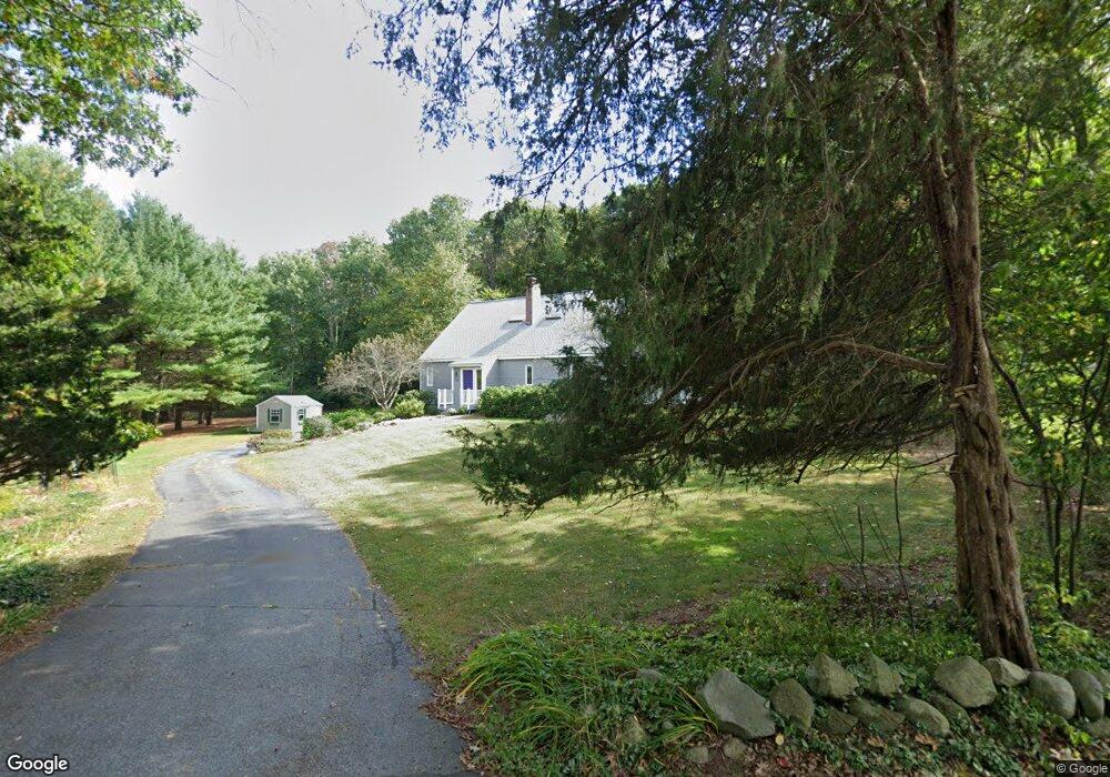
130 Flag Hill Rd Boxborough, MA 01719
Estimated Value: $896,131 - $996,000
4
Beds
3
Baths
2,464
Sq Ft
$383/Sq Ft
Est. Value
About This Home
This home is located at 130 Flag Hill Rd, Boxborough, MA 01719 and is currently estimated at $944,033, approximately $383 per square foot. 130 Flag Hill Rd is a home located in Middlesex County with nearby schools including Acton-Boxborough Regional High School.
Ownership History
Date
Name
Owned For
Owner Type
Purchase Details
Closed on
Apr 29, 2025
Sold by
Michnovez Eric J and Hickey Mary E
Bought by
Mary Ellen Hickey T and Mary Hickey
Current Estimated Value
Purchase Details
Closed on
Jan 8, 2002
Sold by
Krug Marc S and Krug Dawn R
Bought by
Michnovez Eric J and Hickey Mary Ellen
Home Financials for this Owner
Home Financials are based on the most recent Mortgage that was taken out on this home.
Original Mortgage
$175,000
Interest Rate
6.72%
Mortgage Type
Purchase Money Mortgage
Purchase Details
Closed on
Apr 16, 1999
Sold by
Beswick Barry E and Beswick Mary Jo
Bought by
Krug Marc S and Krug Dawn R
Create a Home Valuation Report for This Property
The Home Valuation Report is an in-depth analysis detailing your home's value as well as a comparison with similar homes in the area
Home Values in the Area
Average Home Value in this Area
Purchase History
| Date | Buyer | Sale Price | Title Company |
|---|---|---|---|
| Mary Ellen Hickey T | -- | None Available | |
| Mary Ellen Hickey T | -- | None Available | |
| Michnovez Eric J | $435,000 | -- | |
| Krug Marc S | $355,000 | -- |
Source: Public Records
Mortgage History
| Date | Status | Borrower | Loan Amount |
|---|---|---|---|
| Previous Owner | Krug Marc S | $131,500 | |
| Previous Owner | Krug Marc S | $137,000 | |
| Previous Owner | Krug Marc S | $141,200 | |
| Previous Owner | Michnovez Eric J | $175,000 |
Source: Public Records
Tax History Compared to Growth
Tax History
| Year | Tax Paid | Tax Assessment Tax Assessment Total Assessment is a certain percentage of the fair market value that is determined by local assessors to be the total taxable value of land and additions on the property. | Land | Improvement |
|---|---|---|---|---|
| 2025 | $12,274 | $810,700 | $311,300 | $499,400 |
| 2024 | $11,727 | $782,300 | $299,300 | $483,000 |
| 2023 | $11,046 | $711,700 | $258,300 | $453,400 |
| 2022 | $10,637 | $610,600 | $258,300 | $352,300 |
| 2020 | $9,181 | $549,100 | $258,300 | $290,800 |
| 2019 | $9,016 | $549,100 | $258,300 | $290,800 |
| 2018 | $7,124 | $514,400 | $246,300 | $268,100 |
| 2017 | $8,839 | $525,800 | $246,300 | $279,500 |
| 2016 | $8,327 | $509,000 | $246,300 | $262,700 |
| 2015 | $8,065 | $484,400 | $212,300 | $272,100 |
| 2014 | $8,049 | $455,000 | $206,100 | $248,900 |
Source: Public Records
Map
Nearby Homes
- 96 Cedarwood Rd
- 12 Olde Lantern Rd
- 68 Macintosh Ln
- 134 Russet Ln
- 92 Willow St Unit 3
- 92 Willow St Unit 2
- 90 Willow St Unit 1
- 3 Heather Hill Rd
- 89 Windsor Ave
- 285 Central St Unit 285
- 5 Elm St Unit 1
- 9 Elm St Unit 1
- 4,7,8 Crestwood Ln
- 207 Boxboro Rd
- 777 Depot Rd
- 31 Mohawk Dr
- 30-6 Taylor Rd
- 1155 Burroughs Rd
- 220 Red Acre Rd
- 139 Picnic St
- 140 Flag Hill Rd
- 114 Flag Hill Rd
- 96 Flagg Hill Rd
- 152 Flagg Hill Rd
- 152 Flag Hill Rd
- 119 Flag Hill Rd
- 135 Flagg Hill Rd
- 135 Flagg Hill Rd Unit 135
- 135 Flag Hill Rd
- 94 Flagg Hill Rd
- 92 Flagg Hill Rd
- 90 Flag Hill Rd
- 151 Flag Hill Rd
- 105 Flag Hill Rd
- 158 Flag Hill Rd
- 90 Flagg Hill Rd
- 175 Flagg Hill Rd
- 79 Flagg Hill Rd
- 178 Flagg Hill Rd
- 178 Flag Hill Rd