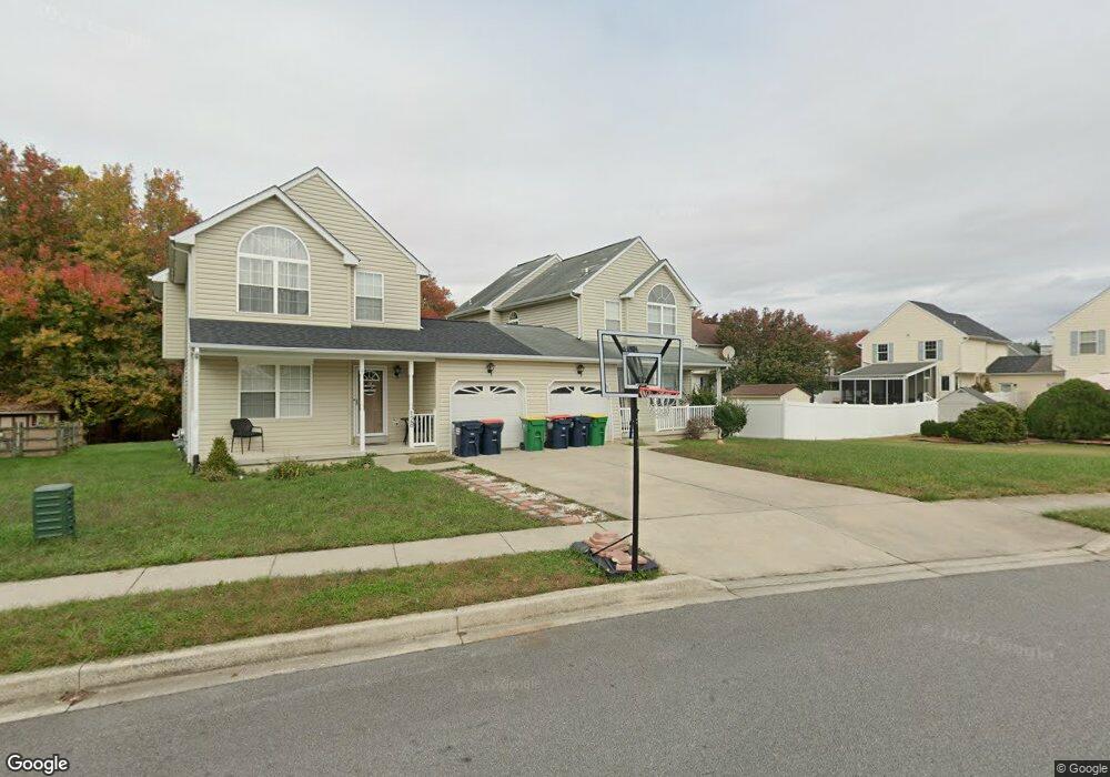
130 Foxtail Ln Middletown, DE 19709
Estimated Value: $325,000 - $377,000
3
Beds
3
Baths
1,304
Sq Ft
$266/Sq Ft
Est. Value
About This Home
This home is located at 130 Foxtail Ln, Middletown, DE 19709 and is currently estimated at $346,288, approximately $265 per square foot. 130 Foxtail Ln is a home located in New Castle County with nearby schools including Bunker Hill Elementary School, Everett Meredith Middle School, and Appoquinimink High School.
Ownership History
Date
Name
Owned For
Owner Type
Purchase Details
Closed on
Feb 6, 2006
Sold by
Cendant Mobility Financial Corp
Bought by
Griffin Tomeka
Current Estimated Value
Home Financials for this Owner
Home Financials are based on the most recent Mortgage that was taken out on this home.
Original Mortgage
$211,800
Interest Rate
6.52%
Mortgage Type
USDA
Purchase Details
Closed on
Mar 3, 2003
Sold by
Whitley Charles and Harrison Patricia
Bought by
Pero Scott B and Pero Amy
Home Financials for this Owner
Home Financials are based on the most recent Mortgage that was taken out on this home.
Original Mortgage
$150,000
Interest Rate
5.95%
Mortgage Type
Purchase Money Mortgage
Purchase Details
Closed on
Jul 18, 2001
Sold by
Whitley Charles and Harrison Patricia
Bought by
Whitley Charles and Harrison Patricia
Create a Home Valuation Report for This Property
The Home Valuation Report is an in-depth analysis detailing your home's value as well as a comparison with similar homes in the area
Home Values in the Area
Average Home Value in this Area
Purchase History
| Date | Buyer | Sale Price | Title Company |
|---|---|---|---|
| Griffin Tomeka | $211,800 | Atlantic Title | |
| Cendant Mobility Financial Corp | $211,800 | None Available | |
| Pero Scott B | $151,000 | -- | |
| Whitley Charles | -- | -- |
Source: Public Records
Mortgage History
| Date | Status | Borrower | Loan Amount |
|---|---|---|---|
| Previous Owner | Griffin Tomeka | $211,800 | |
| Previous Owner | Pero Scott B | $150,000 |
Source: Public Records
Tax History
| Year | Tax Paid | Tax Assessment Tax Assessment Total Assessment is a certain percentage of the fair market value that is determined by local assessors to be the total taxable value of land and additions on the property. | Land | Improvement |
|---|---|---|---|---|
| 2024 | $163 | $54,400 | $12,000 | $42,400 |
| 2023 | $163 | $54,400 | $12,000 | $42,400 |
| 2022 | $1,673 | $54,400 | $12,000 | $42,400 |
| 2021 | $1,636 | $54,400 | $12,000 | $42,400 |
| 2020 | $1,617 | $54,400 | $12,000 | $42,400 |
| 2019 | $1,661 | $54,400 | $12,000 | $42,400 |
| 2018 | $1,434 | $54,400 | $12,000 | $42,400 |
| 2017 | $1,380 | $54,400 | $12,000 | $42,400 |
| 2016 | $1,240 | $54,400 | $12,000 | $42,400 |
| 2015 | $1,362 | $54,400 | $12,000 | $42,400 |
| 2014 | $1,359 | $54,400 | $12,000 | $42,400 |
Source: Public Records
Map
Nearby Homes
- 561 Whispering Trail
- 25 Franklin Dr
- 610 Louis Ln
- 49 Springmill Dr
- 11 E Lockwood St
- 57 W Sarazen Dr
- 162 Liborio Dr
- 659 Warren Dr
- 14 W Lake St
- 1 Hogan Cir
- 304 Daylilly Way
- 113 Crawford St
- 447 Toftrees Dr
- 129 E Main St
- 6 Bradley Cir
- 241 Porky Oliver Dr
- 8 Redding Cir
- 29 W Reybold Dr
- 264 Trellis Ln
- 1850 Congressional Village Dr Unit 5302
Your Personal Tour Guide
Ask me questions while you tour the home.