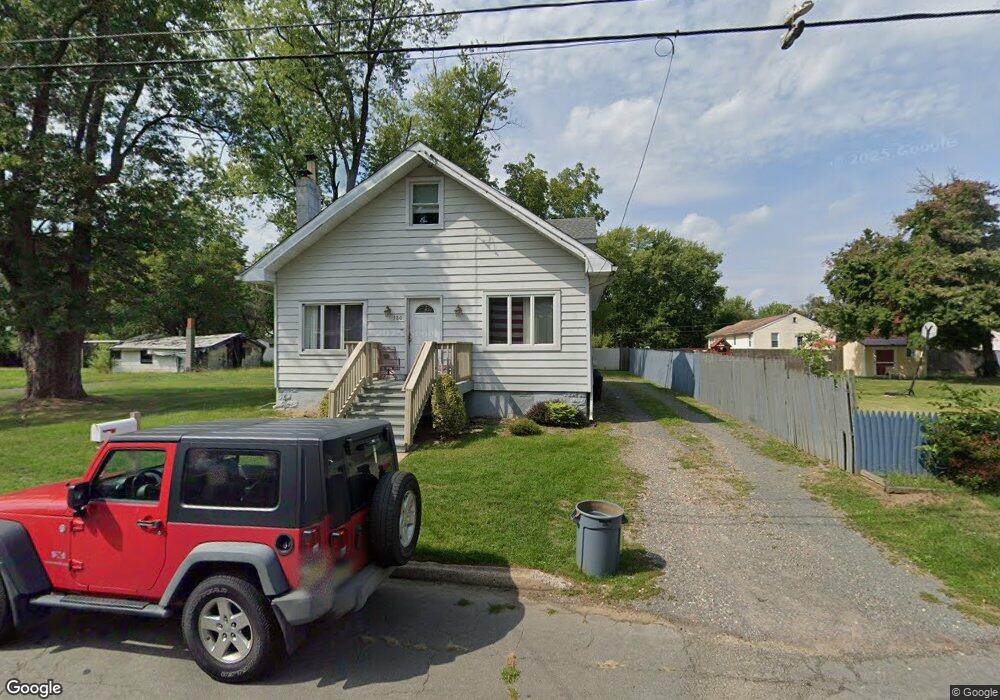
130 Hawthorne Ave Ewing, NJ 08638
Braeburn Heights NeighborhoodEstimated Value: $309,873 - $437,000
4
Beds
2
Baths
--
Sq Ft
8,799
Sq Ft Lot
About This Home
This home is located at 130 Hawthorne Ave, Ewing, NJ 08638 and is currently estimated at $383,218. 130 Hawthorne Ave is a home located in Mercer County with nearby schools including Ewing High School, Paul Robeson Charter School For The Humanities, and Trenton Stem-To-Civics Charter School.
Ownership History
Date
Name
Owned For
Owner Type
Purchase Details
Closed on
Oct 22, 2013
Sold by
130 Hawthorne Avenue Land Trust
Bought by
1951 N Olden Ave Llc
Current Estimated Value
Purchase Details
Closed on
Mar 13, 2009
Sold by
Wilbur Jeffrey W
Bought by
130 Hawthorne Avenue Land Trust
Home Financials for this Owner
Home Financials are based on the most recent Mortgage that was taken out on this home.
Original Mortgage
$100,000
Interest Rate
4.94%
Mortgage Type
Purchase Money Mortgage
Create a Home Valuation Report for This Property
The Home Valuation Report is an in-depth analysis detailing your home's value as well as a comparison with similar homes in the area
Home Values in the Area
Average Home Value in this Area
Purchase History
| Date | Buyer | Sale Price | Title Company |
|---|---|---|---|
| 1951 N Olden Ave Llc | -- | None Available | |
| 130 Hawthorne Avenue Land Trust | $100,000 | Foundation Title Llc |
Source: Public Records
Mortgage History
| Date | Status | Borrower | Loan Amount |
|---|---|---|---|
| Previous Owner | 130 Hawthorne Avenue Land Trust | $100,000 |
Source: Public Records
Tax History Compared to Growth
Tax History
| Year | Tax Paid | Tax Assessment Tax Assessment Total Assessment is a certain percentage of the fair market value that is determined by local assessors to be the total taxable value of land and additions on the property. | Land | Improvement |
|---|---|---|---|---|
| 2025 | $6,926 | $176,100 | $48,400 | $127,700 |
| 2024 | $6,510 | $176,100 | $48,400 | $127,700 |
| 2023 | $6,510 | $176,100 | $48,400 | $127,700 |
| 2022 | $6,334 | $176,100 | $48,400 | $127,700 |
| 2021 | $6,179 | $176,100 | $48,400 | $127,700 |
| 2020 | $6,091 | $176,100 | $48,400 | $127,700 |
| 2019 | $5,933 | $176,100 | $48,400 | $127,700 |
| 2018 | $5,699 | $107,900 | $28,500 | $79,400 |
| 2017 | $5,832 | $107,900 | $28,500 | $79,400 |
| 2016 | $5,753 | $107,900 | $28,500 | $79,400 |
| 2015 | $5,677 | $107,900 | $28,500 | $79,400 |
| 2014 | $5,662 | $107,900 | $28,500 | $79,400 |
Source: Public Records
Map
Nearby Homes
- 137 Ardsley Ave
- 107 Hawthorne Ave
- 194 Woodland Ave
- 14 Chesney Ave
- 186 Upland Ave
- 200 Upland Ave
- 9 Auburn Ave
- 117 Browning Ave
- 200 Claflin Ave
- 50 Groveland Ave
- 120 Sussex St
- 50 Hillman Ave
- 41 Poland St
- 91 Groveland Ave
- 111 Louisiana Ave
- 121 Oregon Ave
- 140 Crescent Ave
- 188 Browning Ave
- 7 Mabel St
- 17 Hillman Ave
- 26 Ormond Ave
- 30 Ormond Ave
- 126 Hawthorne Ave
- 124 LOT 2 Hawthorne Ave
- 124 LOT 1 Hawthorne Ave
- 124 Hawthorne Ave Unit 124
- 124 Hawthorne Ave Unit 2
- 124 Hawthorne Ave Unit 1
- 140 Hawthorne Ave
- 16 Browning Ave
- 129 Hawthorne Ave
- 18 Browning Ave
- 137 Hawthorne Ave
- 127 Hawthorne Ave
- 32 Ormond Ave
- 142 Hawthorne Ave
- 125 Hawthorne Ave
- 132 Ardsley Ave
- 130 Ardsley Ave
- 1 Loring Ave