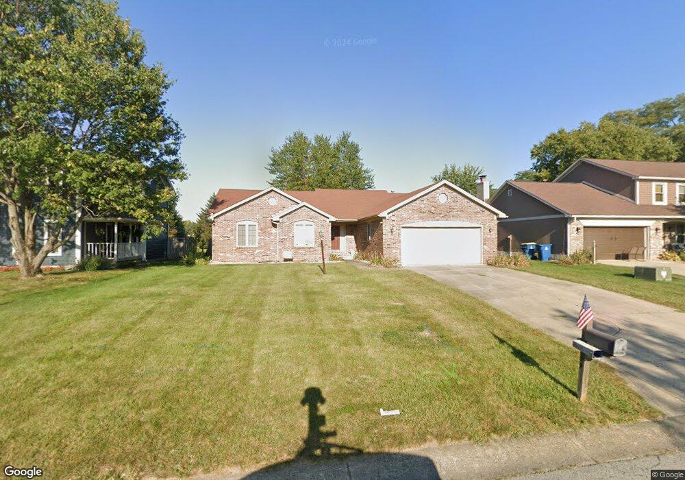
130 Morse Landing Dr Cicero, IN 46034
Estimated Value: $368,000 - $388,000
3
Beds
2
Baths
1,772
Sq Ft
$213/Sq Ft
Est. Value
About This Home
This home is located at 130 Morse Landing Dr, Cicero, IN 46034 and is currently estimated at $377,580, approximately $213 per square foot. 130 Morse Landing Dr is a home located in Hamilton County with nearby schools including Hamilton Heights Primary School, Hamilton Heights Elementary School, and Hamilton Heights Middle School.
Ownership History
Date
Name
Owned For
Owner Type
Purchase Details
Closed on
Mar 24, 2021
Sold by
Stark Debra A and Debra Dickinson Trust
Bought by
Stark Debra A and Debra Stark Trust
Current Estimated Value
Purchase Details
Closed on
Dec 18, 2009
Sold by
Dickinson Debra A
Bought by
Dickinson Debra A
Purchase Details
Closed on
Apr 13, 2009
Sold by
Thornberry Debra Anne
Bought by
Dickinson Debra A
Create a Home Valuation Report for This Property
The Home Valuation Report is an in-depth analysis detailing your home's value as well as a comparison with similar homes in the area
Home Values in the Area
Average Home Value in this Area
Purchase History
| Date | Buyer | Sale Price | Title Company |
|---|---|---|---|
| Stark Debra A | -- | None Available | |
| Dickinson Debra A | -- | None Available | |
| Dickinson Debra A | -- | None Available |
Source: Public Records
Tax History Compared to Growth
Tax History
| Year | Tax Paid | Tax Assessment Tax Assessment Total Assessment is a certain percentage of the fair market value that is determined by local assessors to be the total taxable value of land and additions on the property. | Land | Improvement |
|---|---|---|---|---|
| 2024 | $2,430 | $297,000 | $102,400 | $194,600 |
| 2023 | $2,430 | $259,700 | $102,400 | $157,300 |
| 2022 | $2,436 | $245,200 | $52,500 | $192,700 |
| 2021 | $2,129 | $214,400 | $52,500 | $161,900 |
| 2020 | $2,064 | $207,900 | $52,500 | $155,400 |
| 2019 | $1,742 | $180,800 | $34,300 | $146,500 |
| 2018 | $1,581 | $167,200 | $34,300 | $132,900 |
| 2017 | $18 | $166,100 | $34,300 | $131,800 |
| 2016 | $1,558 | $166,100 | $34,300 | $131,800 |
| 2014 | $1,392 | $150,900 | $31,700 | $119,200 |
| 2013 | $1,392 | $150,400 | $31,800 | $118,600 |
Source: Public Records
Map
Nearby Homes
- 1055 Spinner Ct
- 14 Morse Ct
- 15 Morse Ct
- 31 Bluewater Dr
- 826 N Lanyard Dr
- 100 Confidential Dr
- 18 Point Ln
- 34 Hovden Dr
- 130 Overston Ct
- 1180 Shoreline Cir
- 104 Perlican Dr
- 815 Morse Landing Dr
- 131 Batteese Dr
- 221 Common Loon Blvd
- 22 Point Ln
- 140 Wiley St
- 949 Nantucket Dr
- 70 Armitage St
- 24 Karner Blue Ct
- 47 Karner Blue Ct
- 140 Morse Landing Dr
- 120 Morse Landing Dr
- 110 Morse Landing Dr
- 150 Morse Landing Dr
- 90 Morse Landing Dr
- 160 Morse Landing Dr
- 125 Morse Landing Dr
- 115 Morse Landing Dr
- 135 Morse Landing Dr
- 105 Morse Landing Dr
- 682 Coral Ct
- 70 Morse Landing Dr
- 180 Morse Landing Dr
- 1000 Lions Wood Dr
- 50 Morse Landing Dr
- 200 Morse Landing Dr
- 672 Coral Ct
- 687 Coral Ct
- 1020 Eagles Ridge Dr
- 1010 Eagles Ridge Dr