Estimated Value: $826,321 - $925,000
3
Beds
3
Baths
1,794
Sq Ft
$491/Sq Ft
Est. Value
About This Home
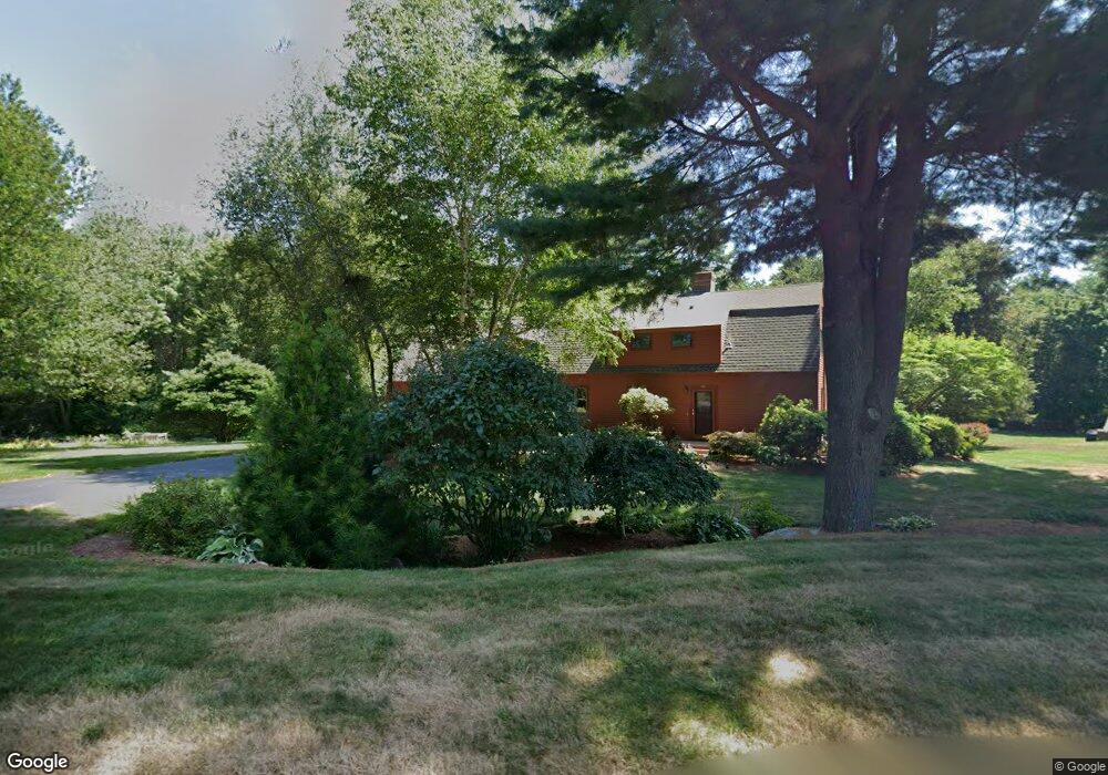
This home is located at 130 Nonset Path, Acton, MA 01720 and is currently estimated at $881,580, approximately $491 per square foot. 130 Nonset Path is a home located in Middlesex County with nearby schools including Acton-Boxborough Regional High School and Oak Meadow Montessori School.
Ownership History
Date
Name
Owned For
Owner Type
Purchase Details
Closed on
Sep 29, 2021
Sold by
Balkus Peter A and Balkus Susan L
Bought by
Balkus Rt
Current Estimated Value
Purchase Details
Closed on
Jun 26, 1984
Bought by
Balkus Peter A
Create a Home Valuation Report for This Property
The Home Valuation Report is an in-depth analysis detailing your home's value as well as a comparison with similar homes in the area
Home Values in the Area
Average Home Value in this Area
Purchase History
| Date | Buyer | Sale Price | Title Company |
|---|---|---|---|
| Balkus Rt | -- | None Available | |
| Balkus Peter A | -- | -- |
Source: Public Records
Mortgage History
| Date | Status | Borrower | Loan Amount |
|---|---|---|---|
| Previous Owner | Balkus Peter A | $100,000 | |
| Previous Owner | Balkus Peter A | $93,000 |
Source: Public Records
Tax History
| Year | Tax Paid | Tax Assessment Tax Assessment Total Assessment is a certain percentage of the fair market value that is determined by local assessors to be the total taxable value of land and additions on the property. | Land | Improvement |
|---|---|---|---|---|
| 2025 | $13,317 | $776,500 | $343,200 | $433,300 |
| 2024 | $12,487 | $749,100 | $343,200 | $405,900 |
| 2023 | $12,343 | $702,900 | $312,100 | $390,800 |
| 2022 | $11,695 | $601,300 | $271,200 | $330,100 |
| 2021 | $11,383 | $562,700 | $251,000 | $311,700 |
| 2020 | $10,744 | $558,400 | $251,000 | $307,400 |
| 2019 | $10,404 | $537,100 | $251,000 | $286,100 |
| 2018 | $10,237 | $528,200 | $251,000 | $277,200 |
| 2017 | $9,982 | $523,700 | $251,000 | $272,700 |
| 2016 | $9,813 | $510,300 | $251,000 | $259,300 |
| 2015 | $9,788 | $513,800 | $251,000 | $262,800 |
| 2014 | $9,503 | $488,600 | $251,000 | $237,600 |
Source: Public Records
Map
Nearby Homes
- 11 Walnut St
- 405 Great Elm Way
- 5 Samantha Way Unit 5
- 262 Brown Bear Crossing Unit 262
- 237 Brown Bear Crossing Unit 237
- 238 Brown Bear Crossing Unit 238
- 420 Great Rd Unit B3
- 390 Great Rd Unit B16
- 159 Skyline Dr Unit 159
- 388 Great Rd Unit A9
- 388 Great Rd Unit B14
- 386 Great Rd Unit A8
- 380A Great Rd Unit 301
- 380 Great Rd Unit B301
- 18 Mcintosh Ln
- 11 Davis Rd Unit A5
- 927 Main St
- 15 Davis Rd Unit B-8
- 87 Canterbury Hill Rd
- 524 Main St
- 132 Nonset Path
- 132 Nonset Path
- 131 Nonset Path
- 128 Nonset Path
- 134 Nonset Path
- 133 Nonset Path
- 126 Nonset Path
- 127 Nonset Path
- 135 Nonset Path
- 7 Henley Rd
- 11 Henley Rd
- 139 Nonset Path
- 124 Nonset Path
- 124 Nonset Path Unit 1
- 121 Nonset Path
- 5 Henley Rd
- 481 Great Rd
- 471 Great Rd
- 477 Great Rd
- 122 Nonset Path
Your Personal Tour Guide
Ask me questions while you tour the home.