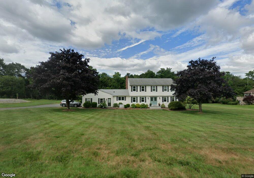
130 Port Cir Warwick, RI 02889
Warwick Neck NeighborhoodEstimated Value: $689,572 - $912,000
5
Beds
4
Baths
3,252
Sq Ft
$252/Sq Ft
Est. Value
About This Home
This home is located at 130 Port Cir, Warwick, RI 02889 and is currently estimated at $820,643, approximately $252 per square foot. 130 Port Cir is a home located in Kent County with nearby schools including Saint Kevin School and Bishop Hendricken High School.
Ownership History
Date
Name
Owned For
Owner Type
Purchase Details
Closed on
Jul 23, 2021
Sold by
Jill R Sholes Lt
Bought by
Shultz Daniel and Shultz Erica
Current Estimated Value
Purchase Details
Closed on
Nov 3, 2010
Sold by
Sholes Steven T and Sholes Jill R
Bought by
Sholes Jill R
Purchase Details
Closed on
May 25, 2001
Sold by
Ferland Corp
Bought by
Sholes Steven T and Sholes Jill R
Home Financials for this Owner
Home Financials are based on the most recent Mortgage that was taken out on this home.
Original Mortgage
$290,000
Interest Rate
7.05%
Create a Home Valuation Report for This Property
The Home Valuation Report is an in-depth analysis detailing your home's value as well as a comparison with similar homes in the area
Home Values in the Area
Average Home Value in this Area
Purchase History
| Date | Buyer | Sale Price | Title Company |
|---|---|---|---|
| Shultz Daniel | $390,000 | None Available | |
| Sholes Jill R | -- | -- | |
| Sholes Steven T | $390,000 | -- |
Source: Public Records
Mortgage History
| Date | Status | Borrower | Loan Amount |
|---|---|---|---|
| Previous Owner | Sholes Steven T | $360,000 | |
| Previous Owner | Sholes Steven T | $234,850 | |
| Previous Owner | Sholes Steven T | $238,000 | |
| Previous Owner | Sholes Steven T | $290,000 |
Source: Public Records
Tax History Compared to Growth
Tax History
| Year | Tax Paid | Tax Assessment Tax Assessment Total Assessment is a certain percentage of the fair market value that is determined by local assessors to be the total taxable value of land and additions on the property. | Land | Improvement |
|---|---|---|---|---|
| 2024 | $10,119 | $699,300 | $181,600 | $517,700 |
| 2023 | $9,923 | $699,300 | $181,600 | $517,700 |
| 2022 | $9,494 | $506,900 | $102,700 | $404,200 |
| 2021 | $9,494 | $506,900 | $102,700 | $404,200 |
| 2020 | $9,494 | $506,900 | $102,700 | $404,200 |
| 2019 | $9,494 | $506,900 | $102,700 | $404,200 |
| 2018 | $9,938 | $491,000 | $136,500 | $354,500 |
| 2017 | $9,938 | $491,000 | $136,500 | $354,500 |
| 2016 | $9,938 | $491,000 | $136,500 | $354,500 |
| 2015 | $10,031 | $483,400 | $166,200 | $317,200 |
| 2014 | $9,697 | $483,400 | $166,200 | $317,200 |
| 2013 | $9,566 | $483,400 | $166,200 | $317,200 |
Source: Public Records
Map
Nearby Homes
- 175 Randall Ave
- 100 Gray St
- 215 Rocky Point Ave
- 240 Narragansett Bay Ave
- 159 Aldrich Ave
- 0 Paine St
- 30 White Rock Rd
- 90 Huron St
- 155 Lewiston St
- 0 Channing St
- 82 Barton Ave
- 342 Warwick Neck Ave
- 52 Uncas St
- 19 Curtis St
- 320 Palmer Ave
- 237 Pequot Ave
- 235 Pequot Ave
- 388 Sea View Dr
- 107 Coburn St
- 81 Fairhaven Ave