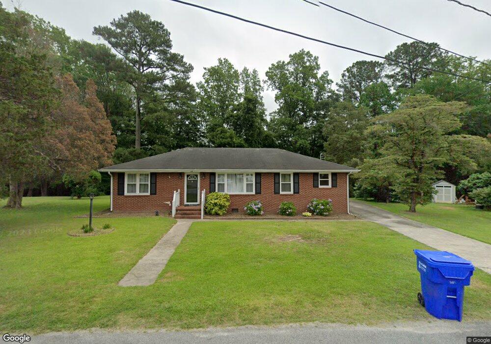
130 Porter Cir Suffolk, VA 23434
Holy Neck NeighborhoodEstimated Value: $274,499 - $280,000
4
Beds
1
Bath
1,404
Sq Ft
$197/Sq Ft
Est. Value
About This Home
This home is located at 130 Porter Cir, Suffolk, VA 23434 and is currently estimated at $277,125, approximately $197 per square foot. 130 Porter Cir is a home located in Suffolk City with nearby schools including Kilby Shores Elementary School, Forest Glen Middle School, and Lakeland High School.
Ownership History
Date
Name
Owned For
Owner Type
Purchase Details
Closed on
Feb 24, 2021
Sold by
Spady Denise H and Spady Devon Hewitt
Bought by
Stone Wesley Tanner and Evans Chelsea H
Current Estimated Value
Home Financials for this Owner
Home Financials are based on the most recent Mortgage that was taken out on this home.
Original Mortgage
$198,753
Outstanding Balance
$178,319
Interest Rate
2.75%
Mortgage Type
New Conventional
Estimated Equity
$98,806
Create a Home Valuation Report for This Property
The Home Valuation Report is an in-depth analysis detailing your home's value as well as a comparison with similar homes in the area
Home Values in the Area
Average Home Value in this Area
Purchase History
| Date | Buyer | Sale Price | Title Company |
|---|---|---|---|
| Stone Wesley Tanner | $204,900 | Insight Title & Stlmnt Svcs |
Source: Public Records
Mortgage History
| Date | Status | Borrower | Loan Amount |
|---|---|---|---|
| Open | Stone Wesley Tanner | $198,753 |
Source: Public Records
Tax History Compared to Growth
Tax History
| Year | Tax Paid | Tax Assessment Tax Assessment Total Assessment is a certain percentage of the fair market value that is determined by local assessors to be the total taxable value of land and additions on the property. | Land | Improvement |
|---|---|---|---|---|
| 2024 | $3,275 | $230,900 | $65,000 | $165,900 |
| 2023 | $2,864 | $220,400 | $60,000 | $160,400 |
| 2022 | $2,137 | $196,100 | $60,000 | $136,100 |
| 2021 | $1,784 | $160,700 | $43,700 | $117,000 |
| 2020 | $1,701 | $153,200 | $43,700 | $109,500 |
| 2019 | $1,580 | $142,300 | $43,700 | $98,600 |
| 2018 | $1,686 | $138,600 | $43,700 | $94,900 |
| 2017 | $1,443 | $134,900 | $43,700 | $91,200 |
| 2016 | $1,403 | $131,100 | $43,700 | $87,400 |
| 2015 | $845 | $146,100 | $43,700 | $102,400 |
| 2014 | $845 | $146,100 | $43,700 | $102,400 |
Source: Public Records
Map
Nearby Homes
- 19 Grove Ave
- 116 Grove Ave
- 68AC Manning Rd
- 128 Deborah Dr
- 202 Grove Ave
- 1673 Faulk Rd
- 109 Winterview Dr
- 4035 Brians Ln
- 205 Pond Dr
- 305 Autumn Cir
- 1665 Holland Rd
- 123 Lake Front Dr
- 404 Great Oak Ct
- SALEM Plan at Brewers Meadows South
- PENWELL Plan at Brewers Meadows South
- HAYDEN Plan at Brewers Meadows South
- GALEN Plan at Brewers Meadows South
- HANOVER Plan at Brewers Meadows South
- 104 Springfield Terrace
- 103 Lake Front Dr
- 128 Porter Cir
- 134 Porter Cir
- 1530 Forest Glen Cir
- 1541 Wilkins Dr
- 136 Porter Cir
- 1537 Wilkins Dr
- 1527 Art Ct
- 1545 Wilkins Dr
- 1535 Wilkins Dr
- 1534 Forest Glen Cir
- 1528 Forest Glen Cir
- 1531 Wilkins Dr
- 1525 Art Ct
- 1549 Wilkins Dr
- 1526 Forest Glen Cir
- 1525 Forest Glen Cir
- 1528 Art Ct
- 1538 Wilkins Dr
- 1544 Wilkins Dr
- 1536 Forest Glen Cir