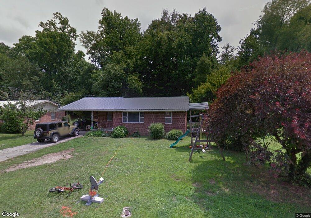
130 Shelton St Linden, TN 37096
Estimated Value: $73,000 - $149,000
--
Bed
1
Bath
1,037
Sq Ft
$103/Sq Ft
Est. Value
About This Home
This home is located at 130 Shelton St, Linden, TN 37096 and is currently estimated at $107,158, approximately $103 per square foot. 130 Shelton St is a home located in Perry County.
Ownership History
Date
Name
Owned For
Owner Type
Purchase Details
Closed on
Oct 30, 2020
Sold by
Harper Brendeazon Jacob and Dunkle Morro Deanna
Bought by
Warf Heather and Warf Loyd A
Current Estimated Value
Home Financials for this Owner
Home Financials are based on the most recent Mortgage that was taken out on this home.
Original Mortgage
$42,013
Interest Rate
2.9%
Mortgage Type
Credit Line Revolving
Purchase Details
Closed on
Dec 30, 2016
Sold by
Harper Robert Earl
Bought by
Harper Brendeazon Jacob
Purchase Details
Closed on
Oct 15, 1963
Bought by
Holt Willie
Create a Home Valuation Report for This Property
The Home Valuation Report is an in-depth analysis detailing your home's value as well as a comparison with similar homes in the area
Home Values in the Area
Average Home Value in this Area
Purchase History
| Date | Buyer | Sale Price | Title Company |
|---|---|---|---|
| Warf Heather | $40,000 | None Available | |
| Harper Brendeazon Jacob | $80,867 | -- | |
| Holt Willie | -- | -- |
Source: Public Records
Mortgage History
| Date | Status | Borrower | Loan Amount |
|---|---|---|---|
| Previous Owner | Warf Heather | $42,013 |
Source: Public Records
Tax History Compared to Growth
Tax History
| Year | Tax Paid | Tax Assessment Tax Assessment Total Assessment is a certain percentage of the fair market value that is determined by local assessors to be the total taxable value of land and additions on the property. | Land | Improvement |
|---|---|---|---|---|
| 2025 | $349 | $12,450 | $0 | $0 |
| 2024 | $349 | $12,450 | $2,000 | $10,450 |
| 2023 | $349 | $12,450 | $2,000 | $10,450 |
| 2022 | $349 | $12,450 | $2,000 | $10,450 |
| 2021 | $349 | $12,450 | $2,000 | $10,450 |
| 2020 | $286 | $12,450 | $2,000 | $10,450 |
| 2019 | $396 | $13,250 | $2,000 | $11,250 |
| 2018 | $396 | $13,250 | $2,000 | $11,250 |
| 2017 | $392 | $13,250 | $2,000 | $11,250 |
| 2016 | $392 | $13,250 | $2,000 | $11,250 |
| 2015 | $385 | $13,250 | $2,000 | $11,250 |
| 2014 | $385 | $13,250 | $2,000 | $11,250 |
| 2013 | $376 | $12,966 | $0 | $0 |
Source: Public Records
Map
Nearby Homes
- 122 Shelton St
- 141 Maple St
- 245 S Mill St
- 218 Cedar Ave
- 130 Elm Ln
- 0 Church St
- 0 Treadwell Prong Unit RTC2707562
- 628 Starlight Dr
- 8884 U S Highway 412
- 107 Possum Trot Ln
- Lot 5 Campers Ln
- Lot 7 Campers Ln
- Lot 9 Campers Ln
- Lot 15 Campers Ln
- Lot 4 Campers Ln
- Lot 8 Campers Ln
- Lot 10 Campers Ln
- Lot 11 Campers Ln
- Lot 6 Campers Ln
- Lot 17 Campers Ln
- 128 Shelton St
- 136 Shelton St
- 126 Shelton St
- 133 W Brooklyn St
- 137 W Brooklyn St
- 140 Shelton St
- 135 Shelton St
- 127 Shelton St
- 125 W Brooklyn St
- 144 Shelton St
- 145 W Brooklyn St
- 134 W Brooklyn St
- 130 W Brooklyn St
- 130 W Brooklyn St
- 124 Brookside Dr
- 119 W Brooklyn St
- 119 W Brooklyn Ave
- 124 W Brooklyn St
- 117 W Brooklyn St
- 135 College Ave