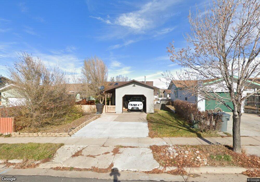
130 Simpson Ave Evanston, WY 82930
Estimated Value: $165,000 - $249,051
3
Beds
2
Baths
1,792
Sq Ft
$109/Sq Ft
Est. Value
About This Home
This home is located at 130 Simpson Ave, Evanston, WY 82930 and is currently estimated at $195,017, approximately $108 per square foot. 130 Simpson Ave is a home located in Uinta County with nearby schools including Evanston High School and Evanston Child Development Center.
Ownership History
Date
Name
Owned For
Owner Type
Purchase Details
Closed on
Jun 29, 2017
Sold by
Brown Mae L
Bought by
Long Jon G
Current Estimated Value
Home Financials for this Owner
Home Financials are based on the most recent Mortgage that was taken out on this home.
Original Mortgage
$74,900
Outstanding Balance
$39,721
Interest Rate
4.02%
Mortgage Type
New Conventional
Estimated Equity
$155,296
Create a Home Valuation Report for This Property
The Home Valuation Report is an in-depth analysis detailing your home's value as well as a comparison with similar homes in the area
Home Values in the Area
Average Home Value in this Area
Purchase History
| Date | Buyer | Sale Price | Title Company |
|---|---|---|---|
| Long Jon G | -- | First American Title Ins Co |
Source: Public Records
Mortgage History
| Date | Status | Borrower | Loan Amount |
|---|---|---|---|
| Open | Long Jon G | $74,900 |
Source: Public Records
Tax History Compared to Growth
Tax History
| Year | Tax Paid | Tax Assessment Tax Assessment Total Assessment is a certain percentage of the fair market value that is determined by local assessors to be the total taxable value of land and additions on the property. | Land | Improvement |
|---|---|---|---|---|
| 2025 | $1,056 | $12,031 | $2,138 | $9,893 |
| 2024 | $852 | $15,534 | $2,850 | $12,684 |
| 2023 | $856 | $15,657 | $1,809 | $13,848 |
| 2022 | $673 | $12,883 | $1,410 | $11,473 |
| 2021 | $662 | $12,716 | $1,410 | $11,306 |
| 2020 | $763 | $11,206 | $1,410 | $9,796 |
| 2019 | $484 | $10,121 | $1,410 | $8,711 |
| 2018 | $485 | $8,462 | $1,410 | $7,052 |
| 2017 | $420 | $9,183 | $1,385 | $7,798 |
| 2016 | $418 | $9,139 | $1,385 | $7,754 |
| 2015 | -- | $7,929 | $1,385 | $6,544 |
| 2014 | -- | $9,322 | $0 | $0 |
Source: Public Records
Map
Nearby Homes
- 413 Crane Ave
- 427 Thayer Cir
- 479 Twin Ridge Ave
- 223 Barber Ave
- 221 Barber Ave
- 405, 411, & 419 Burns Ave
- 405 Burns Ave Unit 3,4,5
- 46 City View Dr
- 824 9th St
- 633 9th St
- 116 Peak Rd
- 155 Highridge Point
- 113 Tower Rd
- 525 8th St
- 104 Canyon Hollow Dr
- 819 Walton Ave
- 115 Peak Rd
- 3925 Yellow Creek Rd
- 3893 Yellow Creek Rd
- 3861 Yellow Creek Rd
- 126 Simpson Ave
- 132 Simpson Ave
- 124 Simpson Ave
- 136 Simpson Ave
- 131 Barrett Ave
- 129 Barrett Ave
- 123 Barrett Ave
- 120 Simpson Ave
- 135 Barrett Ave
- 138 Simpson Ave
- 125 Barrett Ave
- 137 Barrett Ave
- 129 Simpson Ave
- 127 Simpson Ave
- 118 Simpson Ave
- 142 Simpson Ave
- 119 Barrett Ave
- 141 Barrett Ave
- 114 Simpson Ave
- 144 Simpson Ave