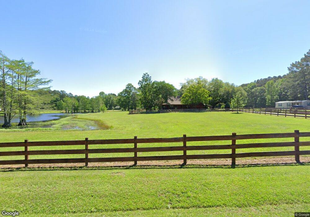
130 Stevenson Rd Laurel, MS 39443
Estimated Value: $157,000 - $358,000
Studio
--
Bath
1,936
Sq Ft
$125/Sq Ft
Est. Value
About This Home
This home is located at 130 Stevenson Rd, Laurel, MS 39443 and is currently estimated at $242,124, approximately $125 per square foot. 130 Stevenson Rd is a home located in Jones County.
Ownership History
Date
Name
Owned For
Owner Type
Purchase Details
Closed on
Oct 18, 2016
Sold by
Breazeale Tony
Bought by
Hodge Charles C and Breazeale Illisia Marie
Current Estimated Value
Home Financials for this Owner
Home Financials are based on the most recent Mortgage that was taken out on this home.
Original Mortgage
$155,200
Outstanding Balance
$124,167
Interest Rate
3.48%
Mortgage Type
Purchase Money Mortgage
Estimated Equity
$117,957
Purchase Details
Closed on
Sep 26, 2006
Sold by
Breazeale Felicia R
Bought by
Breazeale Tony and Breazeale Felicia R
Create a Home Valuation Report for This Property
The Home Valuation Report is an in-depth analysis detailing your home's value as well as a comparison with similar homes in the area
Purchase History
| Date | Buyer | Sale Price | Title Company |
|---|---|---|---|
| Hodge Charles C | -- | -- | |
| Breazeale Tony | -- | -- |
Source: Public Records
Mortgage History
| Date | Status | Borrower | Loan Amount |
|---|---|---|---|
| Open | Hodge Charles C | $155,200 |
Source: Public Records
Tax History
| Year | Tax Paid | Tax Assessment Tax Assessment Total Assessment is a certain percentage of the fair market value that is determined by local assessors to be the total taxable value of land and additions on the property. | Land | Improvement |
|---|---|---|---|---|
| 2025 | $1,268 | $13,020 | $0 | $0 |
| 2024 | $2,405 | $19,004 | $0 | $0 |
| 2023 | $2,405 | $12,685 | $0 | $0 |
| 2022 | $1,341 | $12,685 | $0 | $0 |
| 2021 | $1,348 | $12,686 | $0 | $0 |
| 2020 | $1,379 | $12,697 | $0 | $0 |
| 2019 | $1,384 | $12,686 | $0 | $0 |
| 2018 | $1,384 | $12,686 | $0 | $0 |
| 2017 | $1,382 | $12,687 | $0 | $0 |
| 2016 | $1,222 | $11,748 | $0 | $0 |
| 2015 | $1,123 | $11,710 | $0 | $0 |
| 2014 | $1,123 | $11,497 | $0 | $0 |
Source: Public Records
Map
Nearby Homes
- 1067 Trace Rd
- 0 Sharon Rd
- 73 Mayfield Rd
- 338 Reedy Creek Rd
- 00 Graham Dr
- 909 Sharon Moss Rd
- 4398 Sharon Rd
- 1 Loblolly Ln
- 14 Hoss Dr
- 4514 Forest Dr
- 1105 Glenway Dr
- 60 Forest Dr
- 00 Forest Dr
- 8 Mar - Ree Dr
- 923 Jeffery Dr
- TBA University Ave
- 37 Mar - Ree Dr
- 0 Meadowland Dr Unit Laurel MS 39440
- 56 Mar Ree Dr
- 48 Hoy Rd
- 123 Stevenson Rd
- 100 Stevenson Rd
- 17 Meyers Rd
- 1052 Trace Rd
- 16 Meyers Rd
- 87 Reedy Creek Rd
- 165 Stevenson Rd
- 11 Meyers Rd
- 107 Stevenson Rd
- 77 Reedy Creek Rd
- 167 Stevenson Rd
- 167 Stevenson Rd
- 10 Meyers Rd
- 91 Reedy Creek Rd
- 107 Reedy Creek Rd
- 101 Reedy Creek Rd
- 84 Reedy Creek Rd
- 3 Lucy Rd
- 1100 Trace Rd
- 9 Lucy Rd
Your Personal Tour Guide
Ask me questions while you tour the home.