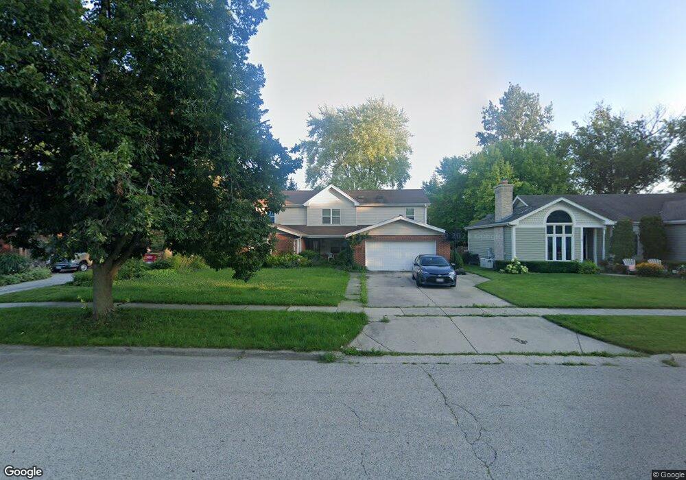
130 W Maple Ave Wauconda, IL 60084
Estimated Value: $399,000 - $526,000
3
Beds
3
Baths
2,761
Sq Ft
$160/Sq Ft
Est. Value
About This Home
This home is located at 130 W Maple Ave, Wauconda, IL 60084 and is currently estimated at $441,405, approximately $159 per square foot. 130 W Maple Ave is a home located in Lake County with nearby schools including Wauconda Grade School, Wauconda Middle School, and Wauconda High School.
Ownership History
Date
Name
Owned For
Owner Type
Purchase Details
Closed on
Dec 28, 2004
Sold by
Angel Vivian
Bought by
Angel Vivian Saba and The Vivian Saba Angel Declarat
Current Estimated Value
Purchase Details
Closed on
Nov 14, 2003
Sold by
Munoz Alex
Bought by
Angel Vivian
Purchase Details
Closed on
Nov 13, 2003
Sold by
Angel James M and Angel Vivian S
Bought by
Munoz Alex
Create a Home Valuation Report for This Property
The Home Valuation Report is an in-depth analysis detailing your home's value as well as a comparison with similar homes in the area
Home Values in the Area
Average Home Value in this Area
Purchase History
| Date | Buyer | Sale Price | Title Company |
|---|---|---|---|
| Angel Vivian Saba | -- | -- | |
| Angel Vivian | $175,000 | First American Title | |
| Munoz Alex | $175,000 | First American Title |
Source: Public Records
Tax History Compared to Growth
Tax History
| Year | Tax Paid | Tax Assessment Tax Assessment Total Assessment is a certain percentage of the fair market value that is determined by local assessors to be the total taxable value of land and additions on the property. | Land | Improvement |
|---|---|---|---|---|
| 2024 | $10,157 | $121,846 | $17,781 | $104,065 |
| 2023 | $10,966 | $111,376 | $16,253 | $95,123 |
| 2022 | $10,966 | $106,497 | $16,362 | $90,135 |
| 2021 | $10,474 | $100,631 | $15,461 | $85,170 |
| 2020 | $10,145 | $95,912 | $14,736 | $81,176 |
| 2019 | $9,017 | $90,646 | $13,927 | $76,719 |
| 2018 | $9,620 | $89,662 | $16,553 | $73,109 |
| 2017 | $9,612 | $88,626 | $16,362 | $72,264 |
| 2016 | $9,032 | $83,926 | $15,494 | $68,432 |
| 2015 | $8,496 | $77,046 | $14,224 | $62,822 |
| 2014 | $7,171 | $67,833 | $16,499 | $51,334 |
| 2012 | $6,988 | $67,413 | $15,786 | $51,627 |
Source: Public Records
Map
Nearby Homes
- 125 E Mill St Unit D103
- 136 Hubbard Ct
- 146 E Mill St
- 131 E Mill St Unit B104
- 226 Barrington Rd
- 300 Barrington Rd
- 318 E Liberty St
- 450 N Main St Unit S307A
- 450 N Main St Unit S208A
- 107 Hammond Ave
- 311 Brown St
- 431 Barrington Rd
- 25721 W Lakeview Ave
- 435 Barrington Rd
- 25586 W High St
- 25578 W High St
- 25570 W High St
- 335 Farmhill Cir
- 325 Sundown Ct Unit B
- 310 Sundown Ct Unit E
- 122 W Maple Ave
- 136 W Maple Ave
- 140 W Maple Ave
- 105 W Church St
- 109 W Church St
- 116 W Maple Ave
- 110 W Maple Ave
- 121 W Church St
- 129 W Maple Ave
- 146 W Maple Ave
- 123 W Maple Ave
- 135 W Maple Ave
- 101 W Church St
- 127 W Church St
- 102 W Maple Ave
- 117 W Maple Ave
- 113 W Maple Ave
- 152 W Maple Ave
- 143 W Maple Ave
- 115 W Maple Ave