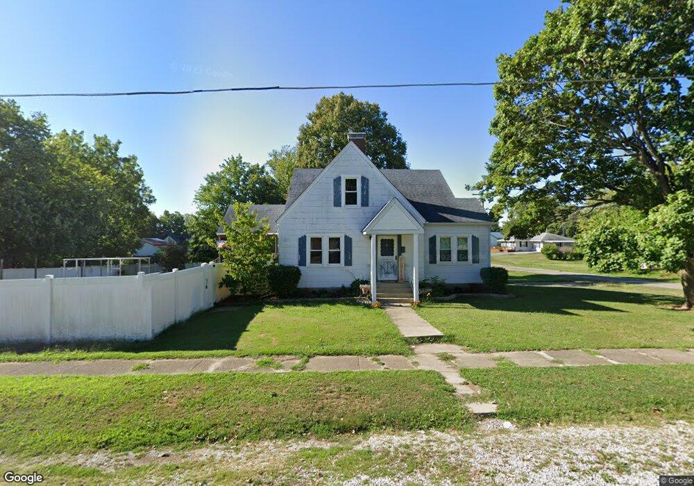
130 W Mulberry St Westfield, IL 62474
Estimated Value: $100,000 - $115,000
--
Bed
--
Bath
1,863
Sq Ft
$57/Sq Ft
Est. Value
About This Home
This home is located at 130 W Mulberry St, Westfield, IL 62474 and is currently estimated at $107,019, approximately $57 per square foot. 130 W Mulberry St is a home located in Clark County with nearby schools including Monroe Elementary School and Casey-Westfield Jr-Sr High School.
Ownership History
Date
Name
Owned For
Owner Type
Purchase Details
Closed on
Dec 8, 2021
Sold by
Evans Nathaniel W and Evans Amy N
Bought by
Livvix Dalton and Livvix Courtney
Current Estimated Value
Purchase Details
Closed on
May 6, 2014
Sold by
Way Charlene and Way Paul
Bought by
Evans Nathaniel W and Evans Amy N
Home Financials for this Owner
Home Financials are based on the most recent Mortgage that was taken out on this home.
Original Mortgage
$50,000
Interest Rate
4.75%
Mortgage Type
Purchase Money Mortgage
Create a Home Valuation Report for This Property
The Home Valuation Report is an in-depth analysis detailing your home's value as well as a comparison with similar homes in the area
Home Values in the Area
Average Home Value in this Area
Purchase History
| Date | Buyer | Sale Price | Title Company |
|---|---|---|---|
| Livvix Dalton | $85,000 | Shoaff Law Llc | |
| Evans Nathaniel W | $50,000 | None Available |
Source: Public Records
Mortgage History
| Date | Status | Borrower | Loan Amount |
|---|---|---|---|
| Previous Owner | Evans Nathaniel W | $50,000 |
Source: Public Records
Tax History Compared to Growth
Tax History
| Year | Tax Paid | Tax Assessment Tax Assessment Total Assessment is a certain percentage of the fair market value that is determined by local assessors to be the total taxable value of land and additions on the property. | Land | Improvement |
|---|---|---|---|---|
| 2024 | $1,237 | $21,033 | $2,136 | $18,897 |
| 2023 | $1,145 | $21,033 | $2,136 | $18,897 |
| 2022 | $1,127 | $18,779 | $1,907 | $16,872 |
| 2021 | $1,057 | $17,550 | $1,782 | $15,768 |
| 2020 | $942 | $15,015 | $2,000 | $13,015 |
| 2019 | $942 | $15,015 | $2,000 | $13,015 |
| 2018 | $956 | $15,015 | $2,000 | $13,015 |
| 2017 | $981 | $15,355 | $2,045 | $13,310 |
| 2016 | $1,065 | $15,015 | $2,000 | $13,015 |
| 2015 | $1,049 | $15,427 | $2,055 | $13,372 |
| 2014 | $542 | $15,015 | $2,000 | $13,015 |
| 2013 | $542 | $15,015 | $2,000 | $13,015 |
Source: Public Records
Map
Nearby Homes
- 305 S Madison St
- 225 S Division St
- 305 E State St
- 825 S Division St
- 2255 N Co Rd 2420 E
- 1729 N Co Road 2300 E
- 20746 E County Road 400n
- 725 S Iowa St
- 9092 2150e
- East E 250th Rd
- 12 E Walnut St
- 6 S Oakland Rd
- 19600 E County Road 780n
- 2102 N Co Road 1920 E
- 506 S Brown St
- 303 S Front St
- 5830 N County Road 1800e
- 409 Illinois St
- 311 E Water St
- 137 E Buena Vista St
- 109 W Mulberry St
- 411 S Jefferson St
- 125 W Mulberry St
- 330 S Jefferson St
- 415 S Jefferson St
- 425 S Washington St
- 215 W Washington St
- 410 S Washington St
- 125 W Lincoln St
- 205 W Lincoln St
- 17 Po Box
- 120 W Elm St
- 120 W Elm St
- 120 W Elm St
- 120 W Elm St
- 330 S Washington St
- 276 Po Box
- 435 S Washington St
- 330 S Madison St
- 210 W Elm St