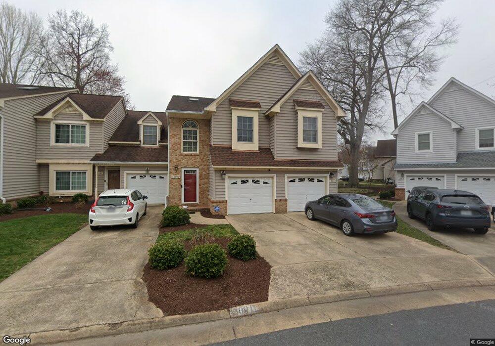
1300 Bunker Ridge Arch Chesapeake, VA 23320
Greenbrier East NeighborhoodEstimated Value: $286,041 - $302,000
2
Beds
2
Baths
1,360
Sq Ft
$219/Sq Ft
Est. Value
About This Home
This home is located at 1300 Bunker Ridge Arch, Chesapeake, VA 23320 and is currently estimated at $297,510, approximately $218 per square foot. 1300 Bunker Ridge Arch is a home located in Chesapeake City with nearby schools including Greenbrier Primary School, Greenbrier Intermediate School, and Greenbrier Middle.
Ownership History
Date
Name
Owned For
Owner Type
Purchase Details
Closed on
Jan 15, 2009
Sold by
Wells Fargo Bank N A Trus
Bought by
Degroat Kimberland L
Current Estimated Value
Home Financials for this Owner
Home Financials are based on the most recent Mortgage that was taken out on this home.
Original Mortgage
$152,981
Outstanding Balance
$97,109
Interest Rate
5.26%
Mortgage Type
FHA
Estimated Equity
$200,401
Create a Home Valuation Report for This Property
The Home Valuation Report is an in-depth analysis detailing your home's value as well as a comparison with similar homes in the area
Home Values in the Area
Average Home Value in this Area
Purchase History
| Date | Buyer | Sale Price | Title Company |
|---|---|---|---|
| Degroat Kimberland L | $155,000 | -- |
Source: Public Records
Mortgage History
| Date | Status | Borrower | Loan Amount |
|---|---|---|---|
| Open | Degroat Kimberland L | $152,981 |
Source: Public Records
Tax History Compared to Growth
Tax History
| Year | Tax Paid | Tax Assessment Tax Assessment Total Assessment is a certain percentage of the fair market value that is determined by local assessors to be the total taxable value of land and additions on the property. | Land | Improvement |
|---|---|---|---|---|
| 2025 | $2,610 | $268,900 | $100,000 | $168,900 |
| 2024 | $2,610 | $258,400 | $90,000 | $168,400 |
| 2023 | $2,205 | $249,500 | $80,000 | $169,500 |
| 2022 | $2,172 | $215,000 | $70,000 | $145,000 |
| 2021 | $1,956 | $186,300 | $60,000 | $126,300 |
| 2020 | $1,839 | $175,100 | $55,000 | $120,100 |
| 2019 | $1,832 | $174,500 | $50,000 | $124,500 |
| 2018 | $1,798 | $171,000 | $45,000 | $126,000 |
| 2017 | $1,796 | $171,000 | $45,000 | $126,000 |
| 2016 | $1,698 | $161,700 | $45,000 | $116,700 |
| 2015 | $1,759 | $167,500 | $45,000 | $122,500 |
| 2014 | $1,666 | $158,700 | $45,000 | $113,700 |
Source: Public Records
Map
Nearby Homes
- 1308 Bunker Ridge Arch Unit F
- 1309 Fairways Lookout Unit B
- 1219 Crooked Stick Crossing
- 930 Shoal Creek Trail Unit A
- 1443 Rollesby Way
- 1305 Turnberry Ct
- 1428 Otterbourne Cir
- 1440 Otterbourne Cir
- 945 Shoal Creek Trail Unit B
- 1202 Fairway Dr
- 1009 Saint Andrews Way Unit B
- 1409 Debbs Ln
- 1008 Saint Andrews Way Unit D
- 1004 Saint Andrews Way Unit D
- 1468 Otterbourne Cir
- 948 Saint Andrews Reach Unit A
- 1108 Mill Lake Quarter
- 1318 Emsworth Dr
- 1307 Emsworth Dr
- 939 Seabreeze Ct
- 1300 Bunker Ridge Arch Unit D
- 1300 Bunker Ridge Arch
- 1300 Bunker Ridge Arch
- 1300 Bunker Ridge Arch
- 1300 Bunker Ridge Arch
- 1300 Bunker Ridge Arch Unit B
- 1312 Sand Bunker Arch
- 1312 Sand Bunker Arch
- 1312 Sand Bunker Arch
- 1312 Sand Bunker Arch
- 1312 Sand Bunker Arch
- 1312 Sand Bunker Arch Unit 6
- 1312 Sand Bunker Arch Unit E
- 1312 Sand Bunker Arch Unit D
- 1304D Bunker Ridge Arch
- 1304 Bunker Ridge Arch
- 1304 Bunker Ridge Arch
- 1304 Bunker Ridge Arch
- 1304 Bunker Ridge Arch
- 1304 Bunker Ridge Arch