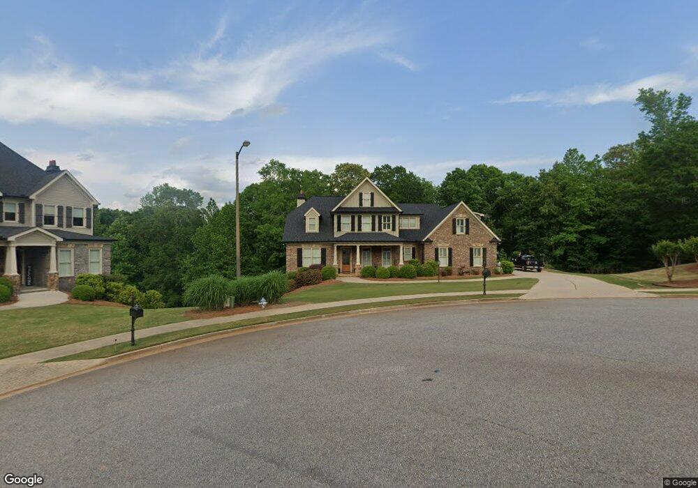
1300 Clint Ct Bogart, GA 30622
Estimated Value: $1,063,000 - $1,318,000
--
Bed
--
Bath
4,212
Sq Ft
$274/Sq Ft
Est. Value
About This Home
This home is located at 1300 Clint Ct, Bogart, GA 30622 and is currently estimated at $1,153,931, approximately $273 per square foot. 1300 Clint Ct is a home with nearby schools including Rocky Branch Elementary School, Malcom Bridge Middle School, and North Oconee High School.
Ownership History
Date
Name
Owned For
Owner Type
Purchase Details
Closed on
Jun 22, 2017
Sold by
D
Bought by
Orr William Jordan and Orr Taylor Michelle
Current Estimated Value
Home Financials for this Owner
Home Financials are based on the most recent Mortgage that was taken out on this home.
Original Mortgage
$478,400
Outstanding Balance
$397,164
Interest Rate
3.95%
Mortgage Type
New Conventional
Estimated Equity
$756,767
Purchase Details
Closed on
Feb 24, 2016
Sold by
D & B Land Ventures Inc
Bought by
D & B Custom Builders Inc
Purchase Details
Closed on
Sep 4, 2015
Sold by
Oconee Somerest Partners L
Bought by
D & B Land Ventures
Create a Home Valuation Report for This Property
The Home Valuation Report is an in-depth analysis detailing your home's value as well as a comparison with similar homes in the area
Home Values in the Area
Average Home Value in this Area
Purchase History
| Date | Buyer | Sale Price | Title Company |
|---|---|---|---|
| Orr William Jordan | $598,000 | -- | |
| D & B Custom Builders Inc | $75,000 | -- | |
| D & B Custom Builders Inc | $75,000 | -- | |
| D & B Land Ventures | $550,000 | -- |
Source: Public Records
Mortgage History
| Date | Status | Borrower | Loan Amount |
|---|---|---|---|
| Open | Orr William Jordan | $478,400 |
Source: Public Records
Tax History Compared to Growth
Tax History
| Year | Tax Paid | Tax Assessment Tax Assessment Total Assessment is a certain percentage of the fair market value that is determined by local assessors to be the total taxable value of land and additions on the property. | Land | Improvement |
|---|---|---|---|---|
| 2024 | $7,987 | $428,280 | $45,000 | $383,280 |
| 2023 | $8,006 | $423,065 | $44,000 | $379,065 |
| 2022 | $7,218 | $336,533 | $40,000 | $296,533 |
| 2021 | $6,960 | $300,864 | $30,000 | $270,864 |
| 2020 | $6,581 | $284,033 | $30,000 | $254,033 |
| 2019 | $6,326 | $273,055 | $30,000 | $243,055 |
| 2018 | $5,577 | $235,726 | $30,000 | $205,726 |
| 2017 | $3,702 | $154,543 | $30,000 | $124,543 |
| 2016 | $476 | $19,200 | $19,200 | $0 |
| 2015 | $440 | $16,800 | $16,800 | $0 |
| 2014 | $369 | $13,500 | $13,500 | $0 |
| 2013 | -- | $9,300 | $9,300 | $0 |
Source: Public Records
Map
Nearby Homes
- 2163 Heather Ln
- 2082 Wade Dr
- 0 Clotfelter Rd Unit 1025303
- 1141 Field Ln
- 0 Ruth Jackson Rd Unit 10582108
- 00 Ruth Jackson Rd
- 2479 Eisenhower Ave
- 1665 Eisenhower Ave
- 1120 Liberty Ln
- 2934 Horseshoe Bend Ln
- 1640 Madison Ct
- 1656 Lincoln Dr
- 2548 E Princeton Dr
- 0 Monroe Hwy Unit 1025452
- 1180 Summerfield Ln
- 1145 Summerfield Ln
- 1327 Eisenhower Ave
- 3240 Monroe Hwy
- 1220 Clint Ct
- 1301 Clint Ct
- 1104 Clint Ct
- 3054 Heather Ln
- 2906 Heather Ln
- 0 Clint Ct Unit 8827435
- 0 Clint Ct Unit 8756842
- 0 Clint Ct Unit 8756337
- 0 Clint Ct
- 2850 Heather Ln
- 1115 Clint Ct
- 1300 Caitlin Ct
- 0 Caitlin Ct Unit 7164866
- 0 Caitlin Ct
- 1244 Caitlin Ct
- 2750 Heather Ln
- 3261 Heather Ln
- 3387 Heather Ln
- 1098 Caitlin Ct
- 3139 Heather Ln