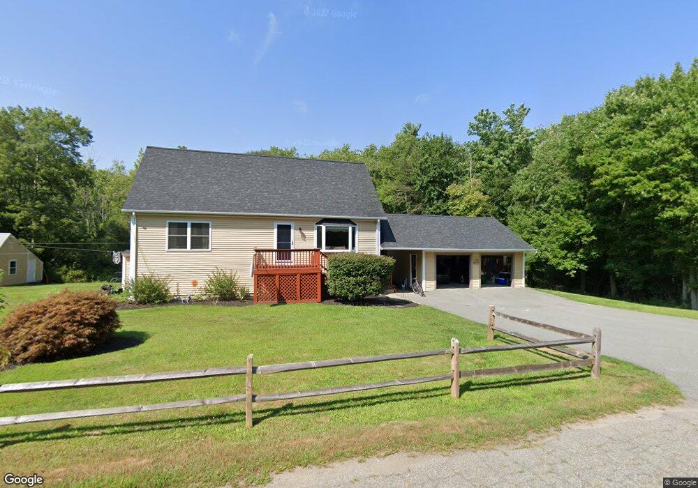
1300 Data Vault Rd Dighton, MA 02715
Estimated Value: $602,652 - $674,000
2
Beds
2
Baths
1,680
Sq Ft
$377/Sq Ft
Est. Value
About This Home
This home is located at 1300 Data Vault Rd, Dighton, MA 02715 and is currently estimated at $633,663, approximately $377 per square foot. 1300 Data Vault Rd is a home located in Bristol County with nearby schools including Dighton-Rehoboth Regional High School, SCEC Life Academy, and Swansea Wood School.
Ownership History
Date
Name
Owned For
Owner Type
Purchase Details
Closed on
May 28, 2025
Sold by
Leduc Robert G and Leduc Pamela J
Bought by
Leduc Patrick and Leduc Hillary
Current Estimated Value
Home Financials for this Owner
Home Financials are based on the most recent Mortgage that was taken out on this home.
Original Mortgage
$504,000
Outstanding Balance
$500,958
Interest Rate
6.83%
Mortgage Type
Purchase Money Mortgage
Estimated Equity
$132,705
Purchase Details
Closed on
Aug 29, 2003
Sold by
Leduc Robert G and Leduc Pamela Jean
Bought by
Midwood Helen
Create a Home Valuation Report for This Property
The Home Valuation Report is an in-depth analysis detailing your home's value as well as a comparison with similar homes in the area
Home Values in the Area
Average Home Value in this Area
Purchase History
| Date | Buyer | Sale Price | Title Company |
|---|---|---|---|
| Leduc Patrick | $630,000 | None Available | |
| Leduc Patrick | $630,000 | None Available | |
| Midwood Helen | -- | -- | |
| Midwood Helen | -- | -- | |
| Midwood Helen | -- | -- |
Source: Public Records
Mortgage History
| Date | Status | Borrower | Loan Amount |
|---|---|---|---|
| Open | Leduc Patrick | $504,000 | |
| Closed | Leduc Patrick | $504,000 | |
| Previous Owner | Midwood Helen | $205,000 |
Source: Public Records
Tax History
| Year | Tax Paid | Tax Assessment Tax Assessment Total Assessment is a certain percentage of the fair market value that is determined by local assessors to be the total taxable value of land and additions on the property. | Land | Improvement |
|---|---|---|---|---|
| 2025 | $5,503 | $438,100 | $149,700 | $288,400 |
| 2024 | $5,408 | $395,300 | $143,700 | $251,600 |
| 2023 | $5,087 | $364,900 | $143,700 | $221,200 |
| 2022 | $4,897 | $342,700 | $140,200 | $202,500 |
| 2021 | $4,648 | $313,400 | $127,600 | $185,800 |
| 2020 | $4,689 | $313,000 | $141,600 | $171,400 |
| 2019 | $4,284 | $307,900 | $141,600 | $166,300 |
| 2018 | $24,648 | $286,300 | $121,500 | $164,800 |
| 2017 | $4,113 | $275,300 | $139,800 | $135,500 |
| 2016 | $4,129 | $271,100 | $143,700 | $127,400 |
| 2015 | $4,052 | $273,800 | $147,600 | $126,200 |
| 2014 | $4,034 | $264,900 | $147,600 | $117,300 |
Source: Public Records
Map
Nearby Homes
- 316 High Hill Rd
- 3035 Clubhouse Dr Unit 6
- 3051 Clubhouse Dr Unit 78
- 3035 Clubhouse Dr Unit 5
- 3057 Clubhouse Dr Unit Model
- 3045 Clubhouse Dr Unit Lot 75
- 74R Club House Dr Unit 74R
- 73H Club House Dr Unit Lot 73H
- 35 Clubhouse Dr Unit RR35
- RR36 Club House Dr Unit Lot RR36
- RR33 Club House Dr Unit Lot RR33
- RR38 Club House Unit RR38
- RR34 Club House Dr Unit RR34
- G1 Club House Dr Unit G1
- RR37 Club House Dr Unit RR37
- R39 Club House Dr Unit Lot R39
- RR76 Clubhouse Dr Unit RR76
- 171 Marvel St
- 65 Marvel St
- 5 Nottingham Cir
- 3425 Sharps Lot Rd
- 3423 Sharps Lot Rd Unit 1
- 1374 Sharps Lot Rd
- 3397 Sharps Lot Rd
- 1378 Sharps Lot Rd
- 1370 Sharps Lot Rd
- 1319 Sharps Lot Rd
- 1372 Sharps Lot Rd
- 11 Murray Place
- 2 Murray Place
- 1329 Sharps Lot Rd
- 1340 Data Vault Rd
- 1338 Sharps Lot Rd
- 1366 Sharps Lot Rd
- 0 Murray Place
- 1372R Sharps Lot Rd
- 2601 Data Vault Rd
- 1320 Sharps Lot Rd
- 25 Murray Place
- 1304 Sharps Lot Rd
Your Personal Tour Guide
Ask me questions while you tour the home.