Estimated Value: $273,439 - $362,000
2
Beds
1
Bath
900
Sq Ft
$359/Sq Ft
Est. Value
About This Home
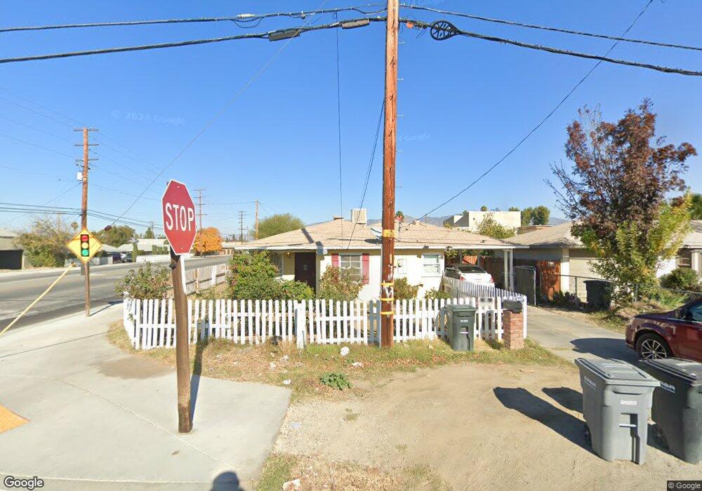
This home is located at 1300 E Date St, Hemet, CA 92544 and is currently estimated at $323,110, approximately $359 per square foot. 1300 E Date St is a home located in Riverside County with nearby schools including Jacob Wiens Elementary School, Rancho Viejo Middle School, and Tahquitz High School.
Ownership History
Date
Name
Owned For
Owner Type
Purchase Details
Closed on
Aug 2, 2019
Sold by
Stamps Robert Clinton
Bought by
Department Of Transportation
Current Estimated Value
Purchase Details
Closed on
Dec 11, 2008
Sold by
Stamps Suzanne Blanche
Bought by
Stamps Robert Clinton
Purchase Details
Closed on
Nov 21, 2008
Sold by
Us Bank National Association
Bought by
Stamps Robert Clinton
Purchase Details
Closed on
Jan 10, 2007
Sold by
Benzor Ernie L
Bought by
Us Bank Na
Purchase Details
Closed on
Aug 6, 2003
Sold by
Stiny Pier E and Stiny Daphne K
Bought by
Benzor Ernie L
Home Financials for this Owner
Home Financials are based on the most recent Mortgage that was taken out on this home.
Original Mortgage
$79,920
Interest Rate
7.95%
Mortgage Type
Purchase Money Mortgage
Create a Home Valuation Report for This Property
The Home Valuation Report is an in-depth analysis detailing your home's value as well as a comparison with similar homes in the area
Purchase History
| Date | Buyer | Sale Price | Title Company |
|---|---|---|---|
| Department Of Transportation | -- | None Available | |
| Stamps Robert Clinton | -- | First American Title Ins Co | |
| Stamps Robert Clinton | $55,000 | First American Title Ins Co | |
| Us Bank Na | $262,892 | None Available | |
| Benzor Ernie L | $100,000 | Orange Coast Title Co |
Source: Public Records
Mortgage History
| Date | Status | Borrower | Loan Amount |
|---|---|---|---|
| Previous Owner | Benzor Ernie L | $79,920 |
Source: Public Records
Tax History
| Year | Tax Paid | Tax Assessment Tax Assessment Total Assessment is a certain percentage of the fair market value that is determined by local assessors to be the total taxable value of land and additions on the property. | Land | Improvement |
|---|---|---|---|---|
| 2025 | $2,275 | $70,801 | $38,622 | $32,179 |
| 2023 | $2,275 | $68,054 | $37,123 | $30,931 |
| 2022 | $796 | $66,721 | $36,396 | $30,325 |
| 2021 | $783 | $65,414 | $35,683 | $29,731 |
| 2019 | $0 | $63,475 | $34,625 | $28,850 |
| 2018 | $738 | $62,232 | $33,947 | $28,285 |
| 2017 | $978 | $61,013 | $33,282 | $27,731 |
| 2016 | $724 | $59,818 | $32,630 | $27,188 |
| 2015 | $722 | $58,922 | $32,141 | $26,781 |
| 2014 | $690 | $57,769 | $31,512 | $26,257 |
Source: Public Records
Map
Nearby Homes
- 410 N San Jacinto St
- 1124 E Campus Way
- 360 Terry Ln
- 317 Terry Ln
- 498 Monte Vista Way
- 608 N San Jacinto St
- 511 N Girard St
- 401 N Santa fe St
- 415 N Santa fe St
- 439 N Santa fe St
- 573 N Girard St
- 621 Brian St
- 1929 E Oakland Ave
- 1400 E Menlo Ave Unit 87
- 1400 E Menlo Ave Unit 49
- 615 Kerilyn Ln
- 1135 E Morton Place
- 291 N Yale St
- 160 S San Jacinto St
- 40480 Melrose Ave
- 1326 E Date St
- 614 N San Jacinto St
- 380 N San Jacinto St
- 1376 E Date St
- 370 N San Jacinto St
- 421 N San Jacinto St Unit 8
- 421 N San Jacinto St
- 448 N San Jacinto St
- 1400 E Date St
- 360 N San Jacinto St
- 408 N Weston Place
- 412 N Weston Place
- 372 N San Jacinto St
- 460 N San Jacinto St
- 395 N San Jacinto St Unit A
- 1426 E Date St
- 414 N Weston Place
- 1375 E Date St
- 361 California 79
- 1450 E Date St
Your Personal Tour Guide
Ask me questions while you tour the home.