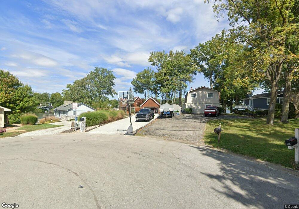
1300 Lighthouse Point Cicero, IN 46034
Estimated Value: $726,000 - $1,181,000
3
Beds
3
Baths
2,542
Sq Ft
$384/Sq Ft
Est. Value
About This Home
This home is located at 1300 Lighthouse Point, Cicero, IN 46034 and is currently estimated at $975,782, approximately $383 per square foot. 1300 Lighthouse Point is a home located in Hamilton County with nearby schools including Cicero Sda Elementary and Indiana Academy.
Ownership History
Date
Name
Owned For
Owner Type
Purchase Details
Closed on
Aug 17, 2018
Sold by
Fishman Randall L and Fishman Esther W
Bought by
Horning Michael J and Windows Tara R
Current Estimated Value
Home Financials for this Owner
Home Financials are based on the most recent Mortgage that was taken out on this home.
Original Mortgage
$85,500
Outstanding Balance
$73,474
Interest Rate
4.5%
Mortgage Type
Credit Line Revolving
Estimated Equity
$902,308
Purchase Details
Closed on
Oct 23, 2017
Sold by
Fishman Randall L and Estate Of James Bernard Fishma
Bought by
Fishman Randall L and Fishman Esther W
Purchase Details
Closed on
Feb 16, 2001
Sold by
Fishman Randall L
Bought by
Fishman James B
Purchase Details
Closed on
Feb 15, 2001
Sold by
Fishman Randall L and Fishman James B
Bought by
Fishman Randall L and Fishman James B
Create a Home Valuation Report for This Property
The Home Valuation Report is an in-depth analysis detailing your home's value as well as a comparison with similar homes in the area
Home Values in the Area
Average Home Value in this Area
Purchase History
| Date | Buyer | Sale Price | Title Company |
|---|---|---|---|
| Horning Michael J | -- | Royal Title Services | |
| Fishman Randall L | -- | None Available | |
| Fishman James B | -- | -- | |
| Fishman James B | -- | -- | |
| Fishman Randall L | -- | -- |
Source: Public Records
Mortgage History
| Date | Status | Borrower | Loan Amount |
|---|---|---|---|
| Open | Horning Michael J | $85,500 |
Source: Public Records
Tax History
| Year | Tax Paid | Tax Assessment Tax Assessment Total Assessment is a certain percentage of the fair market value that is determined by local assessors to be the total taxable value of land and additions on the property. | Land | Improvement |
|---|---|---|---|---|
| 2025 | $8,852 | $877,900 | $511,800 | $366,100 |
| 2024 | $8,244 | $885,200 | $511,800 | $373,400 |
| 2023 | $8,244 | $815,300 | $511,800 | $303,500 |
| 2022 | $7,412 | $737,600 | $321,700 | $415,900 |
| 2021 | $6,693 | $665,300 | $321,700 | $343,600 |
| 2020 | $5,871 | $593,000 | $321,700 | $271,300 |
| 2019 | $5,266 | $533,900 | $226,700 | $307,200 |
| 2018 | $4,500 | $439,300 | $226,700 | $212,600 |
| 2017 | $4,271 | $416,300 | $226,700 | $189,600 |
| 2016 | $4,365 | $424,700 | $226,700 | $198,000 |
| 2014 | $4,188 | $407,100 | $218,600 | $188,500 |
| 2013 | $4,188 | $386,500 | $224,600 | $161,900 |
Source: Public Records
Map
Nearby Homes
- 709 Pleasant Point Cir
- 100 Confidential Dr
- 1940 Nantucket Dr
- 82 Hovden Dr
- 243 Alvor Ct
- 206 Verdant Dr
- 26 Verdant Dr
- 30 Lively Place
- 104 Perlican Dr
- 129 Armitage St
- 15 Morse Ct
- 31 Bluewater Dr
- 140 Wiley St
- 18 Point Ln
- 449 S Peru St
- 249 Cass St
- 209 Bayview Dr
- 27 Karner Blue Ct
- 47 Karner Blue Ct
- 25 Karner Blue Ct
- 1329 Lighthouse Point
- 1320 Lighthouse Point
- 1340 Lighthouse Point
- 1349 Lighthouse Point
- 1360 Lighthouse Point
- 1380 Lighthouse Point
- 1369 Lighthouse Point
- 1400 Lighthouse Point
- 1389 Lighthouse Point
- 1429 Lighthouse Point
- 1420 Lighthouse Point
- 1140 Nantucket Dr
- 1449 Lighthouse Point
- 1440 Lighthouse Point
- 1120 Nantucket Dr
- 1460 Lighthouse Point
- 1180 Nantucket Dr
- 1100 Nantucket Dr
- 1080 Nantucket Dr
- 1480 Lighthouse Point
Your Personal Tour Guide
Ask me questions while you tour the home.