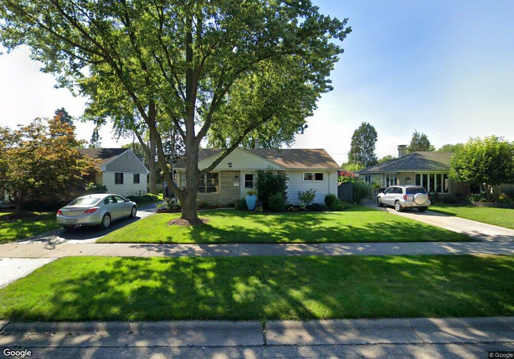
1300 S 2nd Ave Des Plaines, IL 60018
Estimated Value: $376,000 - $441,000
3
Beds
2
Baths
1,297
Sq Ft
$316/Sq Ft
Est. Value
About This Home
This home is located at 1300 S 2nd Ave, Des Plaines, IL 60018 and is currently estimated at $409,499, approximately $315 per square foot. 1300 S 2nd Ave is a home located in Cook County with nearby schools including Forest Elementary School, Algonquin Middle School, and Maine West High School.
Ownership History
Date
Name
Owned For
Owner Type
Purchase Details
Closed on
Nov 25, 1998
Sold by
Scherer Charles P and Scherer Mary Ellen
Bought by
Reese Thomas P and Reese Sharon M
Current Estimated Value
Home Financials for this Owner
Home Financials are based on the most recent Mortgage that was taken out on this home.
Original Mortgage
$159,600
Interest Rate
6.79%
Create a Home Valuation Report for This Property
The Home Valuation Report is an in-depth analysis detailing your home's value as well as a comparison with similar homes in the area
Home Values in the Area
Average Home Value in this Area
Purchase History
| Date | Buyer | Sale Price | Title Company |
|---|---|---|---|
| Reese Thomas P | $168,000 | Professional National Title |
Source: Public Records
Mortgage History
| Date | Status | Borrower | Loan Amount |
|---|---|---|---|
| Previous Owner | Reese Thomas P | $159,600 |
Source: Public Records
Tax History Compared to Growth
Tax History
| Year | Tax Paid | Tax Assessment Tax Assessment Total Assessment is a certain percentage of the fair market value that is determined by local assessors to be the total taxable value of land and additions on the property. | Land | Improvement |
|---|---|---|---|---|
| 2025 | $6,508 | $35,000 | $6,157 | $28,843 |
| 2024 | $6,508 | $28,000 | $5,131 | $22,869 |
| 2023 | $6,324 | $28,000 | $5,131 | $22,869 |
| 2022 | $6,324 | $28,000 | $5,131 | $22,869 |
| 2021 | $4,053 | $16,514 | $4,275 | $12,239 |
| 2020 | $4,053 | $16,514 | $4,275 | $12,239 |
| 2019 | $4,071 | $18,555 | $4,275 | $14,280 |
| 2018 | $6,005 | $23,515 | $3,762 | $19,753 |
| 2017 | $5,917 | $23,515 | $3,762 | $19,753 |
| 2016 | $5,840 | $23,515 | $3,762 | $19,753 |
| 2015 | $5,297 | $20,144 | $3,249 | $16,895 |
| 2014 | $5,201 | $20,144 | $3,249 | $16,895 |
| 2013 | $5,054 | $20,144 | $3,249 | $16,895 |
Source: Public Records
Map
Nearby Homes
- 1394 Carol Ln
- 1050 E Oakton St
- 1162 W Grant Dr
- 1056 E Villa Dr
- 674 E Algonquin Rd
- 1090 W Grant Dr
- 807 Fairmont Ct
- 1205 S Wolf Rd
- 1673 Spruce Ave
- 664 E Oakton St
- 881 E Thacker St
- 1122 Alfini Dr
- 1489 E Algonquin Rd
- 1365 Ashland Ave Unit 604
- 886 E Thacker St
- 1783 Lee St
- 505 Forest Ave
- 905 Center St Unit B208
- 799 Graceland Ave Unit 504A
- 799 Graceland Ave Unit 404A
- 1292 S 2nd Ave
- 1308 S 2nd Ave
- 1284 S 2nd Ave
- 1316 S 2nd Ave
- 1287 Webster Ln
- 1295 Webster Ln
- 1276 S 2nd Ave
- 1277 Webster Ln
- 1303 Webster Ln
- 1301 S 2nd Ave
- 1324 S 2nd Ave
- 1291 S 2nd Ave
- 1309 S 2nd Ave
- 1269 Webster Ln
- 1283 S 2nd Ave
- 1317 S 2nd Ave
- 1332 S 2nd Ave
- 1259 Webster Ln
- 1323 Webster Ln
- 1277 S 2nd Ave