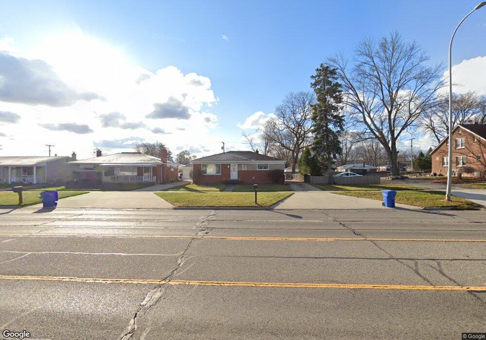
13000 E 12 Mile Rd Warren, MI 48088
Northeast Warren NeighborhoodEstimated Value: $237,730 - $272,000
3
Beds
2
Baths
1,249
Sq Ft
$202/Sq Ft
Est. Value
About This Home
This home is located at 13000 E 12 Mile Rd, Warren, MI 48088 and is currently estimated at $251,683, approximately $201 per square foot. 13000 E 12 Mile Rd is a home located in Macomb County with nearby schools including Warren Woods Tower High School, Frontier International Academy Elementary, and Warren Woods Christian School.
Ownership History
Date
Name
Owned For
Owner Type
Purchase Details
Closed on
Apr 6, 2022
Sold by
Ronald Kosal
Bought by
Kosal Ronald Francis
Current Estimated Value
Home Financials for this Owner
Home Financials are based on the most recent Mortgage that was taken out on this home.
Original Mortgage
$161,600
Outstanding Balance
$149,878
Interest Rate
3.76%
Mortgage Type
New Conventional
Estimated Equity
$101,805
Purchase Details
Closed on
Dec 28, 2012
Sold by
Minoletti William I and Minoletti Jane P
Bought by
Kosal Ronald
Create a Home Valuation Report for This Property
The Home Valuation Report is an in-depth analysis detailing your home's value as well as a comparison with similar homes in the area
Home Values in the Area
Average Home Value in this Area
Purchase History
| Date | Buyer | Sale Price | Title Company |
|---|---|---|---|
| Kosal Ronald Francis | -- | Devon Title Agency | |
| Kosal Ronald | $44,000 | Metro Hills Title Agency Llc |
Source: Public Records
Mortgage History
| Date | Status | Borrower | Loan Amount |
|---|---|---|---|
| Open | Kosal Ronald Francis | $161,600 |
Source: Public Records
Tax History
| Year | Tax Paid | Tax Assessment Tax Assessment Total Assessment is a certain percentage of the fair market value that is determined by local assessors to be the total taxable value of land and additions on the property. | Land | Improvement |
|---|---|---|---|---|
| 2025 | $2,896 | $110,320 | $0 | $0 |
| 2024 | $28 | $100,530 | $0 | $0 |
| 2023 | $3,607 | $90,230 | $0 | $0 |
| 2022 | $2,618 | $79,520 | $0 | $0 |
| 2021 | $2,569 | $75,220 | $0 | $0 |
| 2020 | $2,462 | $72,140 | $0 | $0 |
| 2019 | $2,352 | $67,840 | $0 | $0 |
| 2018 | $2,122 | $62,590 | $0 | $0 |
| 2017 | $2,247 | $56,790 | $9,810 | $46,980 |
| 2016 | $2,229 | $56,790 | $0 | $0 |
| 2015 | -- | $50,920 | $0 | $0 |
| 2012 | -- | $44,070 | $0 | $0 |
Source: Public Records
Map
Nearby Homes
- 29143 Dover Ave
- 29105 Palomino Dr
- 29531 Eiffel Ave
- 29579 Fairfield Dr
- 54765 Palomino Ave
- 28540 Roan Dr
- 29010 Wagner Dr
- 29337 Roan Dr
- 29091 Wagner Dr
- 28625 Bradner Dr
- 29366 Wagner Dr
- 29088 Yorkshire Ln Unit 28
- 12876 Martin Rd
- 29417 Scarborough Dr Unit 28
- 12531 Common Rd
- 30045 Iroquois Dr
- 12855 Ray Dr
- 13517 Yvonne Dr
- 29454 Scarborough Dr Unit 7
- 27738 Roan Ave
- 13012 E 12 Mile Rd
- 13024 E 12 Mile Rd
- 12980 E 12 Mile Rd
- 12953 Stanley Dr
- 12965 Stanley Dr
- 12941 Stanley Dr
- 13036 E 12 Mile Rd
- 13007 Stanley Dr
- 12929 Stanley Dr
- 13048 E 12 Mile Rd
- 12917 Stanley Dr
- 13025 E 12 Mile Rd
- 13031 Stanley Dr
- 12939 Twelve Mile Rd
- 13011 E 12 Mile Rd
- 13037 E 12 Mile Rd
- 12939 E 12 Mile Rd
- 29107 Dover Ave
- 12927 Twelve Mile Rd
- 12927 E 12 Mile Rd
Your Personal Tour Guide
Ask me questions while you tour the home.