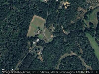
13006 Dry Ridge Rd NE Flintstone, MD 21530
Estimated Value: $230,000 - $266,000
3
Beds
2
Baths
2,600
Sq Ft
$98/Sq Ft
Est. Value
About This Home
This home is located at 13006 Dry Ridge Rd NE, Flintstone, MD 21530 and is currently estimated at $254,801, approximately $98 per square foot. 13006 Dry Ridge Rd NE is a home located in Allegany County with nearby schools including Flintstone Elementary School, Washington Middle School, and Fort Hill High School.
Ownership History
Date
Name
Owned For
Owner Type
Purchase Details
Closed on
Sep 16, 2016
Sold by
Liller Logan C
Bought by
Dry Ridge Properties Llc
Current Estimated Value
Purchase Details
Closed on
Dec 11, 2009
Sold by
Mccoy Adam E and Mccoy Stephanie D
Bought by
Wagner Benjamin A and Wagner Amanda L
Home Financials for this Owner
Home Financials are based on the most recent Mortgage that was taken out on this home.
Original Mortgage
$168,300
Interest Rate
4.92%
Mortgage Type
New Conventional
Purchase Details
Closed on
May 12, 2004
Sold by
Mccoy Adam
Bought by
Mccoy Adam
Purchase Details
Closed on
Dec 30, 2003
Sold by
Mazuran John M and Mazuran Helen A
Bought by
Mccoy Adam
Create a Home Valuation Report for This Property
The Home Valuation Report is an in-depth analysis detailing your home's value as well as a comparison with similar homes in the area
Home Values in the Area
Average Home Value in this Area
Purchase History
| Date | Buyer | Sale Price | Title Company |
|---|---|---|---|
| Dry Ridge Properties Llc | $140,000 | Attorney | |
| Wagner Benjamin A | $165,000 | -- | |
| Mccoy Adam | -- | -- | |
| Mccoy Adam | $67,000 | -- |
Source: Public Records
Mortgage History
| Date | Status | Borrower | Loan Amount |
|---|---|---|---|
| Previous Owner | Liller Logan C | $163,265 | |
| Previous Owner | Wagner Benjamin A | $168,300 | |
| Previous Owner | Mccoy Adam E | $124,000 | |
| Previous Owner | Mccoy Adam E | $13,500 | |
| Closed | Wagner Benjamin A | -- |
Source: Public Records
Tax History Compared to Growth
Tax History
| Year | Tax Paid | Tax Assessment Tax Assessment Total Assessment is a certain percentage of the fair market value that is determined by local assessors to be the total taxable value of land and additions on the property. | Land | Improvement |
|---|---|---|---|---|
| 2024 | $1,970 | $181,200 | $32,300 | $148,900 |
| 2023 | $1,911 | $175,767 | $0 | $0 |
| 2022 | $1,852 | $170,333 | $0 | $0 |
| 2021 | $1,776 | $164,900 | $30,900 | $134,000 |
| 2020 | $1,746 | $160,633 | $0 | $0 |
| 2019 | $1,700 | $156,367 | $0 | $0 |
| 2018 | $1,653 | $152,100 | $20,300 | $131,800 |
| 2017 | $1,632 | $150,000 | $0 | $0 |
| 2016 | -- | $147,900 | $0 | $0 |
| 2015 | $1,576 | $145,800 | $0 | $0 |
| 2014 | $1,576 | $144,467 | $0 | $0 |
Source: Public Records
Map
Nearby Homes
- 13507 Black Valley Rd NE
- 24200 E Hancock Rd
- 11749 Town Creek Rd NE
- 0 Town Creek Rd Unit MDAL2010760
- 0 Old Cumberland Rd Unit MDAL2010314
- 18.87 Acres Elbinsville Rd NE
- 10406 Black Sulphur Rd NE
- 306 Jacksonville Rd
- 0 Green Ridge Rd Unit MDAL2010948
- 0 Creek Rd Unit PABD2002558
- 12105 Cresap Mill Rd SE
- 12515 Cresap Mill Rd SE
- 15915 Williams Rd SE
- 2560 Evitts Creek Rd
- 11109 Butternut Ln NE
- 14404 Old Hancock Rd NE
- 12005 Albin Ln NE
- 13910 Bedford Rd NE
- 3718 Ragged Mountain Rd
- 13317 Lerae St NE
