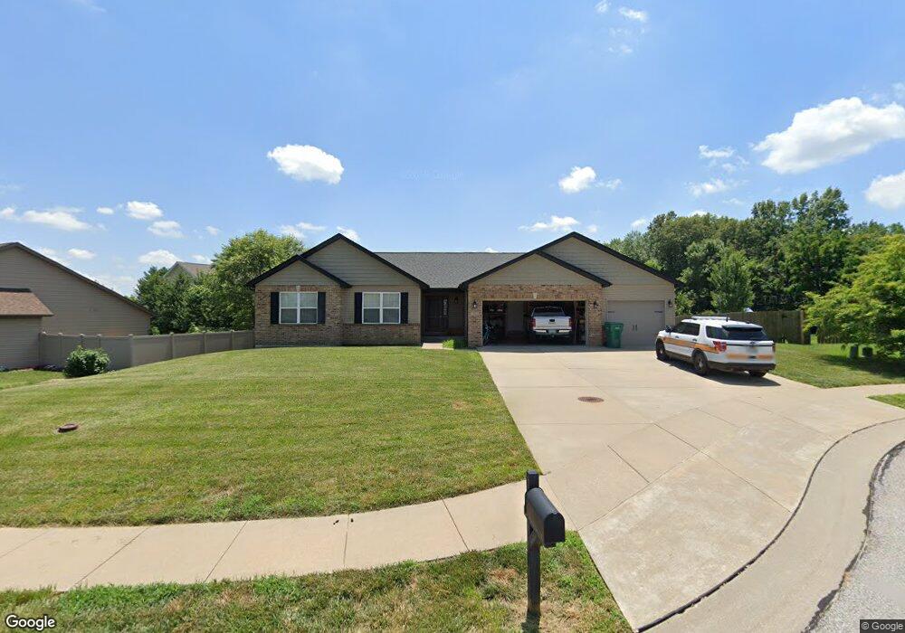
1301 Andy Dr O Fallon, IL 62269
Estimated Value: $360,000 - $426,000
3
Beds
2
Baths
1,595
Sq Ft
$241/Sq Ft
Est. Value
About This Home
This home is located at 1301 Andy Dr, O Fallon, IL 62269 and is currently estimated at $384,733, approximately $241 per square foot. 1301 Andy Dr is a home located in St. Clair County with nearby schools including Moye Elementary School, Carriel Junior High School, and O'Fallon Township High School.
Ownership History
Date
Name
Owned For
Owner Type
Purchase Details
Closed on
Dec 21, 2011
Sold by
Lf & Son Construction Llc
Bought by
Power Robert S and Power Lynda S
Current Estimated Value
Home Financials for this Owner
Home Financials are based on the most recent Mortgage that was taken out on this home.
Original Mortgage
$152,900
Interest Rate
4.01%
Mortgage Type
Purchase Money Mortgage
Purchase Details
Closed on
Oct 5, 2011
Sold by
Ozier Leann
Bought by
Lf & Son Construction Llc
Home Financials for this Owner
Home Financials are based on the most recent Mortgage that was taken out on this home.
Original Mortgage
$180,000
Interest Rate
7.25%
Mortgage Type
Future Advance Clause Open End Mortgage
Create a Home Valuation Report for This Property
The Home Valuation Report is an in-depth analysis detailing your home's value as well as a comparison with similar homes in the area
Home Values in the Area
Average Home Value in this Area
Purchase History
| Date | Buyer | Sale Price | Title Company |
|---|---|---|---|
| Power Robert S | $193,000 | Fatic | |
| Lf & Son Construction Llc | $40,000 | Fatic |
Source: Public Records
Mortgage History
| Date | Status | Borrower | Loan Amount |
|---|---|---|---|
| Closed | Power Robert S | $152,900 | |
| Previous Owner | Lf & Son Construction Llc | $180,000 |
Source: Public Records
Tax History
| Year | Tax Paid | Tax Assessment Tax Assessment Total Assessment is a certain percentage of the fair market value that is determined by local assessors to be the total taxable value of land and additions on the property. | Land | Improvement |
|---|---|---|---|---|
| 2024 | $6,232 | $91,494 | $21,600 | $69,894 |
| 2023 | $5,698 | $81,205 | $19,171 | $62,034 |
| 2022 | $5,351 | $74,657 | $17,625 | $57,032 |
| 2021 | $5,276 | $72,460 | $17,682 | $54,778 |
| 2020 | $5,231 | $68,591 | $16,738 | $51,853 |
| 2019 | $5,102 | $68,591 | $16,738 | $51,853 |
| 2018 | $4,957 | $66,600 | $16,252 | $50,348 |
| 2017 | $5,310 | $68,535 | $18,233 | $50,302 |
| 2016 | $5,290 | $66,935 | $17,807 | $49,128 |
| 2014 | $4,883 | $66,161 | $17,601 | $48,560 |
| 2013 | $28 | $65,145 | $17,331 | $47,814 |
Source: Public Records
Map
Nearby Homes
- 809 E Deer Creek Rd
- 504 Overbrook Cir
- 11274 Branding Stone Dr
- 8629 Savoy Ln
- 8429 Treybrooke Place
- 8625 Savoy Ln
- 437 Marbleton Cir
- 518 Deer Creek Rd
- 513 Ingleside Ln
- 8521 Terracotta Place
- 8565 Treybrooke Place
- 516 Ingleside Ln
- 8526 Treybrooke Place
- 1104 N Smiley St
- 1001 Ramblewood Dr
- 622 Saint Nicholas Dr
- 1150 Old Vincennes Trail
- 1181 Old Vincennes Trail
- 1676 Lancaster Dr
- 621 E Wesley Dr
- 1305 Andy Dr
- 679 Janeita Ct
- 613 Erics Run Dr
- 675 Janeita Ct
- 1300 Andy Dr
- 617 Erics Run Dr
- 671 Janeita Ct
- 1304 Andy Dr
- 700 Cardiff Ct
- 682 Janeita Ct
- 704 Cardiff Ct
- 686 Janeita Ct
- 624 Erics Run Dr
- 674 Janeita Ct
- 625 Erics Run Dr
- 667 Janeita Ct
- 1307 Keck Ridge Dr
- 690 Janeita Ct
- 670 Janeita Ct
- 1311 Keck Ridge Dr
Your Personal Tour Guide
Ask me questions while you tour the home.