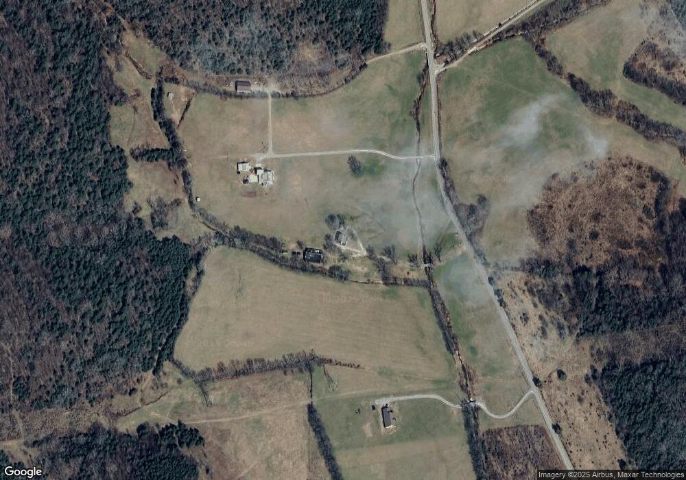
1301 Auburntown Rd Woodbury, TN 37190
Cannon County NeighborhoodEstimated Value: $566,000 - $618,624
2
Beds
2
Baths
1,352
Sq Ft
$438/Sq Ft
Est. Value
About This Home
This home is located at 1301 Auburntown Rd, Woodbury, TN 37190 and is currently estimated at $592,312, approximately $438 per square foot. 1301 Auburntown Rd is a home located in Cannon County with nearby schools including Cannon County High School.
Ownership History
Date
Name
Owned For
Owner Type
Purchase Details
Closed on
Jul 10, 2017
Sold by
Lane Steven B
Bought by
Koonce Donald Oneal and Koonce Lana Kay
Current Estimated Value
Home Financials for this Owner
Home Financials are based on the most recent Mortgage that was taken out on this home.
Original Mortgage
$200,000
Outstanding Balance
$135,679
Interest Rate
3.89%
Mortgage Type
Unknown
Estimated Equity
$456,633
Purchase Details
Closed on
Nov 14, 2014
Sold by
Lane Properties I Lp
Bought by
Lane Steven B
Purchase Details
Closed on
Mar 24, 2005
Sold by
Not Provided
Bought by
Lane Properties I Lp
Purchase Details
Closed on
Apr 1, 1995
Bought by
Tenpenny Paul
Purchase Details
Closed on
Dec 27, 1962
Bought by
Tenpenny Rachel D and Tenpenny Patsy
Create a Home Valuation Report for This Property
The Home Valuation Report is an in-depth analysis detailing your home's value as well as a comparison with similar homes in the area
Home Values in the Area
Average Home Value in this Area
Purchase History
| Date | Buyer | Sale Price | Title Company |
|---|---|---|---|
| Koonce Donald Oneal | $333,090 | -- | |
| Lane Steven B | -- | -- | |
| Lane Properties I Lp | $600,000 | -- | |
| Tenpenny Paul | -- | -- | |
| Tenpenny Rachel D | -- | -- |
Source: Public Records
Mortgage History
| Date | Status | Borrower | Loan Amount |
|---|---|---|---|
| Open | Koonce Donald Oneal | $200,000 |
Source: Public Records
Tax History Compared to Growth
Tax History
| Year | Tax Paid | Tax Assessment Tax Assessment Total Assessment is a certain percentage of the fair market value that is determined by local assessors to be the total taxable value of land and additions on the property. | Land | Improvement |
|---|---|---|---|---|
| 2025 | $1,369 | $85,800 | $0 | $0 |
| 2024 | $1,369 | $85,800 | $18,675 | $67,125 |
| 2023 | $1,317 | $84,400 | $18,675 | $65,725 |
| 2022 | $1,317 | $53,525 | $10,900 | $42,625 |
| 2021 | $1,317 | $53,525 | $10,900 | $42,625 |
| 2020 | $1,397 | $56,775 | $14,150 | $42,625 |
| 2019 | $1,397 | $56,775 | $14,150 | $42,625 |
| 2018 | $1,276 | $56,775 | $14,150 | $42,625 |
| 2017 | $1,970 | $68,175 | $35,925 | $32,250 |
| 2016 | $1,875 | $68,175 | $35,925 | $32,250 |
| 2015 | $1,725 | $68,175 | $35,925 | $32,250 |
| 2014 | $1,725 | $68,175 | $35,925 | $32,250 |
Source: Public Records
Map
Nearby Homes
- 180 Nichols Dr
- 0 Auburntown Rd Unit RTC2823164
- 310 Deerview Ln
- 0 Mcbroom St
- 604 W Adams St
- 200 Nichols Dr
- 406 Terrace Ln
- 2859 Locke Creek Rd
- 313 Terrace Ln
- 204 Terrace Ln
- 418 S Mccrary St
- 301 Old Manchester Rd
- 215 Hayes St
- 94 Hickory Ridge Ln
- 921 S Mccrary St
- 329 Hayes St
- 704 Old Manchester Rd
- 1036 Locke Creek Rd
- 0 Old McMinnville Rd
- 954 Locke Creek Rd
- 1129 Auburntown Rd
- 2 Auburntown Rd
- 1 Auburntown Rd
- 1534 Auburntown Rd
- 911 Auburntown Rd
- 1719 Auburntown Rd
- 761 Auburntown Rd
- 717 Auburntown Rd
- 814 Auburntown Rd
- 606 Mile Valley Rd
- 522 Mile Valley Rd
- 1925 Auburntown Rd
- 667 Auburntown Rd
- 640 Auburntown Rd
- 631 Auburntown Rd
- 579 Mile Valley Rd
- 2011 Auburntown Rd
- 461 Mile Valley Rd
- 504 Auburntown Rd
- 377 Mile Valley Rd
