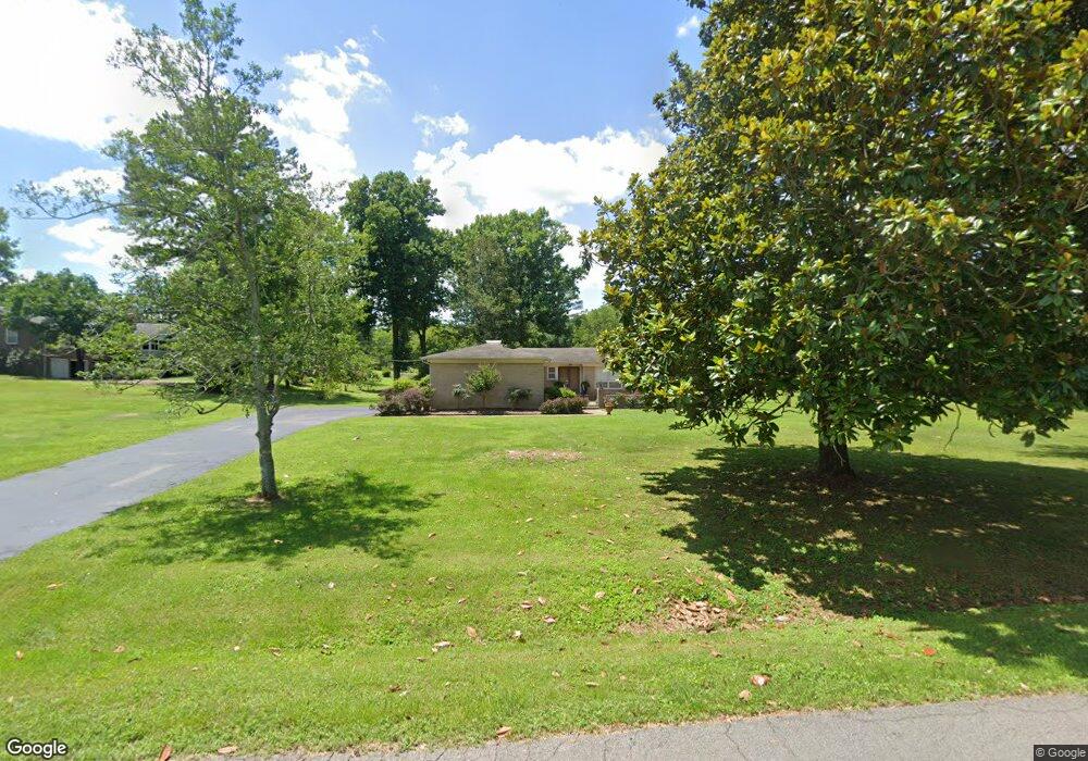
1301 Charlotte Dr Pulaski, TN 38478
Estimated Value: $271,662 - $354,000
--
Bed
2
Baths
2,016
Sq Ft
$155/Sq Ft
Est. Value
About This Home
This home is located at 1301 Charlotte Dr, Pulaski, TN 38478 and is currently estimated at $312,416, approximately $154 per square foot. 1301 Charlotte Dr is a home located in Giles County with nearby schools including Pulaski Elementary School, Southside Elementary School, and Bridgeforth Middle School.
Ownership History
Date
Name
Owned For
Owner Type
Purchase Details
Closed on
Jan 6, 2021
Sold by
Kjmbrough Tammy and Walls Gene
Bought by
Barragan Jose Ramon Soto and Araceli Santana Donato Noemi
Current Estimated Value
Home Financials for this Owner
Home Financials are based on the most recent Mortgage that was taken out on this home.
Original Mortgage
$177,025
Outstanding Balance
$157,968
Interest Rate
2.7%
Mortgage Type
New Conventional
Estimated Equity
$154,448
Purchase Details
Closed on
Jan 5, 2021
Sold by
Kimbrough Michael Cody and Kimbrough Courtney Beth
Bought by
Kimbrough Tammy and Walls Gene
Home Financials for this Owner
Home Financials are based on the most recent Mortgage that was taken out on this home.
Original Mortgage
$177,025
Outstanding Balance
$157,968
Interest Rate
2.7%
Mortgage Type
New Conventional
Estimated Equity
$154,448
Purchase Details
Closed on
Jun 2, 1986
Bought by
Hoover Juanita M
Create a Home Valuation Report for This Property
The Home Valuation Report is an in-depth analysis detailing your home's value as well as a comparison with similar homes in the area
Home Values in the Area
Average Home Value in this Area
Purchase History
| Date | Buyer | Sale Price | Title Company |
|---|---|---|---|
| Barragan Jose Ramon Soto | $182,500 | Giles T&E Svcs Llc | |
| Kimbrough Tammy | -- | Giles T&E Svcs Llc | |
| Hoover Juanita M | -- | -- |
Source: Public Records
Mortgage History
| Date | Status | Borrower | Loan Amount |
|---|---|---|---|
| Open | Barragan Jose Ramon Soto | $177,025 |
Source: Public Records
Tax History Compared to Growth
Tax History
| Year | Tax Paid | Tax Assessment Tax Assessment Total Assessment is a certain percentage of the fair market value that is determined by local assessors to be the total taxable value of land and additions on the property. | Land | Improvement |
|---|---|---|---|---|
| 2024 | $1,650 | $68,500 | $13,675 | $54,825 |
| 2023 | $1,650 | $68,500 | $13,675 | $54,825 |
| 2022 | $1,650 | $68,500 | $13,675 | $54,825 |
| 2021 | $1,201 | $35,475 | $6,450 | $29,025 |
| 2020 | $1,201 | $35,475 | $6,450 | $29,025 |
| 2019 | $1,002 | $35,475 | $6,450 | $29,025 |
| 2018 | $1,201 | $35,475 | $6,450 | $29,025 |
| 2017 | $1,201 | $35,475 | $6,450 | $29,025 |
| 2016 | $1,229 | $34,700 | $6,450 | $28,250 |
| 2015 | $1,159 | $34,700 | $6,450 | $28,250 |
| 2014 | $1,159 | $34,695 | $0 | $0 |
Source: Public Records
Map
Nearby Homes
- 1041 Jackson Dr
- 1205 Beverly Dr
- 1336 Charlotte Ct
- 1202 Parker Dr
- 125 Chicken Creek Rd
- 1200 Mill St
- 1410 Mill St
- 1021 Mill St
- 1549 Mill St
- 929 Kathleen Dr
- 910 Abernathy Dr
- 1818 Crestview Dr
- 1817 Crestview Dr
- 271 Chicken Creek Rd
- 1822 Parkview Terrace
- 850 Brenda Dr
- 1 Chicken Creek Rd
- 2400 Chicken Creek Rd
- 804 Morgan St
- 803 Nichols St
- 1207 Jackson Dr
- 1307 Charlotte Dr
- 1300 Charlotte Dr
- 1220 Gordon Ln
- 1209 Jackson Dr
- 1304 Charlotte Dr
- 1222 Gordon Ln
- 1308 Charlotte Dr
- 1211 Gordon Ln
- 1201 Jackson Dr
- 1319 Brooke Pond Ct
- 1323 Brooke Pond Ct
- 1301 Jackson Dr
- 1224 Gordon Ln
- 1208 Jackson Dr
- 1331 Brooke Pond Ct
- 1209 Gordon Ln
- 1207 Gordon Ln
- 1200 Jackson Dr
- 1215 Gordon Ln