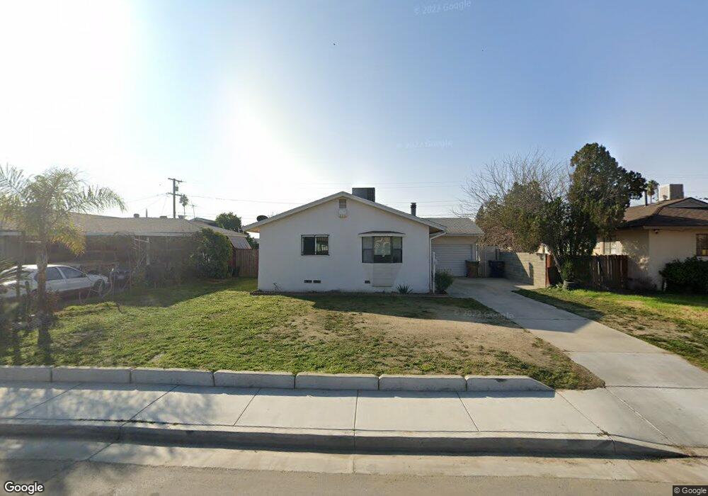
1301 Dorian Dr Bakersfield, CA 93304
Wible Orchard NeighborhoodEstimated Value: $211,000 - $292,000
2
Beds
1
Bath
875
Sq Ft
$285/Sq Ft
Est. Value
About This Home
This home is located at 1301 Dorian Dr, Bakersfield, CA 93304 and is currently estimated at $249,786, approximately $285 per square foot. 1301 Dorian Dr is a home located in Kern County with nearby schools including Frank West Elementary School, Curran Middle School, and South High School.
Ownership History
Date
Name
Owned For
Owner Type
Purchase Details
Closed on
May 23, 2017
Sold by
Alnajar Yousef Nazem
Bought by
Alnajar Saleh Ahmed
Current Estimated Value
Purchase Details
Closed on
Jan 28, 2016
Sold by
Turpin Freddie and The Freddie Curtis Rodgers Spe
Bought by
Alnajar Yousef Nazem
Purchase Details
Closed on
Dec 19, 2003
Sold by
Rogers Karen S and Weese Karen S
Bought by
Rogers Karen S and Freddie Curtis Rogers Special Needs Tr
Create a Home Valuation Report for This Property
The Home Valuation Report is an in-depth analysis detailing your home's value as well as a comparison with similar homes in the area
Home Values in the Area
Average Home Value in this Area
Purchase History
| Date | Buyer | Sale Price | Title Company |
|---|---|---|---|
| Alnajar Saleh Ahmed | -- | None Available | |
| Alnajar Yousef Nazem | $12,000 | None Available | |
| Rogers Karen S | -- | -- |
Source: Public Records
Tax History
| Year | Tax Paid | Tax Assessment Tax Assessment Total Assessment is a certain percentage of the fair market value that is determined by local assessors to be the total taxable value of land and additions on the property. | Land | Improvement |
|---|---|---|---|---|
| 2025 | $2,287 | $136,942 | $40,617 | $96,325 |
| 2024 | $2,236 | $134,258 | $39,821 | $94,437 |
| 2023 | $2,236 | $131,627 | $39,041 | $92,586 |
| 2022 | $2,178 | $129,047 | $38,276 | $90,771 |
| 2021 | $2,072 | $126,518 | $37,526 | $88,992 |
| 2020 | $2,036 | $125,222 | $37,142 | $88,080 |
| 2019 | $1,997 | $125,222 | $37,142 | $88,080 |
| 2018 | $1,952 | $120,360 | $35,700 | $84,660 |
| 2017 | $1,440 | $77,010 | $25,500 | $51,510 |
| 2016 | $931 | $45,877 | $13,138 | $32,739 |
| 2015 | $918 | $45,189 | $12,941 | $32,248 |
| 2014 | $2,432 | $44,305 | $12,688 | $31,617 |
Source: Public Records
Map
Nearby Homes
- 1312 Dorian Dr
- 1208 Lindsay Dr
- 2709 Laurel Dr
- 1605 Sidney Dr
- 2323 S J St
- 935 Sylvia Dr
- 2222 S Chester Ave
- 2709 Lee Dr
- 1016 Meredith Dr
- 3204 S I St
- 2909 S Chester Ave
- 2120 S M St
- 2612 Lee Dr
- 1108 Southgate Dr
- 2701 Houchin Rd
- 1410 Southgate Dr
- 443 Myrtle St
- 3201 Parkland Ct
- 1804 Le May Ave
- 1512 Southgate Dr
- 1305 Dorian Dr
- 1221 Dorian Dr
- 1309 Dorian Dr
- 1217 Dorian Dr
- 1304 Rosalia Dr
- 1300 Rosalia Dr
- 1308 Rosalia Dr
- 1220 Rosalia Dr
- 1300 Dorian Dr
- 1313 Dorian Dr Unit 1
- 1313 Dorian Dr
- 1213 Dorian Dr
- 1220 Dorian Dr
- 1304 Dorian Dr
- 1312 Rosalia Dr
- 1216 Dorian Dr
- 1308 Dorian Dr
- 1216 Rosalia Dr
- 1209 Dorian Dr
- 1317 Dorian Dr
Your Personal Tour Guide
Ask me questions while you tour the home.