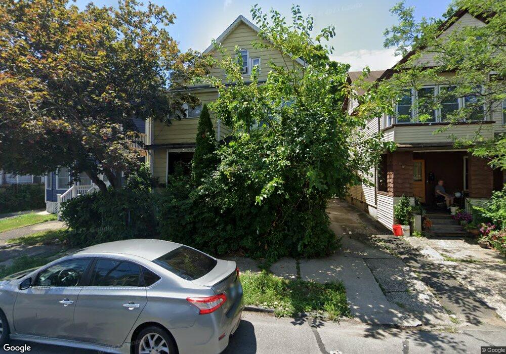
1301 Howard Ave Unit 1303 Bridgeport, CT 06605
West End-West Side NeighborhoodEstimated Value: $269,827 - $572,000
6
Beds
3
Baths
3,300
Sq Ft
$141/Sq Ft
Est. Value
About This Home
This home is located at 1301 Howard Ave Unit 1303, Bridgeport, CT 06605 and is currently estimated at $464,207, approximately $140 per square foot. 1301 Howard Ave Unit 1303 is a home located in Fairfield County with nearby schools including Bryant Elementary School, Bassick High School, and Park City Prep Charter School.
Ownership History
Date
Name
Owned For
Owner Type
Purchase Details
Closed on
Oct 24, 1995
Sold by
Difilippo Nicholas and Difilippo Enrico
Bought by
Amazan Paul F and Isaac Marie A
Current Estimated Value
Home Financials for this Owner
Home Financials are based on the most recent Mortgage that was taken out on this home.
Original Mortgage
$54,400
Interest Rate
7.6%
Mortgage Type
Unknown
Create a Home Valuation Report for This Property
The Home Valuation Report is an in-depth analysis detailing your home's value as well as a comparison with similar homes in the area
Home Values in the Area
Average Home Value in this Area
Purchase History
| Date | Buyer | Sale Price | Title Company |
|---|---|---|---|
| Amazan Paul F | $68,000 | -- | |
| Amazan Paul F | $68,000 | -- |
Source: Public Records
Mortgage History
| Date | Status | Borrower | Loan Amount |
|---|---|---|---|
| Open | Amazan Paul F | $74,000 | |
| Closed | Amazan Paul F | $54,400 | |
| Previous Owner | Amazan Paul F | $100,000 |
Source: Public Records
Tax History Compared to Growth
Tax History
| Year | Tax Paid | Tax Assessment Tax Assessment Total Assessment is a certain percentage of the fair market value that is determined by local assessors to be the total taxable value of land and additions on the property. | Land | Improvement |
|---|---|---|---|---|
| 2025 | $6,494 | $149,460 | $40,450 | $109,010 |
| 2024 | $6,494 | $149,460 | $40,450 | $109,010 |
| 2023 | $6,494 | $149,460 | $40,450 | $109,010 |
| 2022 | $6,494 | $149,460 | $40,450 | $109,010 |
| 2021 | $6,494 | $149,460 | $40,450 | $109,010 |
| 2020 | $6,205 | $114,930 | $24,520 | $90,410 |
| 2019 | $6,205 | $114,930 | $24,520 | $90,410 |
| 2018 | $6,249 | $114,930 | $24,520 | $90,410 |
| 2017 | $6,249 | $114,930 | $24,520 | $90,410 |
| 2016 | $6,249 | $114,930 | $24,520 | $90,410 |
| 2015 | $6,875 | $162,920 | $37,070 | $125,850 |
| 2014 | $6,875 | $162,920 | $37,070 | $125,850 |
Source: Public Records
Map
Nearby Homes
- 2612 North Ave Unit E2
- 2612 North Ave Unit C1
- 74 Carleton Ave
- 25 Cartright St Unit 5D
- 725 Beechwood Ave Unit 727
- 80 Cartright St Unit 5D
- 80 Cartright St Unit 8J
- 80 Cartright St Unit 2F
- 80 Cartright St Unit GC
- 80 Cartright St Unit 8B
- 2370 North Ave Unit 4C
- 2370 North Ave Unit 12G
- 2370 North Ave Unit 3F
- 2660 North Ave Unit 217
- 500 Dewey St
- 368 Lenox Ave
- 860 Briarwood Ave
- 255 Poplar St
- 1059 Hancock Ave Unit 1061
- 1050 Hancock Ave Unit 1052
- 1307 Howard Ave Unit 1309
- 1295 Howard Ave
- 1287 Howard Ave Unit 1289
- 1289 Howard Ave Unit 1
- 1287 Howard Ave Unit 1
- 1315 Howard Ave Unit 1317
- 1315 Howard Ave Unit 2
- 1317 Howard Ave
- 1281 Howard Ave
- 690-692 Dewey St
- 1276 Howard Ave
- 1323 Howard Ave Unit 1325
- 19 Dewey Ct Unit 2
- 19 Dewey Ct
- 1273 Howard Ave Unit 1275
- 1275 Howard Ave
- 1292 Howard Ave Unit 1294
- 1286 Howard Ave
- 1278 Howard Ave
- 1274 Howard Ave Unit 1278