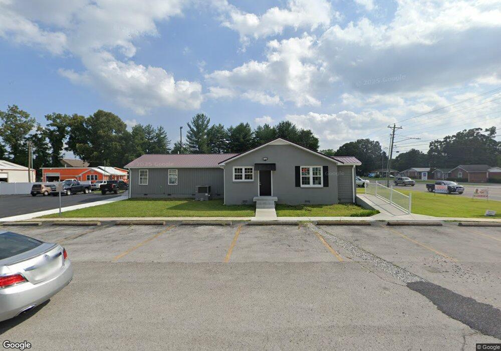
1301 Mcarthur St Manchester, TN 37355
Estimated Value: $313,237
--
Bed
2
Baths
2,218
Sq Ft
$141/Sq Ft
Est. Value
About This Home
This home is located at 1301 Mcarthur St, Manchester, TN 37355 and is currently estimated at $313,237, approximately $141 per square foot. 1301 Mcarthur St is a home located in Coffee County with nearby schools including Westwood Middle School and Temple Baptist Christian School.
Ownership History
Date
Name
Owned For
Owner Type
Purchase Details
Closed on
Apr 5, 2021
Sold by
Dodge Rose
Bought by
Rhoton Family Partnership
Current Estimated Value
Purchase Details
Closed on
Feb 22, 2019
Sold by
Jones John D
Bought by
Dodge Rose
Purchase Details
Closed on
Mar 31, 2005
Sold by
Marcrom Ray E
Bought by
Jones John D
Purchase Details
Closed on
Mar 7, 2001
Sold by
St Thomas Hospital
Bought by
Marcrom Ray E
Purchase Details
Closed on
Nov 7, 1994
Bought by
St Thomas Hospital
Create a Home Valuation Report for This Property
The Home Valuation Report is an in-depth analysis detailing your home's value as well as a comparison with similar homes in the area
Home Values in the Area
Average Home Value in this Area
Purchase History
| Date | Buyer | Sale Price | Title Company |
|---|---|---|---|
| Rhoton Family Partnership | $225,000 | Bell & Alexander Ttl Svcs In | |
| Dodge Rose | $200,000 | Bell & Alexander Ttl Svcs In | |
| Jones John D | $205,000 | -- | |
| Marcrom Ray E | $120,000 | -- | |
| St Thomas Hospital | $133,800 | -- |
Source: Public Records
Tax History Compared to Growth
Tax History
| Year | Tax Paid | Tax Assessment Tax Assessment Total Assessment is a certain percentage of the fair market value that is determined by local assessors to be the total taxable value of land and additions on the property. | Land | Improvement |
|---|---|---|---|---|
| 2024 | $3,690 | $87,520 | $21,080 | $66,440 |
| 2023 | $3,690 | $87,520 | $0 | $0 |
| 2022 | $3,177 | $87,520 | $21,080 | $66,440 |
| 2021 | $3,732 | $81,480 | $18,000 | $63,480 |
| 2020 | $3,732 | $81,480 | $18,000 | $63,480 |
| 2019 | $3,732 | $81,480 | $18,000 | $63,480 |
| 2018 | $3,732 | $81,480 | $18,000 | $63,480 |
| 2017 | $4,081 | $77,800 | $16,000 | $61,800 |
| 2016 | $4,081 | $77,800 | $16,000 | $61,800 |
| 2015 | $4,081 | $77,800 | $16,000 | $61,800 |
| 2014 | $4,080 | $77,790 | $0 | $0 |
Source: Public Records
Map
Nearby Homes
- 1212 Woodcrest Dr
- 970 Oak Dr
- 422 Heritage Cir
- 1011 S Spring St
- 1550 S Spring St
- 195 Hamilton Ct
- 1221 Hillcrest Dr
- 503 Oak Dr
- 142 Heritage Cir
- 820 Keylon St
- 355 W Doak Rd
- 1003 Kennedy Dr
- 1005 Keylon St
- 200 Reynard St
- 333 Blanford Cir
- 1306 Mcmahan St
- 802 Lowry St
- 1203 Edgewood Dr
- 711 Lowry St
- 12 Fox Creek Ct
- 1400 Willow Dr
- 1305 Mcarthur St
- 94 Creek Wood Rd
- 98 Creek Wood Rd
- 1402 Willow Dr
- 1237 Mcarthur St
- 1300 Mcarthur St
- 1309 Mcarthur St
- 1302 Mcarthur St
- 1304 Mcarthur St
- 1313 Mcarthur St
- 1306 Mcarthur St
- 1306 Willow Dr
- 1308 Willow Dr
- 1310 Willow Dr
- 1308 Mcarthur St
- 1315 Mcarthur St
- 1312 Willow Dr
- 1214 Mcarthur St
- 1310 Mcarthur St