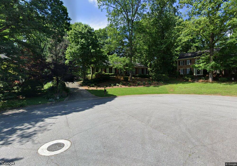
1301 Milstead Trace NE Marietta, GA 30066
Sandy Plains NeighborhoodEstimated Value: $476,757 - $517,000
3
Beds
3
Baths
2,207
Sq Ft
$225/Sq Ft
Est. Value
About This Home
This home is located at 1301 Milstead Trace NE, Marietta, GA 30066 and is currently estimated at $496,189, approximately $224 per square foot. 1301 Milstead Trace NE is a home located in Cobb County with nearby schools including Kincaid Elementary School, Daniell Middle School, and Sprayberry High School.
Ownership History
Date
Name
Owned For
Owner Type
Purchase Details
Closed on
Apr 23, 2024
Sold by
Arthur Sherman Heimburger and Arthur Mary Jane
Bought by
Heimburger Mary Jane
Current Estimated Value
Purchase Details
Closed on
May 7, 2014
Sold by
Heimburger A Sherman
Bought by
Heimburger A Sherman and Heimburger Mary Jane
Purchase Details
Closed on
Dec 14, 2012
Sold by
Edwards Mary Anne W
Bought by
Heimburger A Sherman
Purchase Details
Closed on
Sep 17, 2003
Sold by
Hastings Nancy H
Bought by
Edwards James M and Edwards Mary A
Home Financials for this Owner
Home Financials are based on the most recent Mortgage that was taken out on this home.
Original Mortgage
$174,000
Interest Rate
5.59%
Mortgage Type
New Conventional
Create a Home Valuation Report for This Property
The Home Valuation Report is an in-depth analysis detailing your home's value as well as a comparison with similar homes in the area
Home Values in the Area
Average Home Value in this Area
Purchase History
| Date | Buyer | Sale Price | Title Company |
|---|---|---|---|
| Heimburger Mary Jane | -- | None Listed On Document | |
| Heimburger A Sherman | -- | -- | |
| Heimburger A Sherman | $172,500 | -- | |
| Edwards James M | $217,500 | -- |
Source: Public Records
Mortgage History
| Date | Status | Borrower | Loan Amount |
|---|---|---|---|
| Previous Owner | Edwards James M | $174,000 |
Source: Public Records
Tax History Compared to Growth
Tax History
| Year | Tax Paid | Tax Assessment Tax Assessment Total Assessment is a certain percentage of the fair market value that is determined by local assessors to be the total taxable value of land and additions on the property. | Land | Improvement |
|---|---|---|---|---|
| 2025 | $5,629 | $186,816 | $40,000 | $146,816 |
| 2024 | $4,889 | $162,172 | $27,200 | $134,972 |
| 2023 | $5,115 | $169,636 | $38,000 | $131,636 |
| 2022 | $4,634 | $152,700 | $27,200 | $125,500 |
| 2021 | $3,351 | $110,416 | $27,200 | $83,216 |
| 2020 | $3,351 | $110,416 | $27,200 | $83,216 |
| 2019 | $3,057 | $100,728 | $27,200 | $73,528 |
| 2018 | $3,057 | $100,728 | $27,200 | $73,528 |
| 2017 | $2,680 | $93,204 | $24,000 | $69,204 |
| 2016 | $2,337 | $81,304 | $24,000 | $57,304 |
| 2015 | $2,395 | $81,304 | $24,000 | $57,304 |
| 2014 | $2,050 | $68,984 | $0 | $0 |
Source: Public Records
Map
Nearby Homes
- 2839 Pine Meadow Dr
- 2642 Morgan Rd NE
- 2116 Morgan Rd NE
- 1597 Sprayberry Dr
- 2314 Sandy Oaks Dr
- 2742 Bob Bettis Rd
- 1748 Brown Cir
- 1756 Brown Cir
- 1386 Valmont Trace NE
- 1100 Sallete Ct
- 1924 Wilkenson Crossing
- 2725 Stillwater Lake Ln Unit 2
- 2729 Stillwater Lake Ln Unit 1
- 1814 Chasewood Park Dr
- 922 Red Apple Dr
- Robie Plan at The Village at Sandy Plains
- Harbor Plan at The Village at Sandy Plains
- Hanover Plan at The Village at Sandy Plains
- Bowen Plan at The Village at Sandy Plains
- Elston Plan at The Village at Sandy Plains
- 1303 Milstead Trace NE
- 2343 Milstead Cir NE
- 2341 Milstead Cir NE
- 1300 Milstead Trace NE
- 1305 Milstead Trace NE
- 2345 Milstead Cir NE
- 2339 Milstead Cir NE Unit 1
- 2339 Milstead Cir NE
- 2331 Milstead Cir NE
- 2331 Milstead Cir NE
- 2333 Milstead Cir NE
- 1304 Milstead Trace NE
- 2354 Milstead Cir NE
- 1307 Milstead Trace NE
- 2347 Milstead Cir NE
- 2356 Milstead Cir NE
- 2337 Milstead Cir NE
- 2351 Milstead Cir NE
- 2307 Milstead Cir NE
- 2327 Milstead Cir NE