1301 Old Tin Top Rd Weatherford, TX 76087
Estimated payment $13,052/month
Highlights
- Horses Allowed On Property
- Community Lake
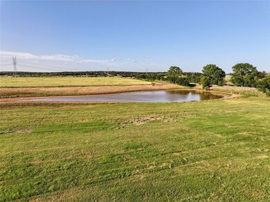
- 1 Stock Tank or Pond
- Waterfront
- Pond
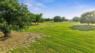
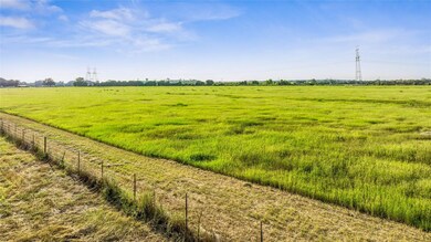
- Pasture
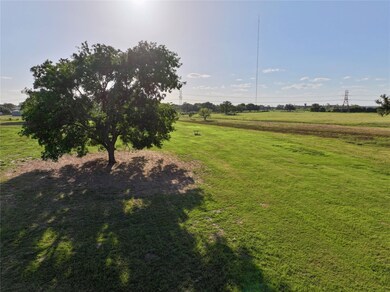
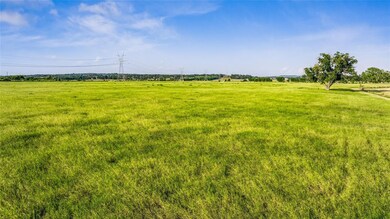
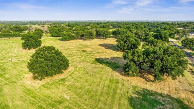
About This Lot
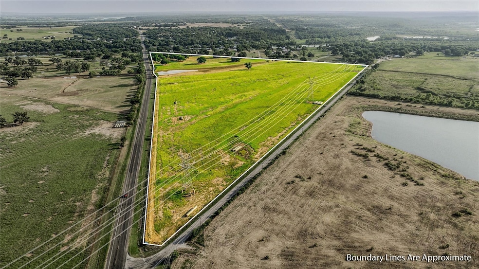
Expansive 70-Acre Ranch with Endless Possibilities in Weatherford, TX
Nestled in the scenic landscapes of Parker County, 1301 Old Tin Top Road offers an unparalleled opportunity for those seeking a vast expanse of land in Weatherford, Texas. Spanning over 70.29 acres, this property is a dream for ranchers, developers, or anyone looking to build their ideal country estate.
The property is fully fenced with perimeter fencing, ensuring privacy and security for your livestock or agricultural pursuits. Its vast open spaces are perfect for grazing, farming, or even developing a custom ranch or equestrian facility. The lands natural beauty is complemented by its strategic location, offering both seclusion and easy access to local amenities.
This ranch represents a significant investment in one of Texass most desirable regions. The propertys potential is vast, whether you envision a sprawling ranch, a family homestead, or a lucrative development project.
Located within the Weatherford Independent School District, the property is also ideal for families seeking a rural lifestyle with access to quality education. Schools like Raymond E. Curtis Elementary and Weatherford High School are just a short drive away.
For those interested in exploring this unique offering, the property is listed under MLS #20692708 and is actively seeking new ownership. Whether youre looking to expand your ranching operations or develop a new residential community, 1301 Old Tin Top Road is a must-see.
For more detailed information or to schedule a private tour, consider reaching out to the listing agent, Don Bell of UC | Don Bell Properties, LLC

Property Details
Property Type
- Land
Est. Annual Taxes
- $141
Lot Details
- Waterfront
- Few Trees
- Potential uses include agriculture, equine, grazing, hunting/fishing, for development
Farming
- 1 Stock Tank or Pond
- Pasture
- Fenced For Cattle
- Fenced For Horses
Horse Facilities and Amenities
- Horses Allowed On Property
Community Details
Overview
- Community Lake
Recreation
- Pond
Map
Home Values in the Area
Average Home Value in this Area
Tax History
| Year | Tax Paid | Tax Assessment Tax Assessment Total Assessment is a certain percentage of the fair market value that is determined by local assessors to be the total taxable value of land and additions on the property. | Land | Improvement |
|---|---|---|---|---|
| 2023 | $141 | $8,720 | $8,720 | $0 |
| 2022 | $155 | $1,756,980 | $0 | $0 |
| 2021 | $160 | $1,672,950 | $0 | $0 |
| 2020 | $161 | $803,020 | $0 | $0 |
| 2019 | $172 | $803,020 | $0 | $0 |
| 2018 | $146 | $803,020 | $0 | $0 |
| 2017 | $149 | $803,020 | $0 | $0 |
| 2016 | $148 | $535,340 | $0 | $0 |
| 2015 | $146 | $535,340 | $0 | $0 |
| 2014 | $142 | $535,340 | $0 | $0 |
Property History
| Date | Event | Price | Change | Sq Ft Price |
|---|---|---|---|---|
| 08/02/2024 08/02/24 | For Sale | $2,354,346 | -- | -- |
Purchase History
| Date | Type | Sale Price | Title Company |
|---|---|---|---|
| Deed | -- | Fidelity National Title | |
| Warranty Deed | -- | Stnt | |
| Warranty Deed | -- | None Available | |
| Deed | -- | -- | |
| Deed | -- | -- | |
| Deed | -- | -- |
Mortgage History
| Date | Status | Loan Amount | Loan Type |
|---|---|---|---|
| Previous Owner | $0 | New Conventional | |
| Previous Owner | $376,000 | Unknown | |
| Previous Owner | $1,500,000 | Unknown |
- TBD Old Tin Top Rd
- 0 Old Tin Top Rd
- 450 Tin Top Estates Rd
- 301 Tin Top Estates Rd
- 104 Shadowglenn Dr
- 323 E El Camino Real
- 252 E El Camino Real
- 116 Songwood Dr
- 1102 River Ranch Ln
- 344 Hillcroft Dr
- 1308 Green Ridge Rd
- 106 Hillcroft Dr
- 115 Cedar Ridge Dr
- 5057 Tin Top Rd
- 108 Jade Ct
- 103 Silver Sage Ct
- TBD Eastmeadow Ln
- 116 Eastmeadow Ln
- 113 Garnet Dr
- TBD 000 Westmeadow Dr
- 700 Cactus Rio Dr
- 147 Western Lake Dr
- 102 Haynes Rd
- 4302 Mountain Hollow Dr
- 5820 Arrowhead Dr
- 3719 Washington Trail
- 1146 Harmony Cir
- 1148 Harmony Cir
- 329 Capricorn Dr
- 2808 Beechwood St
- 2803 Beechwood St
- 301 Oar Wood Dr
- 206 Casas Del Sur St
- 287 Harmony Rd Unit 285
- 122 Sunburst Ct
- 124 Sunburst Ct
- 400 Timber Wild Dr
- 8849 Old Brock Rd
- 1723 Dennis Rd
- 3118 Weave Ct