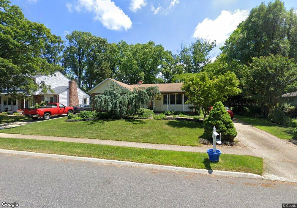
1301 Saint Francis Rd Bel Air, MD 21014
Estimated Value: $395,000 - $431,000
--
Bed
3
Baths
1,368
Sq Ft
$305/Sq Ft
Est. Value
About This Home
This home is located at 1301 Saint Francis Rd, Bel Air, MD 21014 and is currently estimated at $416,826, approximately $304 per square foot. 1301 Saint Francis Rd is a home located in Harford County with nearby schools including Red Pump Elementary School, Bel Air Middle School, and Bel Air High School.
Ownership History
Date
Name
Owned For
Owner Type
Purchase Details
Closed on
Mar 28, 2023
Sold by
Adams Cheryl
Bought by
Cheryl & Kenneth Adams Revocable Trust
Current Estimated Value
Purchase Details
Closed on
Aug 10, 2001
Sold by
Kee Leland M
Bought by
Adams Kenneth and Adams Cheryl
Purchase Details
Closed on
Oct 13, 1998
Sold by
Gail Lundgren and Gail Thomas
Bought by
Kee Leland M and Kee Sonia M
Purchase Details
Closed on
Feb 22, 1995
Sold by
Boyle David G
Bought by
Lundgren Thomas Gail
Home Financials for this Owner
Home Financials are based on the most recent Mortgage that was taken out on this home.
Original Mortgage
$105,000
Interest Rate
9.17%
Create a Home Valuation Report for This Property
The Home Valuation Report is an in-depth analysis detailing your home's value as well as a comparison with similar homes in the area
Home Values in the Area
Average Home Value in this Area
Purchase History
| Date | Buyer | Sale Price | Title Company |
|---|---|---|---|
| Cheryl & Kenneth Adams Revocable Trust | -- | None Listed On Document | |
| Adams Kenneth | $162,900 | -- | |
| Kee Leland M | $154,000 | -- | |
| Lundgren Thomas Gail | $132,000 | -- |
Source: Public Records
Mortgage History
| Date | Status | Borrower | Loan Amount |
|---|---|---|---|
| Previous Owner | Lundgren Thomas Gail | $105,000 | |
| Closed | Kee Leland M | -- |
Source: Public Records
Tax History Compared to Growth
Tax History
| Year | Tax Paid | Tax Assessment Tax Assessment Total Assessment is a certain percentage of the fair market value that is determined by local assessors to be the total taxable value of land and additions on the property. | Land | Improvement |
|---|---|---|---|---|
| 2025 | $2,655 | $258,600 | $86,200 | $172,400 |
| 2024 | $2,329 | $243,633 | $0 | $0 |
| 2023 | $2,329 | $228,667 | $0 | $0 |
| 2022 | $2,329 | $213,700 | $86,200 | $127,500 |
| 2021 | $2,466 | $213,700 | $86,200 | $127,500 |
| 2020 | $2,466 | $213,700 | $86,200 | $127,500 |
| 2019 | $2,609 | $226,100 | $114,500 | $111,600 |
| 2018 | $2,574 | $225,100 | $0 | $0 |
| 2017 | $2,563 | $226,100 | $0 | $0 |
| 2016 | -- | $223,100 | $0 | $0 |
| 2015 | $2,598 | $223,100 | $0 | $0 |
| 2014 | $2,598 | $223,100 | $0 | $0 |
Source: Public Records
Map
Nearby Homes
- 1208 Saint Francis Rd
- 400 Birchwood Manor Ln
- 1353 Sweetbriar Ln
- 1346 Vanderbilt Rd
- 110 Meadow Rd
- 1003 Running Creek Way Unit G
- 1605 Samantha Dr
- 1322 Locust Ave
- 1615 Samantha Dr
- 222 Steed Ln
- 1316 Ipswich Dr
- 747 Roland Ave
- 752 Roland Ave
- 502 Lloyd Place Unit F
- 243 Bynum Ridge Rd
- 309 Cannery Ln
- 275 Spencer Cir
- 245 Bynum Ridge Rd
- 1716 Landmark Dr Unit 3D
- 918 Chesney Ln
- 1303 Saint Francis Rd
- 1243 Saint Francis Rd
- 1305 Saint Francis Rd
- 1241 Saint Francis Rd
- 1201 Marywood Dr
- 1307 Saint Francis Rd
- 1239 Saint Francis Rd
- 1302 St Francis Rd
- 1302 Saint Francis Rd
- 1200 Marywood Dr
- 1304 Saint Francis Rd
- 1309 Saint Francis Rd
- 1237 Saint Francis Rd
- 1234 Saint Francis Rd
- 1306 St Francis Rd
- 1306 Saint Francis Rd
- 1203 Marywood Dr
- 1311 Saint Francis Rd
- 1303 Georgetown Dr
- 1202 Marywood Dr