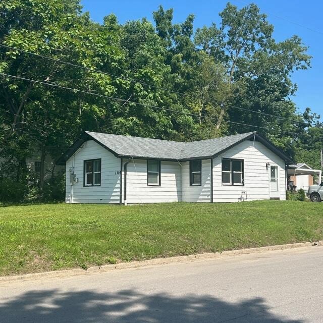
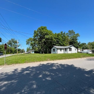
1301 W Ash St Columbia, MO 65203
Estimated payment $1,056/month
Highlights
- Ranch Style House
- No HOA
- Bathroom on Main Level
- David H. Hickman High School Rated A-
- 1 Car Attached Garage
- 4-minute walk to Again Street Park
About This Home
Been used as rental, current vacant Nice location convenient to Arc and downtown. Lots of upgrades, new roof, new electrical, new insulation, drywall and kitchen.
Buyer to verify all data, sold as is
Home Details
Home Type
- Single Family
Est. Annual Taxes
- $1,311
Year Built
- Built in 1945
Lot Details
- Lot Dimensions are 65x174
- East Facing Home
Parking
- 1 Car Attached Garage
Home Design
- Ranch Style House
Interior Spaces
- 970 Sq Ft Home
- Crawl Space
Bedrooms and Bathrooms
- 2 Bedrooms
- Bathroom on Main Level
- 2 Full Bathrooms
Schools
- Benton Elementary School
- Oakland Middle School
- Hickman High School
Community Details
- No Home Owners Association
- Hunthill Sub Subdivision
Listing and Financial Details
- Assessor Parcel Number 1631700050910001
Map
Home Values in the Area
Average Home Value in this Area
Tax History
| Year | Tax Paid | Tax Assessment Tax Assessment Total Assessment is a certain percentage of the fair market value that is determined by local assessors to be the total taxable value of land and additions on the property. | Land | Improvement |
|---|---|---|---|---|
| 2025 | $1,457 | $22,249 | $3,610 | $18,639 |
| 2024 | $1,311 | $19,437 | $3,610 | $15,827 |
| 2023 | $1,300 | $19,437 | $3,610 | $15,827 |
| 2022 | $1,203 | $17,993 | $3,610 | $14,383 |
| 2021 | $1,205 | $17,993 | $3,610 | $14,383 |
| 2020 | $1,145 | $16,066 | $3,610 | $12,456 |
| 2019 | $1,145 | $16,066 | $3,610 | $12,456 |
| 2018 | $1,068 | $0 | $0 | $0 |
| 2017 | $1,055 | $14,877 | $3,610 | $11,267 |
| 2016 | $1,083 | $14,877 | $3,610 | $11,267 |
| 2015 | $999 | $14,877 | $3,610 | $11,267 |
| 2014 | -- | $14,877 | $3,610 | $11,267 |
Property History
| Date | Event | Price | List to Sale | Price per Sq Ft |
|---|---|---|---|---|
| 09/25/2025 09/25/25 | Price Changed | $179,750 | -5.3% | $185 / Sq Ft |
| 08/16/2025 08/16/25 | Price Changed | $189,750 | -5.0% | $196 / Sq Ft |
| 06/19/2025 06/19/25 | For Sale | $199,750 | -- | $206 / Sq Ft |
| 06/18/2025 06/18/25 | Off Market | -- | -- | -- |
Purchase History
| Date | Type | Sale Price | Title Company |
|---|---|---|---|
| Warranty Deed | -- | -- | |
| Warranty Deed | -- | None Available |
Mortgage History
| Date | Status | Loan Amount | Loan Type |
|---|---|---|---|
| Open | $100,000 | Construction | |
| Previous Owner | $73,815 | FHA |
Source: Columbia Board of REALTORS®
MLS Number: 427921
APN: 16-317-00-05-091-00-01
Disclaimer: Certain information contained herein is derived from information provided by parties other than Homes.com. All information provided is deemed reliable, but is not guaranteed to be accurate and should be independently verified.
![]() IDX information is provided exclusively for personal, non-commercial use, and may not be used for any purpose other than to identify prospective properties consumers may be interested in purchasing. Information is deemed reliable but not guaranteed.
IDX information is provided exclusively for personal, non-commercial use, and may not be used for any purpose other than to identify prospective properties consumers may be interested in purchasing. Information is deemed reliable but not guaranteed.
- 1304 W Worley St
- 601 Hardin St
- 1208 London Dr
- 301 Crown Point
- 704 Hardin St
- 812 W Broadway
- 4 Rockingham Dr
- 607 Ridgeway Ave
- 1108 W Stewart Rd
- 1000 Hardin St
- 213 Longfellow Ln
- 709 Mikel St
- 701 703 & 707 Mikel Rd
- 404 S Greenwood Ave
- 401 W Worley St
- 303 S Glenwood Ave
- 705 Westridge Dr
- 605 Jackson St
- 1402 W Rollins Rd
- 211 Bourn Ave
- 201 Wheaton Ct Unit 203
- 207 Wheaton Ct
- 203 Wheaton Ct
- 1411 Gary St
- 204 Wheaton Ct
- 212 Wheaton Ct
- 202 Wheaton Ct Unit 204
- 1103 W Broadway
- 1007 W Ash St
- 104 Clinkscales Rd Unit 404
- 1321 W Broadway
- 205 West Blvd N Unit 207
- 201 West Blvd N Unit 203
- 215 West Blvd N
- 203 West Blvd N
- 207 West Blvd N
- 108 West Blvd N Unit MIDDLE
- 108 West Blvd N Unit LOWER
- 1120 W Broadway Unit 1
- 2012 W Ash St
