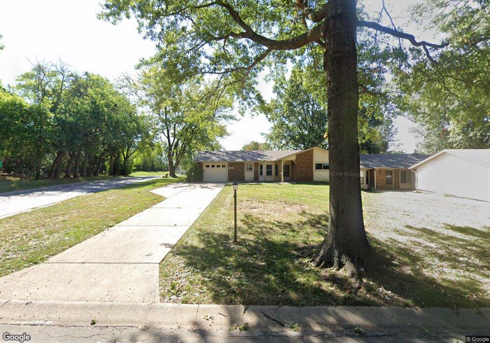
1301 W Johns Blvd Raymore, MO 64083
Estimated Value: $152,000 - $169,000
2
Beds
2
Baths
1,398
Sq Ft
$114/Sq Ft
Est. Value
About This Home
This home is located at 1301 W Johns Blvd, Raymore, MO 64083 and is currently estimated at $160,052, approximately $114 per square foot. 1301 W Johns Blvd is a home located in Cass County with nearby schools including Creekmoor Elementary School, Raymore-Peculiar East Middle School, and Raymore-Peculiar Senior High School.
Ownership History
Date
Name
Owned For
Owner Type
Purchase Details
Closed on
Aug 29, 2014
Sold by
Blc Management 3 Llc
Bought by
Blc Foxwood Springs Llc
Current Estimated Value
Purchase Details
Closed on
Jan 31, 2012
Sold by
Halbur Shirley J
Bought by
American Retirement Corp
Purchase Details
Closed on
Oct 21, 2009
Sold by
Lacey Stephen W and Lacey Ann E
Bought by
Halbur Shirley J
Purchase Details
Closed on
Dec 15, 2008
Sold by
Anderson Retha J
Bought by
Lacey Ann E
Create a Home Valuation Report for This Property
The Home Valuation Report is an in-depth analysis detailing your home's value as well as a comparison with similar homes in the area
Home Values in the Area
Average Home Value in this Area
Purchase History
| Date | Buyer | Sale Price | Title Company |
|---|---|---|---|
| Blc Foxwood Springs Llc | -- | None Available | |
| American Retirement Corp | -- | Hight & Associates Land Titl | |
| Halbur Shirley J | -- | None Available | |
| Lacey Ann E | -- | -- |
Source: Public Records
Tax History Compared to Growth
Tax History
| Year | Tax Paid | Tax Assessment Tax Assessment Total Assessment is a certain percentage of the fair market value that is determined by local assessors to be the total taxable value of land and additions on the property. | Land | Improvement |
|---|---|---|---|---|
| 2025 | $1,022 | $14,080 | $2,380 | $11,700 |
| 2024 | $1,022 | $12,560 | $2,170 | $10,390 |
| 2023 | $1,021 | $12,560 | $2,170 | $10,390 |
| 2022 | $915 | $11,180 | $2,170 | $9,010 |
| 2021 | $915 | $11,180 | $2,170 | $9,010 |
| 2020 | $900 | $10,810 | $2,170 | $8,640 |
| 2019 | $869 | $10,810 | $2,170 | $8,640 |
| 2018 | $864 | $10,370 | $2,170 | $8,200 |
| 2017 | $1,187 | $10,370 | $2,170 | $8,200 |
| 2016 | $1,187 | $14,790 | $2,170 | $12,620 |
| 2015 | $1,187 | $14,790 | $2,170 | $12,620 |
| 2014 | $1,188 | $14,790 | $2,170 | $12,620 |
| 2013 | -- | $14,790 | $2,170 | $12,620 |
Source: Public Records
Map
Nearby Homes
- 600 Andypaul Ct Unit 602
- 503 N Jenkins Blvd
- 1412 W Stone Blvd
- 1205 Wiltshire Blvd
- 1704 W Long Blvd
- 1025 Kaycee Dr
- 215 Scott Dr
- 701 Hampstead Dr
- 0 Scott Dr
- 1010 Wiltshire Blvd
- 806 Creekmoor Pond Ln
- 608 Johnston Pkwy
- 1705 W Pelham Path
- 1214 High Ridge Ct
- 1105 Brookside Place
- 104 N Darrowby Dr
- The Westridge Plan at Madison Valley
- The Stratford Plan at Madison Valley
- The Aspen Plan at Madison Valley
- The Lexington Plan at Madison Valley
- 1303 W Johns Blvd
- 1305 W Johns Blvd
- 1307 W Johns Blvd
- 1302 W Jenkins Blvd
- 1304 W Jenkins Blvd
- 1306 W Jenkins Blvd
- 1302 W Johns Blvd
- 1304 W Johns Blvd
- 1308 W Jenkins Blvd
- 518 Andypaul Ct
- 516 Andypaul Ct
- 520 Andypaul Ct
- 1309 W Johns Blvd
- 1306 W Johns Blvd
- 514 Andypaul Ct
- 522 Andypaul Ct Unit 524
- 1308 W Johns Blvd
- 1310 W Jenkins Blvd
- 1311 W Johns Blvd
- 526 Andypaul Ct