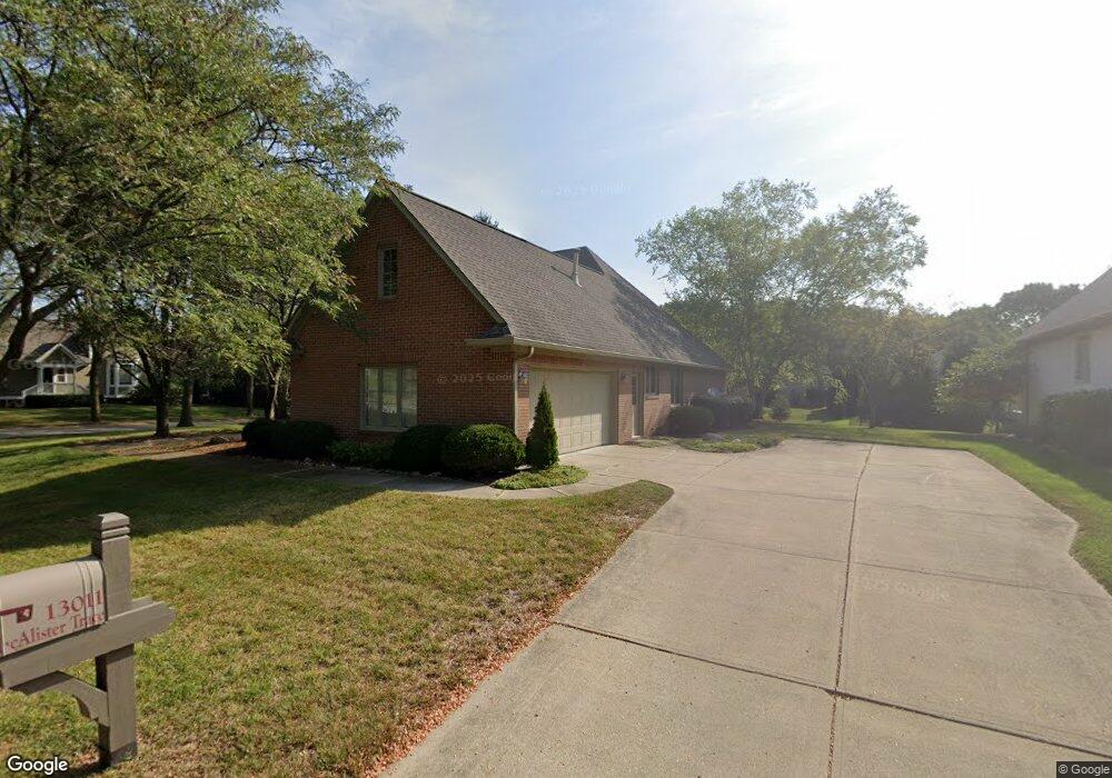
13011 Macalister Trace Carmel, IN 46033
East Carmel NeighborhoodEstimated Value: $570,026 - $631,000
3
Beds
2
Baths
2,529
Sq Ft
$241/Sq Ft
Est. Value
About This Home
This home is located at 13011 Macalister Trace, Carmel, IN 46033 and is currently estimated at $608,757, approximately $240 per square foot. 13011 Macalister Trace is a home located in Hamilton County with nearby schools including Prairie Trace Elementary School, Clay Middle School, and Carmel High School.
Ownership History
Date
Name
Owned For
Owner Type
Purchase Details
Closed on
Nov 30, 2001
Sold by
Caro Jose F and Caro Marice E
Bought by
Benson John A and Benson Reba G
Current Estimated Value
Home Financials for this Owner
Home Financials are based on the most recent Mortgage that was taken out on this home.
Original Mortgage
$125,000
Interest Rate
6.68%
Purchase Details
Closed on
Dec 7, 2000
Sold by
Custom Concrete Co Inc and Staebler Douglas W
Bought by
Caro Jose F and Caro Marice E
Home Financials for this Owner
Home Financials are based on the most recent Mortgage that was taken out on this home.
Original Mortgage
$195,000
Interest Rate
7.58%
Create a Home Valuation Report for This Property
The Home Valuation Report is an in-depth analysis detailing your home's value as well as a comparison with similar homes in the area
Home Values in the Area
Average Home Value in this Area
Purchase History
| Date | Buyer | Sale Price | Title Company |
|---|---|---|---|
| Benson John A | -- | Mid America Title Co Inc | |
| Caro Jose F | -- | -- | |
| Custom Concrete Co Inc | -- | -- |
Source: Public Records
Mortgage History
| Date | Status | Borrower | Loan Amount |
|---|---|---|---|
| Previous Owner | Benson John A | $125,000 | |
| Previous Owner | Caro Jose F | $195,000 |
Source: Public Records
Tax History Compared to Growth
Tax History
| Year | Tax Paid | Tax Assessment Tax Assessment Total Assessment is a certain percentage of the fair market value that is determined by local assessors to be the total taxable value of land and additions on the property. | Land | Improvement |
|---|---|---|---|---|
| 2024 | $5,084 | $457,200 | $170,300 | $286,900 |
| 2023 | $5,084 | $468,300 | $170,300 | $298,000 |
| 2022 | $4,731 | $414,200 | $170,300 | $243,900 |
| 2021 | $4,314 | $380,900 | $170,300 | $210,600 |
| 2020 | $4,314 | $380,900 | $170,300 | $210,600 |
| 2019 | $3,952 | $349,400 | $95,600 | $253,800 |
| 2018 | $3,695 | $332,600 | $95,600 | $237,000 |
| 2017 | $3,701 | $333,100 | $95,600 | $237,500 |
| 2016 | $3,677 | $335,900 | $95,600 | $240,300 |
| 2014 | $3,112 | $294,300 | $82,100 | $212,200 |
| 2013 | $3,112 | $306,700 | $82,100 | $224,600 |
Source: Public Records
Map
Nearby Homes
- 12999 Abraham Run
- 13137 Brooks Landing Place
- 5703 Cantigny Way N
- 5900 Silas Ct
- 5898 Silas Ct
- 13213 Mattock Chase
- 13220 Griffin Run
- 12656 Cerromar Ct
- 5298 Ivy Hill Dr
- 5898 Sandalwood Dr
- 5305 Breakers Way
- 5808 Corralberry Ct
- 5857 Stone Pine Trail
- 5872 Sandalwood Dr
- 7248 River Glen Dr
- 5310 Gray Eagle Ct
- 11959 Halla Place
- 5260 Ivy Hill Dr
- 12980 Fawns Dell Place
- 5983 Clearview Dr
- 13011 MacAlister Trc
- 12999 Macalister Trace
- 12998 Abraham Run
- 12992 Abraham Run
- 13023 Fletcher Trace
- 12986 Abraham Run
- 13022 Abraham Run
- 12975 Macalister Trace
- 13035 Fletcher Trace
- 12974 Abraham Run
- 13034 Abraham Run
- 12963 MacAlister Trc
- 12963 Macalister Trace
- 12997 Abraham Run
- 13047 Fletcher Trace
- 12962 Abraham Run
- 13021 Abraham Run
- 12985 Abraham Run
- 13046 Abraham Run
- 12973 Abraham Run