Estimated Value: $305,027 - $332,000
3
Beds
2
Baths
992
Sq Ft
$323/Sq Ft
Est. Value
About This Home
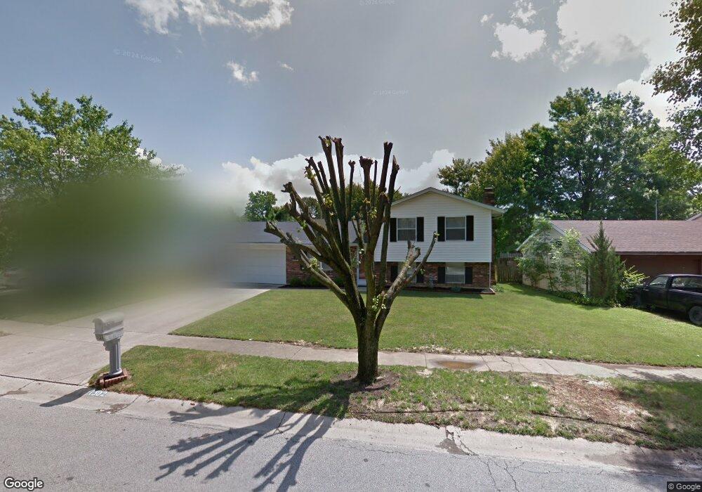
This home is located at 1302 Anthony Ln, Mason, OH 45040 and is currently estimated at $320,507, approximately $323 per square foot. 1302 Anthony Ln is a home located in Warren County with nearby schools including Mason Intermediate Elementary School, Mason Middle School, and William Mason High School.
Ownership History
Date
Name
Owned For
Owner Type
Purchase Details
Closed on
Aug 27, 1991
Sold by
Thomas Ramsey and Thomas Mark
Bought by
Garguilo Garguilo and Garguilo Neil
Current Estimated Value
Purchase Details
Closed on
May 2, 1985
Sold by
Schmidt & Alan G & Trustee
Bought by
Thomas Ramsey and Thomas Mark
Purchase Details
Closed on
Apr 27, 1984
Sold by
Florence & Mark & Trustee
Bought by
Schmidt & Alan G. & Trustee
Purchase Details
Closed on
Nov 30, 1983
Sold by
Jonathan Company & The
Bought by
Florence Florence and Florence Mark
Purchase Details
Closed on
Mar 12, 1980
Sold by
Jonathan Group & Inc
Create a Home Valuation Report for This Property
The Home Valuation Report is an in-depth analysis detailing your home's value as well as a comparison with similar homes in the area
Home Values in the Area
Average Home Value in this Area
Purchase History
| Date | Buyer | Sale Price | Title Company |
|---|---|---|---|
| Garguilo Garguilo | $88,000 | -- | |
| Thomas Ramsey | $59,900 | -- | |
| Schmidt & Alan G. & Trustee | $130,000 | -- | |
| Florence Florence | $106,700 | -- | |
| -- | -- | -- |
Source: Public Records
Tax History
| Year | Tax Paid | Tax Assessment Tax Assessment Total Assessment is a certain percentage of the fair market value that is determined by local assessors to be the total taxable value of land and additions on the property. | Land | Improvement |
|---|---|---|---|---|
| 2025 | $3,276 | $80,720 | $24,500 | $56,220 |
| 2024 | $3,276 | $80,720 | $24,500 | $56,220 |
| 2023 | $2,910 | $60,571 | $10,762 | $49,808 |
| 2022 | $2,872 | $60,571 | $10,763 | $49,809 |
| 2021 | $2,721 | $60,571 | $10,763 | $49,809 |
| 2020 | $2,580 | $49,245 | $8,750 | $40,495 |
| 2019 | $2,372 | $49,245 | $8,750 | $40,495 |
| 2018 | $2,380 | $49,245 | $8,750 | $40,495 |
| 2017 | $2,194 | $42,389 | $8,274 | $34,115 |
| 2016 | $2,260 | $42,389 | $8,274 | $34,115 |
| 2015 | $2,265 | $42,389 | $8,274 | $34,115 |
| 2014 | $2,270 | $39,610 | $7,730 | $31,880 |
| 2013 | $2,275 | $44,840 | $8,750 | $36,090 |
Source: Public Records
Map
Nearby Homes
- 792 Majken Place
- 899 Tradewind Dr
- 968 Olympia Dr
- 1475 St Lawrence Dr
- 1041 Sheffield Dr
- 8335 Charming Manor
- 6300 Amber Ct
- 6404 Coverage Ct
- 6394 Coverage Ct
- 6382 Coverage Ct
- 6378 Coverage Ct
- 6364 Coverage Ct
- 6411 Coverage Ct
- 6403 Nicholas Way
- 6354 Coverage Ct
- 6393 Nicholas Way
- 6179 Nicholas Way
- 6175 Nicholas Way
- 6358 Coverage Ct
- 6171 Nicholas Way
- 1298 Anthony Ln
- 1306 Anthony Ln
- 1276 Troy Ct
- 1294 Anthony Ln
- 1310 Anthony Ln
- 1273 Troy Ct
- 1307 Anthony Ln
- 1303 Anthony Ln
- 1290 Anthony Ln
- 1299 Anthony Ln
- 1314 Anthony Ln
- 1287 Terry Ct
- 1311 Anthony Ln
- 1272 Troy Ct
- 1295 Anthony Ln
- 1269 Troy Ct
- 1283 Terry Ct
- 1286 Anthony Ln
- 1312 Anthony Ln
- 1291 Anthony Ln
Your Personal Tour Guide
Ask me questions while you tour the home.