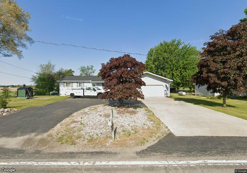
1302 Carter Rd Midland, MI 48642
Estimated Value: $153,000 - $303,000
3
Beds
1
Bath
1,056
Sq Ft
$210/Sq Ft
Est. Value
About This Home
This home is located at 1302 Carter Rd, Midland, MI 48642 and is currently estimated at $221,695, approximately $209 per square foot. 1302 Carter Rd is a home located in Bay County with nearby schools including Auburn Elementary School, Western Middle School, and Bay City Western High School.
Ownership History
Date
Name
Owned For
Owner Type
Purchase Details
Closed on
Jan 20, 2021
Sold by
Bingham Chad M
Bought by
Bingham Chad M and Bingham Pamela S
Current Estimated Value
Home Financials for this Owner
Home Financials are based on the most recent Mortgage that was taken out on this home.
Original Mortgage
$147,250
Outstanding Balance
$107,419
Interest Rate
2.6%
Mortgage Type
New Conventional
Estimated Equity
$114,276
Purchase Details
Closed on
Mar 23, 2006
Sold by
Haynes Donald K
Bought by
Bingham Chad M
Home Financials for this Owner
Home Financials are based on the most recent Mortgage that was taken out on this home.
Original Mortgage
$101,100
Interest Rate
6.38%
Mortgage Type
Fannie Mae Freddie Mac
Purchase Details
Closed on
Jun 7, 2005
Sold by
Finner Donald E
Bought by
Finner Donald E and Donald E Finner Declaration Trust
Create a Home Valuation Report for This Property
The Home Valuation Report is an in-depth analysis detailing your home's value as well as a comparison with similar homes in the area
Home Values in the Area
Average Home Value in this Area
Purchase History
| Date | Buyer | Sale Price | Title Company |
|---|---|---|---|
| Bingham Chad M | -- | None Available | |
| Bingham Chad M | $143,000 | None Available | |
| Finner Donald E | -- | None Available |
Source: Public Records
Mortgage History
| Date | Status | Borrower | Loan Amount |
|---|---|---|---|
| Open | Bingham Chad M | $147,250 | |
| Closed | Bingham Chad M | $101,100 |
Source: Public Records
Tax History Compared to Growth
Tax History
| Year | Tax Paid | Tax Assessment Tax Assessment Total Assessment is a certain percentage of the fair market value that is determined by local assessors to be the total taxable value of land and additions on the property. | Land | Improvement |
|---|---|---|---|---|
| 2025 | $1,320 | $97,700 | $0 | $0 |
| 2024 | $1,320 | $84,700 | $0 | $0 |
| 2023 | $1,257 | $80,900 | $0 | $0 |
| 2022 | $2,152 | $75,100 | $0 | $0 |
| 2021 | $2,019 | $69,900 | $10,100 | $59,800 |
| 2020 | $1,981 | $66,850 | $10,100 | $56,750 |
| 2019 | $1,817 | $61,700 | $0 | $0 |
| 2018 | $1,776 | $57,200 | $0 | $0 |
| 2017 | $1,799 | $57,050 | $0 | $0 |
| 2016 | $1,735 | $48,900 | $7,000 | $41,900 |
| 2015 | -- | $51,600 | $7,000 | $44,600 |
| 2014 | -- | $56,400 | $5,900 | $50,500 |
Source: Public Records
Map
Nearby Homes
- 0 S 11 Mile Rd
- 2515 S 11 Mile Rd
- 2041 S Carter Rd
- 2010 Eleven Mile
- 4949 S Garfield Rd
- 2192 S Garfield Rd
- Lot B N Waldo
- Lot A N Waldo
- 0 W Beaver Rd
- 1255 S Nine Mile Rd
- 2615 N Waldo Rd
- 2509 N Waldo Rd
- 2730 W Anderson Rd
- 3175 S Carter Rd
- 1428 S 8 Mile Rd
- 2858 N Cedaridge Dr
- 2404 N Quail Run Dr
- 1826 8 Mile Rd
- 3954 E Marilyn Ln
- 4117 E Old Pine Trail
- 1292 Carter Rd
- 1282 Carter Rd
- 1303 Carter Rd
- 1305 Carter Rd
- 1196 S Carter Rd
- 1213 Carter Rd
- 1307 Carter Rd
- 1307 S Carter Rd
- 1306 Carter Rd
- 1309 Carter Rd
- 1184 Carter Rd
- 1308 Carter Rd
- 1313 Carter Rd
- 1178 Carter Rd
- 1319 Carter Rd
- 1150 Carter Rd
- 1151 Carter Rd
- 1318 Carter Rd
- 1347 Carter Rd
- 1347 S Carter Rd