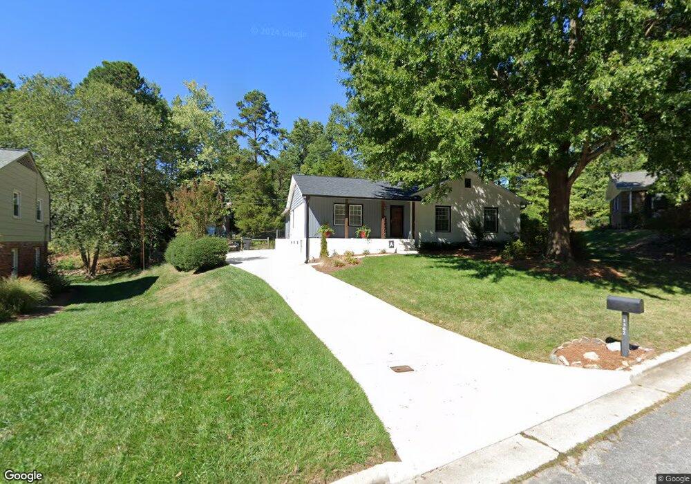
1302 Danbury Ct High Point, NC 27262
Greater High Point NeighborhoodEstimated Value: $274,427 - $323,000
3
Beds
2
Baths
1,626
Sq Ft
$183/Sq Ft
Est. Value
About This Home
This home is located at 1302 Danbury Ct, High Point, NC 27262 and is currently estimated at $297,607, approximately $183 per square foot. 1302 Danbury Ct is a home located in Guilford County with nearby schools including Northwood Elementary School, Ferndale Middle School, and High Point Central High School.
Ownership History
Date
Name
Owned For
Owner Type
Purchase Details
Closed on
Nov 18, 2020
Sold by
Armstrong Michael Scott
Bought by
Armstrong Michael Scott and Armstrong Stacey
Current Estimated Value
Home Financials for this Owner
Home Financials are based on the most recent Mortgage that was taken out on this home.
Original Mortgage
$146,502
Outstanding Balance
$130,366
Interest Rate
2.8%
Mortgage Type
New Conventional
Estimated Equity
$167,241
Purchase Details
Closed on
Mar 1, 1996
Bought by
Armstrong Michael Scott
Create a Home Valuation Report for This Property
The Home Valuation Report is an in-depth analysis detailing your home's value as well as a comparison with similar homes in the area
Home Values in the Area
Average Home Value in this Area
Purchase History
| Date | Buyer | Sale Price | Title Company |
|---|---|---|---|
| Armstrong Michael Scott | -- | Amrock | |
| Armstrong Michael Scott | $113,500 | -- |
Source: Public Records
Mortgage History
| Date | Status | Borrower | Loan Amount |
|---|---|---|---|
| Open | Armstrong Michael Scott | $146,502 |
Source: Public Records
Tax History Compared to Growth
Tax History
| Year | Tax Paid | Tax Assessment Tax Assessment Total Assessment is a certain percentage of the fair market value that is determined by local assessors to be the total taxable value of land and additions on the property. | Land | Improvement |
|---|---|---|---|---|
| 2025 | $2,177 | $158,000 | $46,000 | $112,000 |
| 2024 | $2,177 | $158,000 | $46,000 | $112,000 |
| 2023 | $2,177 | $158,000 | $46,000 | $112,000 |
| 2022 | $2,130 | $158,000 | $46,000 | $112,000 |
| 2021 | $1,812 | $131,500 | $35,000 | $96,500 |
| 2020 | $1,812 | $131,500 | $35,000 | $96,500 |
| 2019 | $1,812 | $131,500 | $0 | $0 |
| 2018 | $1,803 | $131,500 | $0 | $0 |
| 2017 | $1,812 | $131,500 | $0 | $0 |
| 2016 | $1,853 | $132,100 | $0 | $0 |
| 2015 | $1,863 | $132,100 | $0 | $0 |
| 2014 | $1,894 | $132,100 | $0 | $0 |
Source: Public Records
Map
Nearby Homes
- 1232 Dovershire Place
- 1228 Dovershire Place
- 1307 Hempshire Ct
- 1408 Wales Dr
- 824 W Lexington Ave
- 1319 Robin Hood Rd
- 427 Woodbrook Dr
- 1504 Heathcliff Rd
- 1042 Rockford Rd
- 407 Emerywood Dr
- 605 Westchester Dr
- 1122 Kensington Dr
- 1509 Heathcliff Rd
- 510 Otteray Ave
- 1204 Ascot Ct
- 416 W Lexington Ave
- 1376 Trafalgar Dr
- 501 Westchester Dr
- 1200 Devlin Ct
- 1304 Wickliff Ave
- 1306 Danbury Ct
- 1300 Danbury Ct
- 1105 Robin Hood Rd Unit A
- 1105 Robin Hood Rd Unit B
- 1105 Robin Hood Rd Unit C
- 1105 Robin Hood Rd Unit D
- 1105 Robin Hood Rd
- 1105 Robin Hood Rd Unit F
- 1105 Robin Hood Rd Unit 1105-E
- 1105 Robin Hood Rd Unit F
- 912 Westchester Dr
- 1101 Robin Hood Rd Unit H
- 1101 Robin Hood Rd Unit G
- 1101 Robin Hood Rd Unit F
- 1101 Robin Hood Rd
- 1101 Robin Hood Rd Unit D
- 1101 Robin Hood Rd Unit C
- 1101 Robin Hood Rd Unit B
- 1101 Robin Hood Rd Unit G
- 1101 Robin Hood Rd