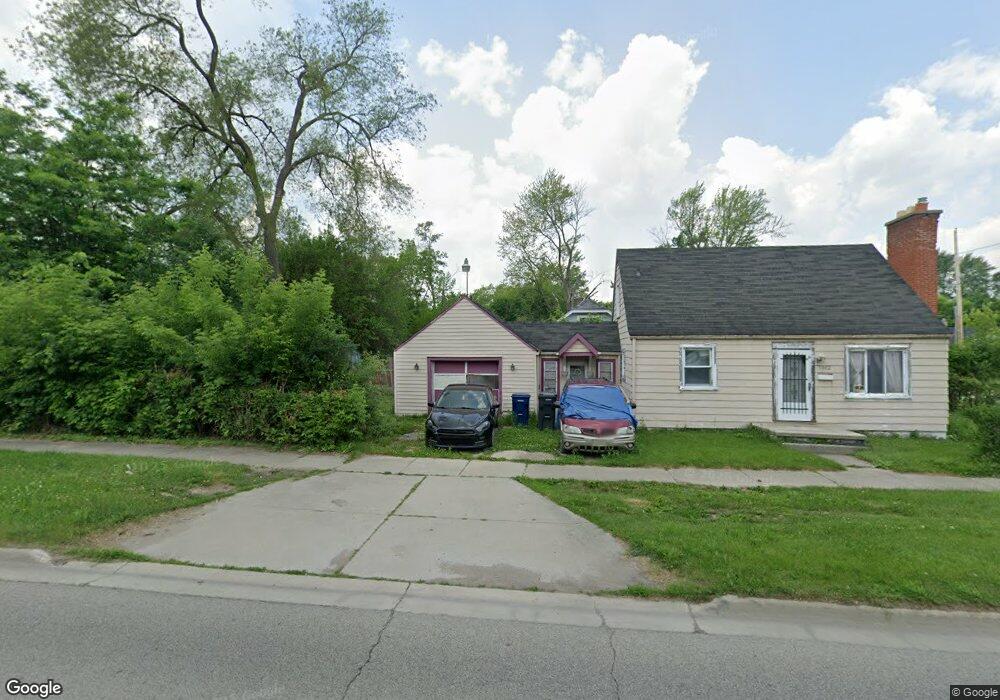
1302 S Ballenger Hwy Flint, MI 48532
Chevrolet NeighborhoodEstimated Value: $54,470 - $65,000
3
Beds
2
Baths
840
Sq Ft
$72/Sq Ft
Est. Value
About This Home
This home is located at 1302 S Ballenger Hwy, Flint, MI 48532 and is currently estimated at $60,118, approximately $71 per square foot. 1302 S Ballenger Hwy is a home located in Genesee County with nearby schools including Durant-Tuuri-Mott Elementary School, Flint Southwestern Classical Academy, and St. Paul Lutheran School.
Ownership History
Date
Name
Owned For
Owner Type
Purchase Details
Closed on
Mar 28, 2016
Sold by
Genesee County Land Bank Authority
Bought by
Spiller Loretta A
Current Estimated Value
Purchase Details
Closed on
Jan 6, 2012
Sold by
The Genesee County Land Bank Authority
Bought by
Spiller Loretta A
Purchase Details
Closed on
Dec 21, 2011
Sold by
Genesee County Treasurer
Bought by
Genesee County Land Bank
Purchase Details
Closed on
Dec 23, 1999
Sold by
Beckley Jodi
Bought by
Kloss Alfred R and Kloss Diana C
Create a Home Valuation Report for This Property
The Home Valuation Report is an in-depth analysis detailing your home's value as well as a comparison with similar homes in the area
Home Values in the Area
Average Home Value in this Area
Purchase History
| Date | Buyer | Sale Price | Title Company |
|---|---|---|---|
| Spiller Loretta A | -- | None Available | |
| Spiller Loretta A | $8,000 | None Available | |
| Genesee County Land Bank | -- | None Available | |
| Kloss Alfred R | $10,000 | Metropolitan Title Company |
Source: Public Records
Mortgage History
| Date | Status | Borrower | Loan Amount |
|---|---|---|---|
| Closed | Spiller Loretta A | $0 |
Source: Public Records
Tax History Compared to Growth
Tax History
| Year | Tax Paid | Tax Assessment Tax Assessment Total Assessment is a certain percentage of the fair market value that is determined by local assessors to be the total taxable value of land and additions on the property. | Land | Improvement |
|---|---|---|---|---|
| 2025 | $791 | $23,900 | $0 | $0 |
| 2024 | $724 | $18,700 | $0 | $0 |
| 2023 | $715 | $15,000 | $0 | $0 |
| 2022 | $0 | $12,500 | $0 | $0 |
| 2021 | $738 | $10,400 | $0 | $0 |
| 2020 | $673 | $8,700 | $0 | $0 |
| 2019 | $866 | $8,400 | $0 | $0 |
| 2018 | $686 | $9,000 | $0 | $0 |
| 2017 | $692 | $0 | $0 | $0 |
| 2016 | $688 | $0 | $0 | $0 |
| 2015 | -- | $0 | $0 | $0 |
| 2014 | -- | $0 | $0 | $0 |
| 2012 | -- | $0 | $0 | $0 |
Source: Public Records
Map
Nearby Homes
- 1412 S Ballenger Hwy
- 1308 Barney Ave
- 3413 Augusta St
- 3801 Augusta St
- 1217 Barney Ave
- 3217 Arlene Ave
- 1122 Stocker Ave
- 1205 Stocker Ave
- 1318 Knapp Ave
- 1202 Knapp Ave
- 3214 Clairmont St
- 1017 Stocker Ave
- 976 Barney Ave
- 1326 Hughes Ave
- 3813 Larchmont St
- 3918 Larchmont St
- 960 Salisbury Ave
- 3305 Larchmont St
- 960 Mann Ave
- 3506 Chicago Blvd
- 3605 Brown St
- 3609 Brown St
- 3604 Whitney Ave
- 3521 Brown St
- 3610 Whitney Ave
- 3617 Brown St
- 3614 Whitney Ave
- 3517 Brown St
- 3610 Brown St
- 3618 Whitney Ave
- 3614 Brown St
- 3513 Brown St
- 3522 Brown St
- 3622 Whitney Ave
- 3625 Brown St
- 3618 Brown St
- 3518 Brown St
- 3626 Whitney Ave
- 3512 Whitney Ave
- 3505 Brown St