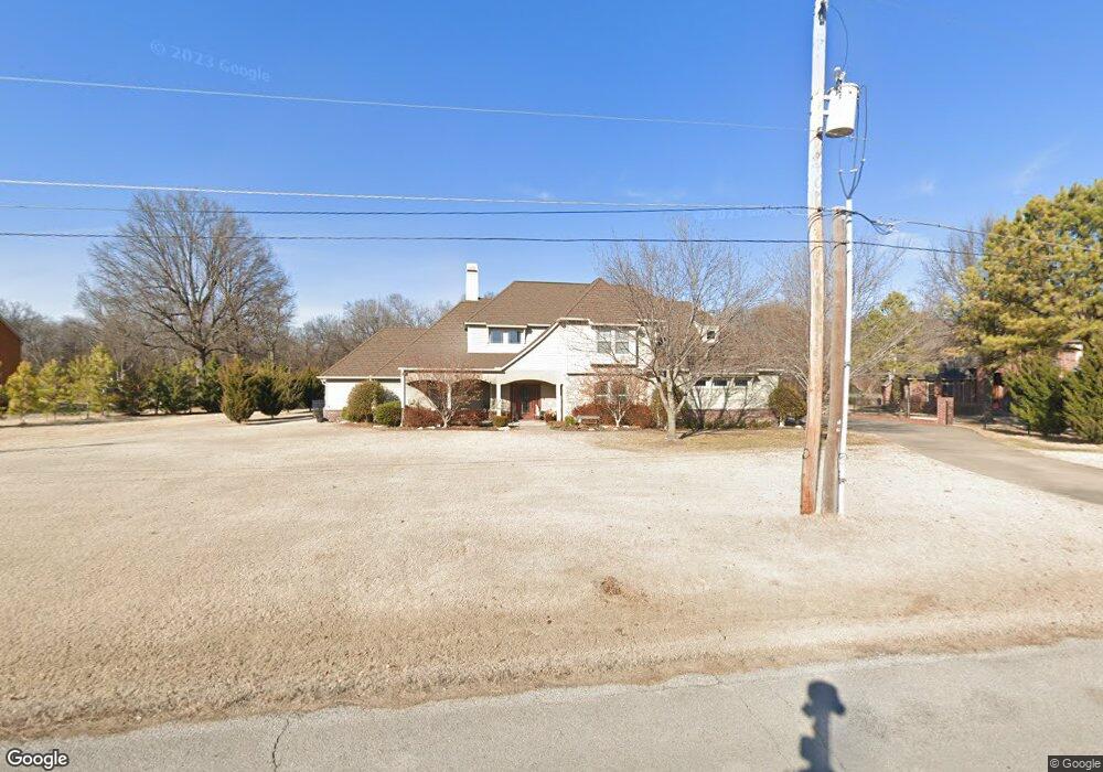
13021 E 67th St Broken Arrow, OK 74012
Southbrook NeighborhoodEstimated Value: $494,000 - $607,000
Studio
4
Baths
4,304
Sq Ft
$127/Sq Ft
Est. Value
About This Home
This home is located at 13021 E 67th St, Broken Arrow, OK 74012 and is currently estimated at $547,493, approximately $127 per square foot. 13021 E 67th St is a home located in Tulsa County with nearby schools including Peters Elementary School, Union 8th Grade Center, and Union 6th-7th Grade Center.
Ownership History
Date
Name
Owned For
Owner Type
Purchase Details
Closed on
Feb 19, 2008
Sold by
Myers Dennis and Myers Lori B
Bought by
The Dennis Grant & Lori Beth Myers Mutua
Current Estimated Value
Purchase Details
Closed on
Sep 29, 2005
Sold by
Wakley Ryan and Wakley June Anne
Bought by
Myers Dennis
Create a Home Valuation Report for This Property
The Home Valuation Report is an in-depth analysis detailing your home's value as well as a comparison with similar homes in the area
Home Values in the Area
Average Home Value in this Area
Purchase History
| Date | Buyer | Sale Price | Title Company |
|---|---|---|---|
| The Dennis Grant & Lori Beth Myers Mutua | -- | None Available | |
| Myers Dennis | $82,500 | -- |
Source: Public Records
Tax History
| Year | Tax Paid | Tax Assessment Tax Assessment Total Assessment is a certain percentage of the fair market value that is determined by local assessors to be the total taxable value of land and additions on the property. | Land | Improvement |
|---|---|---|---|---|
| 2025 | $7,072 | $53,863 | $9,355 | $44,508 |
| 2024 | $6,952 | $53,863 | $9,355 | $44,508 |
| 2023 | $6,952 | $54,863 | $9,529 | $45,334 |
| 2022 | $6,873 | $52,817 | $9,173 | $43,644 |
| 2021 | $6,691 | $51,250 | $8,901 | $42,349 |
| 2020 | $6,735 | $51,250 | $8,901 | $42,349 |
| 2019 | $6,724 | $51,250 | $8,901 | $42,349 |
| 2018 | $6,704 | $51,250 | $8,901 | $42,349 |
| 2017 | $6,793 | $52,250 | $9,075 | $43,175 |
| 2016 | $6,704 | $52,250 | $9,075 | $43,175 |
| 2015 | $6,707 | $52,250 | $9,075 | $43,175 |
| 2014 | $6,668 | $52,250 | $9,075 | $43,175 |
Source: Public Records
Map
Nearby Homes
- 6712 S 136th Ave E
- 0 S 136th East Ave
- 3108 W Norman Cir
- 1316 N Nyssa Ave
- 3033 W Oakland St
- 2909 W Oakland St
- 3413 W Norman St
- 2817 W Oakland St
- 1218 N Elder Ave
- 3200 W Lansing St
- 1219 N Elder Ave
- 2701 W Madison St
- 1200 N Dogwood Ave
- Lee II Plan at Bricktown East - Broken Arrow
- 1331 N Beech St
- Hampton III Plan at Bricktown East - Broken Arrow
- Walker FH Plan at Bricktown East - Broken Arrow
- Hamilton Plan at Bricktown East - Broken Arrow
- Dorsey V Plan at Bricktown East - Broken Arrow
- Hampton IV 3C Plan at Bricktown East - Broken Arrow
- 13031 E 67th St
- 13011 E 67th St
- 13016 E 67th St
- 13010 E 67th St
- 13006 E 67th St
- 13007 E 67th St
- 3300 W Queens St
- 3304 W Queens St
- 3301 W Queens St
- 3308 W Queens St
- 13200 E 67th St
- 3305 W Queens St
- 3300 W Princeton St
- 3309 W Queens St
- 3304 W Princeton St
- 13030 E 67th St
- 3400 W Queens St
- 3308 W Princeton St
- 13207 E 68th St
- 3404 W Queens St
