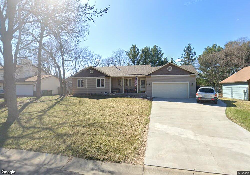
13022 Killdeer St NW Coon Rapids, MN 55448
Estimated Value: $385,967 - $441,000
4
Beds
2
Baths
1,180
Sq Ft
$345/Sq Ft
Est. Value
About This Home
This home is located at 13022 Killdeer St NW, Coon Rapids, MN 55448 and is currently estimated at $406,742, approximately $344 per square foot. 13022 Killdeer St NW is a home located in Anoka County with nearby schools including Lucile Bruner Elementary School, Morris Bye Elementary School, and Laughlin Junior/Senior High School.
Ownership History
Date
Name
Owned For
Owner Type
Purchase Details
Closed on
May 29, 2009
Sold by
Rak Steven and Rak Tonya
Bought by
Powell Daniel and Powell Kristine
Current Estimated Value
Home Financials for this Owner
Home Financials are based on the most recent Mortgage that was taken out on this home.
Original Mortgage
$217,979
Outstanding Balance
$143,055
Interest Rate
5.5%
Mortgage Type
FHA
Estimated Equity
$263,687
Purchase Details
Closed on
Apr 27, 2000
Sold by
Weber Gregory F and Weber Wendy L
Bought by
Deleon Jose and Deleon Kathy A
Create a Home Valuation Report for This Property
The Home Valuation Report is an in-depth analysis detailing your home's value as well as a comparison with similar homes in the area
Home Values in the Area
Average Home Value in this Area
Purchase History
| Date | Buyer | Sale Price | Title Company |
|---|---|---|---|
| Powell Daniel | $222,000 | -- | |
| Deleon Jose | $154,900 | -- |
Source: Public Records
Mortgage History
| Date | Status | Borrower | Loan Amount |
|---|---|---|---|
| Open | Powell Daniel | $217,979 |
Source: Public Records
Tax History Compared to Growth
Tax History
| Year | Tax Paid | Tax Assessment Tax Assessment Total Assessment is a certain percentage of the fair market value that is determined by local assessors to be the total taxable value of land and additions on the property. | Land | Improvement |
|---|---|---|---|---|
| 2025 | $3,802 | $350,800 | $94,500 | $256,300 |
| 2024 | $3,802 | $342,700 | $91,400 | $251,300 |
| 2023 | $3,568 | $331,500 | $75,600 | $255,900 |
| 2022 | $3,263 | $342,200 | $75,600 | $266,600 |
| 2021 | $3,191 | $279,400 | $58,800 | $220,600 |
| 2020 | $3,044 | $267,200 | $58,800 | $208,400 |
| 2019 | $2,923 | $245,400 | $58,800 | $186,600 |
| 2018 | $2,768 | $229,300 | $0 | $0 |
| 2017 | $2,287 | $211,300 | $0 | $0 |
| 2016 | $2,329 | $188,300 | $0 | $0 |
| 2015 | $2,274 | $188,300 | $52,500 | $135,800 |
| 2014 | -- | $156,900 | $37,200 | $119,700 |
Source: Public Records
Map
Nearby Homes
- 1687 131st Ln NW
- 1776 133rd Ave NW
- 1930 127th Cir NW
- 1520 129th Ave NW
- 12554 Grouse St NW
- 12760 Raven St NW
- 1593 126th Ln NW
- 12796 Bluebird St NW
- 13416 Swallow St NW
- 1450 126th Ln NW
- 13519 Partridge Cir NW
- 2147 125th Ln NW
- 12365 Jay St NW
- 1234 128th Cir NW
- 1625 124th Ave NW
- 2068 124th Ln NW
- 12463 Drake St NW
- 13182 Zion St NW
- 2270 137th Ln NW
- 1727 121st Ln NW
- 13008 Killdeer St NW
- 13036 Killdeer St NW
- 12994 Killdeer St NW
- 13025 Linnet St NW
- 12975 Linnet St NW
- 13007 Killdeer St NW
- 13055 Linnet St NW
- 13023 Killdeer St NW
- 13075 Linnet St NW
- 13048 Killdeer St NW
- 12925 Linnet St NW
- 13035 Killdeer St NW
- 12993 Killdeer St NW
- 13047 Killdeer St NW
- 1871 130th Ln NW
- 1863 128th Ave NW
- 1883 128th Ave NW
- 13034 Jay St NW
- 13000 Linnet St NW
- 1820 131st Ave NW