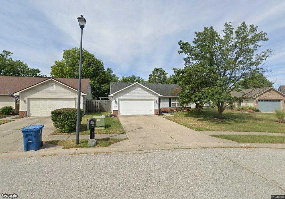
13026 Saint Andrews Way Fishers, IN 46038
Estimated Value: $296,655 - $301,000
3
Beds
2
Baths
1,244
Sq Ft
$240/Sq Ft
Est. Value
About This Home
This home is located at 13026 Saint Andrews Way, Fishers, IN 46038 and is currently estimated at $298,914, approximately $240 per square foot. 13026 Saint Andrews Way is a home located in Hamilton County with nearby schools including Cumberland Road Elementary School, East Middle School, and Fishers Junior High School.
Ownership History
Date
Name
Owned For
Owner Type
Purchase Details
Closed on
Apr 26, 2022
Sold by
Monroe Diana G
Bought by
Moffat William Maxwell
Current Estimated Value
Home Financials for this Owner
Home Financials are based on the most recent Mortgage that was taken out on this home.
Original Mortgage
$221,000
Outstanding Balance
$207,066
Interest Rate
3.85%
Mortgage Type
New Conventional
Estimated Equity
$91,848
Create a Home Valuation Report for This Property
The Home Valuation Report is an in-depth analysis detailing your home's value as well as a comparison with similar homes in the area
Home Values in the Area
Average Home Value in this Area
Purchase History
| Date | Buyer | Sale Price | Title Company |
|---|---|---|---|
| Moffat William Maxwell | $260,000 | Near North Title Group |
Source: Public Records
Mortgage History
| Date | Status | Borrower | Loan Amount |
|---|---|---|---|
| Open | Moffat William Maxwell | $221,000 |
Source: Public Records
Tax History Compared to Growth
Tax History
| Year | Tax Paid | Tax Assessment Tax Assessment Total Assessment is a certain percentage of the fair market value that is determined by local assessors to be the total taxable value of land and additions on the property. | Land | Improvement |
|---|---|---|---|---|
| 2024 | $2,479 | $251,800 | $77,000 | $174,800 |
| 2023 | $2,514 | $235,700 | $41,300 | $194,400 |
| 2022 | $2,291 | $207,700 | $41,300 | $166,400 |
| 2021 | $1,821 | $172,000 | $41,300 | $130,700 |
| 2020 | $1,602 | $156,200 | $41,300 | $114,900 |
| 2019 | $1,406 | $142,700 | $29,600 | $113,100 |
| 2018 | $1,225 | $130,800 | $29,600 | $101,200 |
| 2017 | $1,146 | $126,300 | $29,600 | $96,700 |
| 2016 | $1,105 | $124,000 | $29,600 | $94,400 |
| 2014 | $934 | $116,400 | $29,600 | $86,800 |
| 2013 | $934 | $110,900 | $29,600 | $81,300 |
Source: Public Records
Map
Nearby Homes
- 12959 Shandon Ln
- 12991 Wingstem Ct
- 12677 Ladson St
- 11798 & 11842 E 131st St
- 9080 Teaneck Dr
- 10066 Perlita Place
- 9050 Sparta Dr
- 10150 Beresford Ct
- 13068 Raritan Dr
- 9009 Mercer Dr
- 13068 Lamarque Place
- 9335 Clarendon Dr
- 10175 Pamona Ct
- 13721 Gatsby Dr
- 12541 Trester Ln
- 13853 Oak Grove Ct
- 13854 Meadow Grass Way
- 13048 Ross Crossing
- 10093 Parkshore Dr
- 12966 Pleasant View Ln
- 13022 Saint Andrews Way
- 9602 Aberdeen Ct
- 13018 Saint Andrews Way
- 13018 St Andrews Way
- 13068 Saint Andrews Way
- 9608 Aberdeen Ct
- 13014 Saint Andrews Way
- 9600 Claymore Dr
- 9618 Aberdeen Ct
- 9633 Aberdeen Ct
- 13010 Saint Andrews Way
- 13010 St Andrews Way
- 9628 Aberdeen Ct
- 9610 Claymore Dr
- 9643 Aberdeen Ct
- 9638 Aberdeen Ct
- 12998 Saint Andrews Way
- 9648 Aberdeen Ct
- 9653 Aberdeen Ct
- 12994 Saint Andrews Way