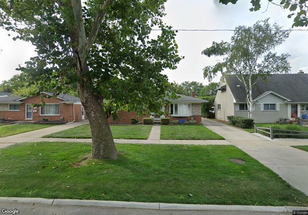
13028 Common Rd Warren, MI 48088
Northeast Warren NeighborhoodEstimated Value: $228,081 - $248,000
3
Beds
1
Bath
1,095
Sq Ft
$219/Sq Ft
Est. Value
About This Home
This home is located at 13028 Common Rd, Warren, MI 48088 and is currently estimated at $239,520, approximately $218 per square foot. 13028 Common Rd is a home located in Macomb County with nearby schools including Warren Woods Tower High School, Frontier International Academy Elementary, and Warren Woods Christian School.
Ownership History
Date
Name
Owned For
Owner Type
Purchase Details
Closed on
May 28, 2004
Sold by
Quinn Randy and Quinn Erin M
Bought by
Schell Milissa A
Current Estimated Value
Home Financials for this Owner
Home Financials are based on the most recent Mortgage that was taken out on this home.
Original Mortgage
$85,000
Interest Rate
6.06%
Mortgage Type
Purchase Money Mortgage
Purchase Details
Closed on
Apr 17, 2001
Sold by
Ruzycki Rebecca L
Bought by
Quinn Randy
Home Financials for this Owner
Home Financials are based on the most recent Mortgage that was taken out on this home.
Original Mortgage
$139,500
Interest Rate
7.18%
Mortgage Type
Purchase Money Mortgage
Purchase Details
Closed on
Dec 16, 1998
Sold by
Adler Donald J
Bought by
Torzy Jeffrey R
Create a Home Valuation Report for This Property
The Home Valuation Report is an in-depth analysis detailing your home's value as well as a comparison with similar homes in the area
Home Values in the Area
Average Home Value in this Area
Purchase History
| Date | Buyer | Sale Price | Title Company |
|---|---|---|---|
| Schell Milissa A | $171,900 | Homeowners Title Agency Reco | |
| Quinn Randy | $147,000 | -- | |
| Torzy Jeffrey R | $44,500 | -- |
Source: Public Records
Mortgage History
| Date | Status | Borrower | Loan Amount |
|---|---|---|---|
| Previous Owner | Schell Milissa A | $85,000 | |
| Previous Owner | Quinn Randy | $139,500 |
Source: Public Records
Tax History
| Year | Tax Paid | Tax Assessment Tax Assessment Total Assessment is a certain percentage of the fair market value that is determined by local assessors to be the total taxable value of land and additions on the property. | Land | Improvement |
|---|---|---|---|---|
| 2025 | $2,891 | $106,310 | $0 | $0 |
| 2024 | $28 | $96,460 | $0 | $0 |
| 2023 | $2,665 | $93,090 | $0 | $0 |
| 2022 | $2,613 | $81,290 | $0 | $0 |
| 2021 | $2,564 | $74,330 | $0 | $0 |
| 2020 | $2,457 | $69,900 | $0 | $0 |
| 2019 | $2,348 | $66,840 | $0 | $0 |
| 2018 | $2,371 | $55,730 | $0 | $0 |
| 2017 | $2,243 | $50,060 | $9,660 | $40,400 |
| 2016 | $2,225 | $50,060 | $0 | $0 |
| 2015 | -- | $44,900 | $0 | $0 |
| 2012 | -- | $42,950 | $0 | $0 |
Source: Public Records
Map
Nearby Homes
- 30045 Iroquois Dr
- 12531 Common Rd
- 29820 Palomino Dr
- 13325 Iowa Dr
- 54765 Palomino Ave
- 30745 Iroquois Dr
- 30806 Ridgefield Ave
- 30829 Eiffel Ave
- 29143 Dover Ave
- 29337 Roan Dr
- 29366 Wagner Dr
- 30955 Iroquois Dr
- 29105 Palomino Dr
- 13209 E 13 Mile Rd
- 30139 Flanders Ave
- 13342 Lutz Ave
- 29454 Scarborough Dr Unit 7
- 29088 Yorkshire Ln Unit 28
- 29091 Wagner Dr
- 30747 Sutherland Ave
- 13004 Common Rd
- 13027 Walter Ave
- 13039 Walter Ave
- 13015 Walter Ave
- 29843 Dover Ave
- 12984 Common Rd
- 29819 Dover Ave
- 13027 Common Rd
- 12955 Walter Ave
- 29807 Dover Ave
- 13015 Common Rd
- 12972 Common Rd
- 13001 Common Rd
- 13053 Common Rd
- 12943 Walter Ave
- 12979 Common Rd
- 13065 Common Rd
- 12931 Walter Ave
- 29842 Dover Ave
- 29830 Dover Ave
Your Personal Tour Guide
Ask me questions while you tour the home.