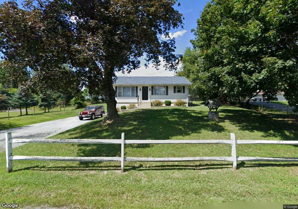
1303 Dolsontown Rd Middletown, NY 10940
Estimated Value: $294,184 - $334,000
2
Beds
1
Bath
864
Sq Ft
$355/Sq Ft
Est. Value
About This Home
This home is located at 1303 Dolsontown Rd, Middletown, NY 10940 and is currently estimated at $306,796, approximately $355 per square foot. 1303 Dolsontown Rd is a home located in Orange County with nearby schools including Middletown Twin Towers Middle School, Monhagen Middle School, and Middletown High School.
Ownership History
Date
Name
Owned For
Owner Type
Purchase Details
Closed on
May 25, 2016
Sold by
Rog-Vic Holding Corp
Bought by
Beisiegel Joseph
Current Estimated Value
Home Financials for this Owner
Home Financials are based on the most recent Mortgage that was taken out on this home.
Original Mortgage
$130,099
Outstanding Balance
$52,661
Interest Rate
2.87%
Mortgage Type
FHA
Estimated Equity
$254,135
Purchase Details
Closed on
Sep 7, 1999
Sold by
Eason Veta
Bought by
Eason Ernest and Eason Richard E
Create a Home Valuation Report for This Property
The Home Valuation Report is an in-depth analysis detailing your home's value as well as a comparison with similar homes in the area
Home Values in the Area
Average Home Value in this Area
Purchase History
| Date | Buyer | Sale Price | Title Company |
|---|---|---|---|
| Beisiegel Joseph | $132,500 | Richard Croughan | |
| Eason Ernest | $46,368 | -- |
Source: Public Records
Mortgage History
| Date | Status | Borrower | Loan Amount |
|---|---|---|---|
| Open | Beisiegel Joseph | $130,099 |
Source: Public Records
Tax History Compared to Growth
Tax History
| Year | Tax Paid | Tax Assessment Tax Assessment Total Assessment is a certain percentage of the fair market value that is determined by local assessors to be the total taxable value of land and additions on the property. | Land | Improvement |
|---|---|---|---|---|
| 2024 | $4,789 | $30,800 | $5,300 | $25,500 |
| 2023 | $4,789 | $30,800 | $5,300 | $25,500 |
| 2022 | $4,913 | $30,800 | $5,300 | $25,500 |
| 2021 | $5,214 | $30,800 | $5,300 | $25,500 |
| 2020 | $1,547 | $30,800 | $5,300 | $25,500 |
| 2019 | $5,270 | $30,800 | $5,300 | $25,500 |
| 2018 | $5,270 | $30,800 | $5,300 | $25,500 |
| 2017 | $5,305 | $30,800 | $5,300 | $25,500 |
| 2016 | $4,873 | $29,700 | $5,300 | $24,400 |
| 2015 | -- | $29,700 | $5,300 | $24,400 |
| 2014 | -- | $29,700 | $5,300 | $24,400 |
Source: Public Records
Map
Nearby Homes
- 20 Atwood Dr
- 0 Airport Rd Unit ONEH6195533
- 4 Langton Mews Unit 7
- 3 Allan Park Mews
- 1 Chancery Mews
- 6 Perrins Mews
- 5 Raleigh Close Unit 3
- 2 Danielle Ct
- 318 Ruth Ct
- 8 Ebury Mews
- 49 Ruth Ct
- 147 Ruth Ct
- 215 Ruth Ct
- 19-21 Wilson St
- 30 Wilson St
- 38 Wilson St
- 82 Houston Ave
- 96 Belmont Ave
- 214 Phillips St
- 6 Milo Rd
- 1309 Dolsontown Rd
- 1308 Dolsontown Rd
- 0 Schutt & Avenue F Rd Unit H4747935
- 0 Schutt & Avenue F Rd Unit H4908841
- 0 Schutt & Avenue F Rd Unit 4909189
- 0 Schutt & Avenue F Rd Unit 4917664
- 0 Schutt & Avenue F Rd
- 295 Genung St
- 14 Airport Rd
- 1283 Dolsontown Rd
- 1291 Dolsontown Rd
- 1291 Dolsontown Rd Unit 1
- 330 Genung St
- 316 Genung St
- 306 Genung St
- 1277 Dolsontown Rd
- 280 Genung St
- 12 Schutt Rd
- 25 Lindentree Ln
- 27 Lindentree Ln