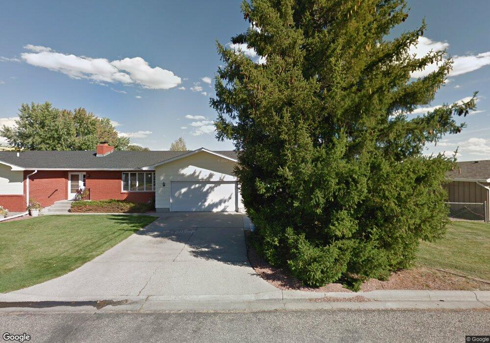
1303 Nez Perce Dr Laurel, MT 59044
Estimated Value: $414,000 - $441,000
5
Beds
3
Baths
3,316
Sq Ft
$128/Sq Ft
Est. Value
About This Home
This home is located at 1303 Nez Perce Dr, Laurel, MT 59044 and is currently estimated at $423,852, approximately $127 per square foot. 1303 Nez Perce Dr is a home located in Yellowstone County with nearby schools including West School, Fred W. Graff School, and Laurel Middle School.
Ownership History
Date
Name
Owned For
Owner Type
Purchase Details
Closed on
Nov 9, 2016
Sold by
Michunovich Michael J and Michunovich Laura D
Bought by
Fake Richard L and Fake Chelsey L
Current Estimated Value
Home Financials for this Owner
Home Financials are based on the most recent Mortgage that was taken out on this home.
Original Mortgage
$150,000
Outstanding Balance
$120,614
Interest Rate
3.47%
Mortgage Type
VA
Estimated Equity
$303,238
Purchase Details
Closed on
Oct 7, 2008
Sold by
Michunovich Michael J and Michunovich Laura D
Bought by
Michunovich Michael J and Michunovich Laura D
Create a Home Valuation Report for This Property
The Home Valuation Report is an in-depth analysis detailing your home's value as well as a comparison with similar homes in the area
Home Values in the Area
Average Home Value in this Area
Purchase History
| Date | Buyer | Sale Price | Title Company |
|---|---|---|---|
| Fake Richard L | -- | American Title & Escrow | |
| Michunovich Michael J | -- | None Available |
Source: Public Records
Mortgage History
| Date | Status | Borrower | Loan Amount |
|---|---|---|---|
| Open | Fake Richard L | $150,000 |
Source: Public Records
Tax History Compared to Growth
Tax History
| Year | Tax Paid | Tax Assessment Tax Assessment Total Assessment is a certain percentage of the fair market value that is determined by local assessors to be the total taxable value of land and additions on the property. | Land | Improvement |
|---|---|---|---|---|
| 2025 | $3,343 | $430,800 | $63,916 | $366,884 |
| 2024 | $3,343 | $344,700 | $41,680 | $303,020 |
| 2023 | $3,078 | $344,700 | $41,680 | $303,020 |
| 2022 | $2,680 | $284,100 | $32,758 | $251,342 |
| 2021 | $2,703 | $284,100 | $0 | $0 |
| 2020 | $2,548 | $262,100 | $0 | $0 |
| 2019 | $2,522 | $262,100 | $0 | $0 |
| 2018 | $2,449 | $240,800 | $0 | $0 |
| 2017 | $2,271 | $240,800 | $0 | $0 |
| 2016 | $2,119 | $224,800 | $0 | $0 |
| 2015 | $2,094 | $224,800 | $0 | $0 |
| 2014 | $1,929 | $108,120 | $0 | $0 |
Source: Public Records
Map
Nearby Homes
- 512 W 14th St
- 403 Grandview Blvd
- 1013 W 12th St
- 1109 10th Ave
- 1036 9th Ave
- 1106 W 12th St
- 109 E 12th St
- 1336 Pennsylvania Ave
- 1003 Montana Ave
- 1013 Rochelle Dr
- TBD Block 3 Lot 9
- 1014 Rochelle Ln
- TBD Block 1 Lot 2
- TBD Block 3 Lot 1
- TBD Block 1 Lot 3
- TBD Block 3 Lot 4
- TBD Block 3 Lot 6
- 1960 Coyote Ridge Rd N
- 110 E 5th St
- 516 Pennsylvania Ave
- 1305 Nez Perce Dr
- 603 W 13th St
- 601 W 13th St
- 1304 Nez Perce Dr
- 1325 Nez Perce Dr
- 605 W 13th St
- 1320 Nez Perce Dr
- 1310 Meadow Cir
- 1318 Meadow Cir
- 602 W 13th St
- 1331 Nez Perce Dr
- 610 W 13th St
- 1326 Nez Perce Dr
- 618 W 13th St
- 703 W 13th St
- 713 Beartooth Cir
- 1305 Meadow Cir
- 626 W 13th St
- 1321 Meadow Cir
- 610 W 14th St