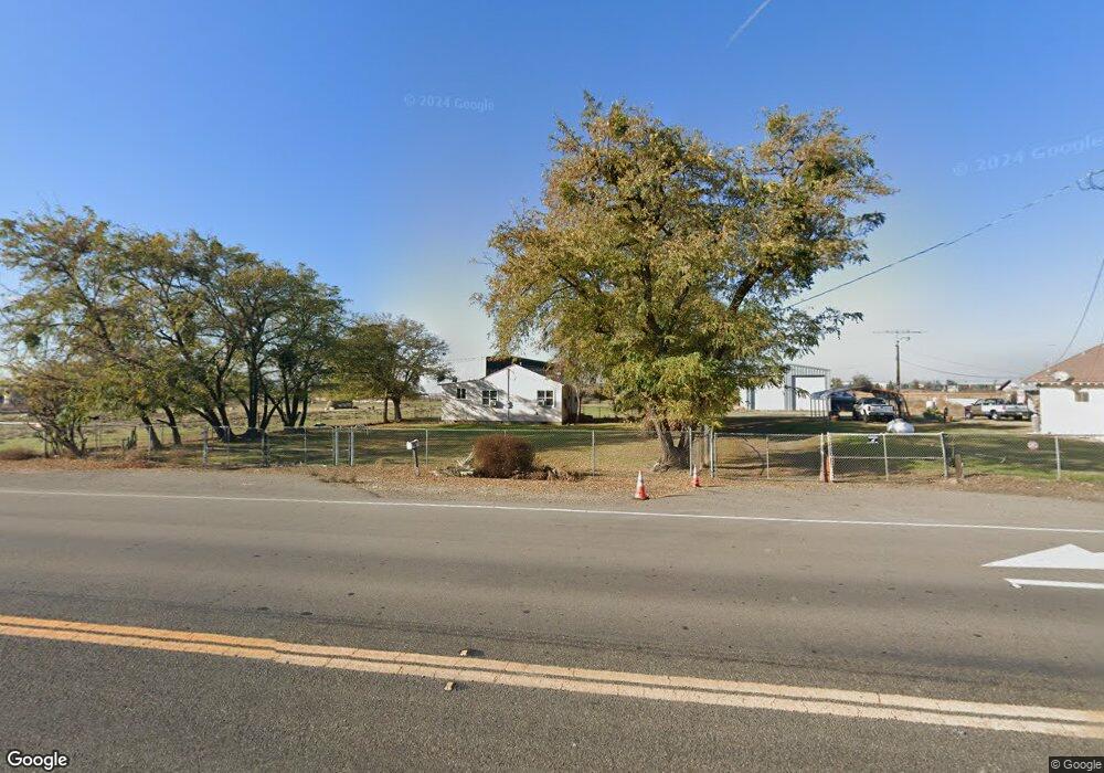
13033 S Airport Way Manteca, CA 95336
Estimated Value: $233,000
2
Beds
1
Bath
874
Sq Ft
$267/Sq Ft
Est. Value
About This Home
This home is located at 13033 S Airport Way, Manteca, CA 95336 and is currently priced at $233,000, approximately $266 per square foot. 13033 S Airport Way is a home located in San Joaquin County with nearby schools including French Camp Elementary School, East Union High School, and BE.TECH Charter High School.
Ownership History
Date
Name
Owned For
Owner Type
Purchase Details
Closed on
Oct 19, 2022
Sold by
Edward & Mary Stumpfhauser Living Trust
Bought by
Richard J Riella And Mikki M Riella 2006 Fami
Current Estimated Value
Purchase Details
Closed on
May 1, 2007
Sold by
Stumpfhauser Mary O and Telles Mary O
Bought by
Stumpfhauser Edward H and Stumpfhauser Mary
Purchase Details
Closed on
Oct 15, 1996
Sold by
Riella Richard J and Riella Mikki M
Bought by
Telles Mary O
Create a Home Valuation Report for This Property
The Home Valuation Report is an in-depth analysis detailing your home's value as well as a comparison with similar homes in the area
Home Values in the Area
Average Home Value in this Area
Purchase History
| Date | Buyer | Sale Price | Title Company |
|---|---|---|---|
| Richard J Riella And Mikki M Riella 2006 Fami | $1,000,000 | Old Republic Title | |
| Stumpfhauser Edward H | -- | None Available | |
| Telles Mary O | -- | Alliance Title Company |
Source: Public Records
Tax History Compared to Growth
Tax History
| Year | Tax Paid | Tax Assessment Tax Assessment Total Assessment is a certain percentage of the fair market value that is determined by local assessors to be the total taxable value of land and additions on the property. | Land | Improvement |
|---|---|---|---|---|
| 2025 | $399 | $32,914 | $1,564 | $31,350 |
| 2024 | $388 | $32,270 | $1,534 | $30,736 |
| 2023 | $370 | $31,638 | $1,504 | $30,134 |
| 2022 | $364 | $31,019 | $1,475 | $29,544 |
| 2021 | $361 | $30,412 | $1,447 | $28,965 |
| 2020 | $347 | $30,101 | $1,433 | $28,668 |
| 2019 | $343 | $29,511 | $1,405 | $28,106 |
| 2018 | $338 | $28,933 | $1,378 | $27,555 |
| 2017 | $333 | $28,366 | $1,351 | $27,015 |
| 2016 | $325 | $27,809 | $1,324 | $26,485 |
| 2014 | $305 | $26,855 | $1,279 | $25,576 |
Source: Public Records
Map
Nearby Homes
- 2105 N Airport Way
- 1665 River Birch St
- Barcelona Plan at The Estates - Rosewood at the Estates
- Brisbane Plan at The Estates - Rosewood at the Estates
- Macon II Plan at The Estates - Rosewood at the Estates
- Aegean Plan at The Estates - Rosewood at the Estates
- Faro Plan at The Estates - Meridian at The Estates
- The Asheville Plan at The Estates - Meridian at The Estates
- Boise Plan at The Estates - Meridian at The Estates
- Water Lily II Plan at The Estates - Meridian at The Estates
- 1626 River Birch St
- 2970 Cotton Briar Ln
- 2053 Shady Oak St
- 1995 Shady Oak St
- 1672 Arbor Brook Dr
- 2961 Clear Point Way
- 2491 Redbud Way
- 2421 Shady Oak Place
- 2348 Degroot Ln
- 2473 Dutchwood Ln
- 3157 N Airport Way
- 13182 S Airport Way
- 12900 S Airport Way
- 13496 S Airport Way
- 13856 S Airport Way
- 1995 Salvador Way
- 2991 Cotton Briar Ln
- 1681 River Birch St
- 2985 Cotton Briar Ln
- 2979 Cotton Briar Ln
- 2973 Cotton Briar Ln
- 2965 Cotton Briar Ln
- 2957 Cotton Briar Ln
- 2951 Cotton Briar Ln
- 1643 River Birch St
- 2943 Cotton Briar Ln
- 2935 Cotton Briar Ln
- 1644 River Birch St
- 1625 River Birch St
- 2927 Cotton Briar Ln