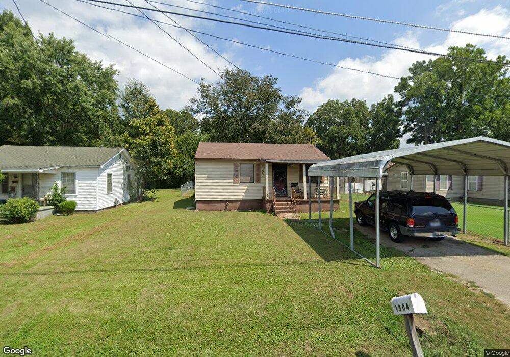
1304 Dungan St Humboldt, TN 38343
Estimated Value: $54,000 - $88,000
2
Beds
1
Bath
920
Sq Ft
$80/Sq Ft
Est. Value
About This Home
This home is located at 1304 Dungan St, Humboldt, TN 38343 and is currently estimated at $73,183, approximately $79 per square foot. 1304 Dungan St is a home located in Gibson County with nearby schools including Stigall Primary School, East Elementary School, and Humboldt Middle School.
Ownership History
Date
Name
Owned For
Owner Type
Purchase Details
Closed on
Dec 16, 2021
Sold by
Ferguson Kristie L and Jarvis Family Revocable Trust
Bought by
Ferguson Kristie L and Teresa A Johnson Trust
Current Estimated Value
Purchase Details
Closed on
Mar 27, 2012
Sold by
Guiher Max
Bought by
Jarvis Blaise N Wendy G Trus and Jarvis Family Revocable Trust
Purchase Details
Closed on
Jun 6, 2005
Sold by
Green Connie Lynn
Bought by
Guiher Max E
Purchase Details
Closed on
Feb 24, 1996
Sold by
Arrington Jerry
Bought by
Green Connie L
Purchase Details
Closed on
Jun 17, 1988
Bought by
Arrington Jerry and Arrington Roanna
Create a Home Valuation Report for This Property
The Home Valuation Report is an in-depth analysis detailing your home's value as well as a comparison with similar homes in the area
Home Values in the Area
Average Home Value in this Area
Purchase History
| Date | Buyer | Sale Price | Title Company |
|---|---|---|---|
| Ferguson Kristie L | -- | None Available | |
| Ferguson Kristie L | -- | None Available | |
| Jarvis Blaise N Wendy G Trus | $37,700 | -- | |
| Guiher Max E | $30,000 | -- | |
| Green Connie L | $32,000 | -- | |
| Arrington Jerry | $20,000 | -- |
Source: Public Records
Tax History Compared to Growth
Tax History
| Year | Tax Paid | Tax Assessment Tax Assessment Total Assessment is a certain percentage of the fair market value that is determined by local assessors to be the total taxable value of land and additions on the property. | Land | Improvement |
|---|---|---|---|---|
| 2025 | $345 | $12,725 | $0 | $0 |
| 2024 | $345 | $12,725 | $2,500 | $10,225 |
| 2023 | $78 | $7,050 | $1,250 | $5,800 |
| 2022 | $73 | $7,050 | $1,250 | $5,800 |
| 2021 | $73 | $7,050 | $1,250 | $5,800 |
| 2020 | $265 | $7,050 | $1,250 | $5,800 |
| 2019 | $265 | $7,050 | $1,250 | $5,800 |
| 2018 | $283 | $6,975 | $1,250 | $5,725 |
| 2017 | $280 | $6,975 | $1,250 | $5,725 |
| 2016 | $280 | $6,975 | $1,250 | $5,725 |
| 2015 | $277 | $6,975 | $1,250 | $5,725 |
| 2014 | $277 | $6,975 | $1,250 | $5,725 |
Source: Public Records
Map
Nearby Homes
- 1338 Dungan St
- 1211 N 29th Ave
- 811 N 24th Ave
- 2508 Vine St
- 2425 St Mary Dr
- 2107 Campbell St
- 00000 Lot 7 Mullins St
- 0000 lot 6-C Mullins St
- 000Lot 6-B Mullins St
- 00-lot 6-A Mullins St
- 3117 Laurel St
- 0 +-6 Acres Gadsden Todd Levee Unit 241321
- 700 N 29th Ave
- 0 Eastend Dr
- 2162 Dodson St
- 1438 N 19th Ave
- 2900 E Mitchell St
- 1012 Parkway Cove
- 2310 Dodson St
- 171 N 28th Ave