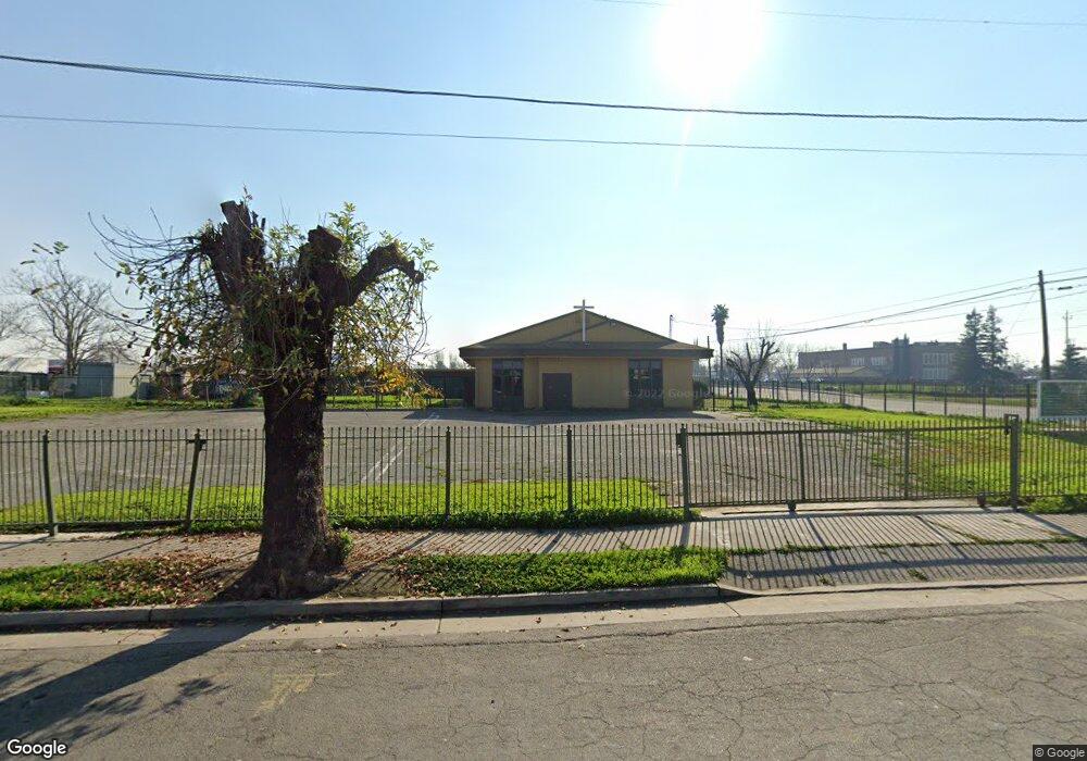
1304 E Anderson St Stockton, CA 95205
East Stockton NeighborhoodEstimated Value: $708,022
--
Bed
--
Bath
--
Sq Ft
0.52
Acres
About This Home
This home is located at 1304 E Anderson St, Stockton, CA 95205 and is currently estimated at $708,022. 1304 E Anderson St is a home located in San Joaquin County with nearby schools including John C. Fremont Elementary School, King Elementary School, and Roosevelt Elementary School.
Ownership History
Date
Name
Owned For
Owner Type
Purchase Details
Closed on
Nov 24, 1999
Sold by
Assemblies Of God
Bought by
Unity Church Of God In Christ Of Stockto
Current Estimated Value
Purchase Details
Closed on
Apr 22, 1998
Sold by
Assemblies Of God
Bought by
Unity Church Of God In Christ Of Stockto
Home Financials for this Owner
Home Financials are based on the most recent Mortgage that was taken out on this home.
Original Mortgage
$105,000
Interest Rate
7.13%
Mortgage Type
Commercial
Create a Home Valuation Report for This Property
The Home Valuation Report is an in-depth analysis detailing your home's value as well as a comparison with similar homes in the area
Home Values in the Area
Average Home Value in this Area
Purchase History
| Date | Buyer | Sale Price | Title Company |
|---|---|---|---|
| Unity Church Of God In Christ Of Stockto | -- | -- | |
| Unity Church Of God In Christ Of Stockto | $175,500 | Fidelity National Title Co |
Source: Public Records
Mortgage History
| Date | Status | Borrower | Loan Amount |
|---|---|---|---|
| Previous Owner | Unity Church Of God In Christ Of Stockto | $105,000 | |
| Closed | Unity Church Of God In Christ Of Stockto | $35,020 |
Source: Public Records
Tax History Compared to Growth
Tax History
| Year | Tax Paid | Tax Assessment Tax Assessment Total Assessment is a certain percentage of the fair market value that is determined by local assessors to be the total taxable value of land and additions on the property. | Land | Improvement |
|---|---|---|---|---|
| 2025 | $1,443 | $231,671 | $111,764 | $119,907 |
| 2024 | $3,234 | $227,129 | $109,573 | $117,556 |
| 2023 | $3,159 | $222,676 | $107,425 | $115,251 |
| 2022 | $2,788 | $218,311 | $105,319 | $112,992 |
| 2021 | $2,679 | $214,031 | $103,254 | $110,777 |
| 2020 | $2,727 | $211,838 | $102,196 | $109,642 |
| 2019 | $3,581 | $207,686 | $100,193 | $107,493 |
| 2018 | $2,666 | $203,615 | $98,229 | $105,386 |
| 2017 | $2,572 | $203,365 | $96,303 | $107,062 |
| 2016 | $2,618 | $199,451 | $94,415 | $105,036 |
| 2014 | $2,494 | $192,737 | $91,176 | $101,561 |
Source: Public Records
Map
Nearby Homes
- 835 S Airport Way
- 832 S Pilgrim St
- 1636 E Anderson St
- 921 S Aurora St
- 1145 S Grant St
- 336 S Airport Way
- 609 E Jefferson St
- 1224 E Lafayette St
- 711 Oso St
- 647 E 1st St
- 739 E 2nd St
- 1120 S California St
- 1816 E Sonora St
- 446 E Anderson St
- 709 E Sonora St
- 1444 S California St
- 1125 S Sutter St
- 525 S California St
- 2136 E Market St
- 320 E Jefferson St
- 1330 E Anderson St
- 1311 E Anderson St
- 1305 E Anderson St
- 1317 E Anderson St
- 1325 E Anderson St
- 1333 E Anderson St
- 1234 E Anderson St
- 932 S Airport Way
- 1341 E Anderson St
- 937 S Airport Way
- 1345 E Anderson St
- 1233 E Anderson St
- 928 S Airport Way
- 933 S Sierra Nevada St
- 1227 E Anderson St
- 920 S Airport Way
- 931 S Airport Way
- 919 S Sierra Nevada St
- 946 S Sierra Nevada St
- 1306 E Worth St