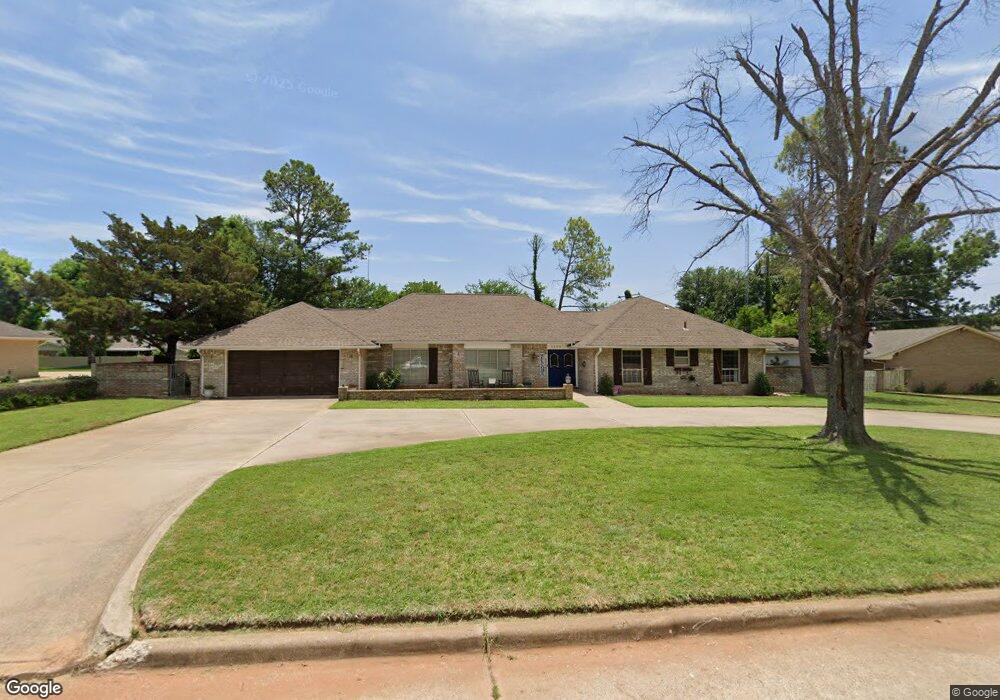
1304 Mccasland Pkwy Duncan, OK 73533
Estimated Value: $242,000 - $280,000
3
Beds
3
Baths
2,621
Sq Ft
$101/Sq Ft
Est. Value
About This Home
This home is located at 1304 Mccasland Pkwy, Duncan, OK 73533 and is currently estimated at $264,478, approximately $100 per square foot. 1304 Mccasland Pkwy is a home located in Stephens County with nearby schools including Emerson Elementary School, Duncan Middle School, and Duncan High School.
Ownership History
Date
Name
Owned For
Owner Type
Purchase Details
Closed on
Mar 23, 2018
Sold by
Brown Tyrel A and Brown Colleen
Bought by
Barry Christopher Alan and Barry Aja Dawn
Current Estimated Value
Home Financials for this Owner
Home Financials are based on the most recent Mortgage that was taken out on this home.
Original Mortgage
$156,120
Outstanding Balance
$136,042
Interest Rate
5.12%
Mortgage Type
FHA
Estimated Equity
$128,436
Purchase Details
Closed on
Jul 18, 2016
Sold by
Gann David Randy and Gann Ricky Glenn
Bought by
Brown Tyrel A and Brown Colleen
Home Financials for this Owner
Home Financials are based on the most recent Mortgage that was taken out on this home.
Original Mortgage
$88,000
Interest Rate
3.66%
Mortgage Type
New Conventional
Purchase Details
Closed on
Aug 20, 1996
Sold by
Clinkenbeard Harold L
Bought by
Gann David V Trust
Create a Home Valuation Report for This Property
The Home Valuation Report is an in-depth analysis detailing your home's value as well as a comparison with similar homes in the area
Home Values in the Area
Average Home Value in this Area
Purchase History
| Date | Buyer | Sale Price | Title Company |
|---|---|---|---|
| Barry Christopher Alan | $159,000 | None Available | |
| Brown Tyrel A | $110,000 | None Available | |
| Gann David V Trust | $145,000 | -- |
Source: Public Records
Mortgage History
| Date | Status | Borrower | Loan Amount |
|---|---|---|---|
| Open | Barry Christopher Alan | $156,120 | |
| Previous Owner | Brown Tyrel A | $88,000 |
Source: Public Records
Tax History Compared to Growth
Tax History
| Year | Tax Paid | Tax Assessment Tax Assessment Total Assessment is a certain percentage of the fair market value that is determined by local assessors to be the total taxable value of land and additions on the property. | Land | Improvement |
|---|---|---|---|---|
| 2025 | $1,503 | $18,816 | $2,019 | $16,797 |
| 2024 | $1,471 | $18,268 | $2,019 | $16,249 |
| 2023 | $1,471 | $18,268 | $2,019 | $16,249 |
| 2022 | $1,379 | $17,736 | $2,019 | $15,717 |
| 2021 | $1,338 | $16,718 | $2,019 | $14,699 |
| 2020 | $1,425 | $17,497 | $2,019 | $15,478 |
| 2019 | $1,429 | $17,520 | $2,019 | $15,501 |
| 2018 | $1,384 | $15,538 | $2,019 | $13,519 |
| 2017 | $1,353 | $15,738 | $2,019 | $13,719 |
| 2016 | $1,284 | $16,103 | $2,019 | $14,084 |
| 2015 | $1,211 | $16,103 | $2,019 | $14,084 |
| 2014 | $1,211 | $15,732 | $1,728 | $14,004 |
Source: Public Records
Map
Nearby Homes
- 1312 Pkwy
- 1444 N 8th St
- 1412 N 12th St
- 1202 N Grand Blvd
- 1112 1112 N 12th
- 1001 1001 W Hackberry
- 807 Columbus Place
- 1107 W Elk Ave
- 1105 N Grand Blvd
- 1114 N 13th St
- 705 W Hackberry Ave
- 1508 N 13th St
- 810 810 N 12th St
- 1402 1402 W Elk Ave
- 1112 N 5th St
- 1405 Evergreen Dr
- 815 N 14th St
- 812 N 15th St
- 1527 1527 N 13th
- 1213 W Pine Ave
- 1304 1304 N McCasland
- 1306 Mccasland Pkwy
- 1301 Normandy Rd
- 1302 Mccasland Pkwy
- 1303 Normandy Rd
- 1303 Mccasland Pkwy
- 1301 Mccasland Pkwy
- 1305 Mccasland Pkwy
- 1308 Mccasland Pkwy
- 1305 Normandy Rd
- 1310 N 10th St
- 1307 Normandy Rd
- 1307 Mccasland Pkwy
- 1310 1310 McCasland Pkwy
- 1309 Normandy Rd
- 1309 1309 McCasland Pkwy
- 1309 Mccasland Pkwy
- 1302 Highland Way
- 1304 Normandy Rd
- 1211 1211 N 10th St