Estimated Value: $868,972 - $974,000
3
Beds
2
Baths
1,440
Sq Ft
$649/Sq Ft
Est. Value
About This Home
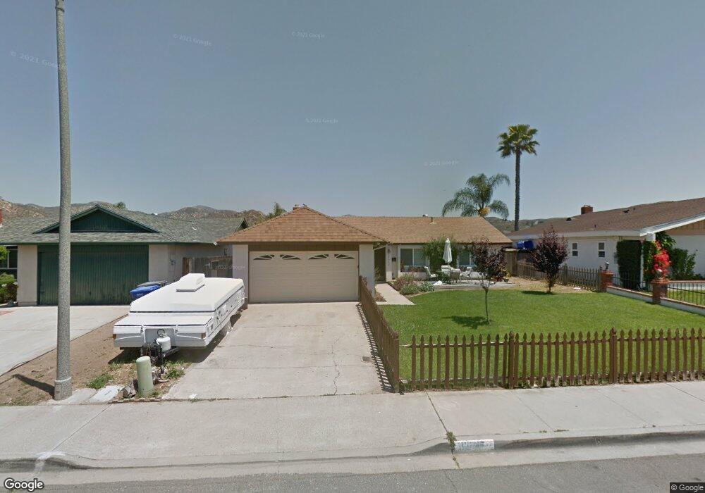
This home is located at 13047 Acton Ave, Poway, CA 92064 and is currently estimated at $934,243, approximately $648 per square foot. 13047 Acton Ave is a home located in San Diego County with nearby schools including Garden Road Elementary, Twin Peaks Middle, and Poway High.
Ownership History
Date
Name
Owned For
Owner Type
Purchase Details
Closed on
Jan 26, 2022
Sold by
Marston Delrey M
Bought by
Marston Family Trust
Current Estimated Value
Purchase Details
Closed on
Jan 18, 2022
Sold by
Marston Delrey M
Bought by
Marston Family Trust
Purchase Details
Closed on
Jan 15, 2022
Sold by
Marston Family Trust
Bought by
Marston Gregory Stephen
Purchase Details
Closed on
Jan 31, 1998
Sold by
Marston Vernard L and Marston Del Rey M
Bought by
Marston Vernard L and Marston Del Rey
Create a Home Valuation Report for This Property
The Home Valuation Report is an in-depth analysis detailing your home's value as well as a comparison with similar homes in the area
Home Values in the Area
Average Home Value in this Area
Purchase History
| Date | Buyer | Sale Price | Title Company |
|---|---|---|---|
| Marston Family Trust | -- | -- | |
| Marston Family Trust | -- | -- | |
| Marston Family Trust | -- | -- | |
| Marston Gregory Stephen | -- | Moreno Law Group Apc | |
| Marston Vernard L | -- | -- |
Source: Public Records
Tax History
| Year | Tax Paid | Tax Assessment Tax Assessment Total Assessment is a certain percentage of the fair market value that is determined by local assessors to be the total taxable value of land and additions on the property. | Land | Improvement |
|---|---|---|---|---|
| 2025 | $7,913 | $711,008 | $477,543 | $233,465 |
| 2024 | $7,913 | $697,068 | $468,180 | $228,888 |
| 2023 | $7,746 | $683,400 | $459,000 | $224,400 |
| 2022 | $7,618 | $174,466 | $70,964 | $103,502 |
| 2021 | $2,071 | $174,466 | $70,964 | $103,502 |
| 2020 | $2,044 | $172,678 | $70,237 | $102,441 |
| 2019 | $1,993 | $169,293 | $68,860 | $100,433 |
| 2018 | $1,939 | $165,974 | $67,510 | $98,464 |
| 2017 | $1,889 | $162,721 | $66,187 | $96,534 |
| 2016 | $1,851 | $159,532 | $64,890 | $94,642 |
| 2015 | $1,824 | $157,137 | $63,916 | $93,221 |
| 2014 | $1,784 | $154,059 | $62,664 | $91,395 |
Source: Public Records
Map
Nearby Homes
- 13419 Sebago Ave
- 14610 Fairburn St
- 14118 Ipava Dr
- 13746 Paseo Bonita
- 000 Carlson Ct 9 Unit 9
- 14003 Jasmine Ave Unit 193
- 14089 Pomegranate Ave Unit 214
- 13908 Hibiscus Ave Unit 40
- 13941 Wisteria Ave
- 13716 Midland Rd
- 13947 Midland Rd
- 13850 Midgrove Ct
- 15792 Via Santa Pradera
- 13329 Casa Vista St Unit 98
- 0 Indian Springs Rd Unit NDP2602071
- 11764 Big Canyon Ln
- 12959 Creek Park Dr
- 13220 Dana Vista St Unit 114
- 13619 Sycamore Tree Ln
- 13230 Creekside Ln
- 13053 Acton Ave
- 13041 Acton Ave
- 13035 Acton Ave
- 13029 Acton Ave
- 14575 Kennebunk St
- 14595 Scarboro St
- 14588 Scarboro St
- 13025 Acton Ave
- 14589 Scarboro St
- 14569 Kennebunk St
- 14582 Scarboro St
- 14594 Glenville St
- 14592 Kennebunk St
- 14586 Kennebunk St
- 14583 Scarboro St
- 13019 Acton Ave
- 14580 Kennebunk St
- 14588 Glenville St
- 14563 Kennebunk St
- 14576 Scarboro St
Your Personal Tour Guide
Ask me questions while you tour the home.