Estimated Value: $155,521 - $197,000
Studio
2
Baths
1,954
Sq Ft
$91/Sq Ft
Est. Value
About This Home
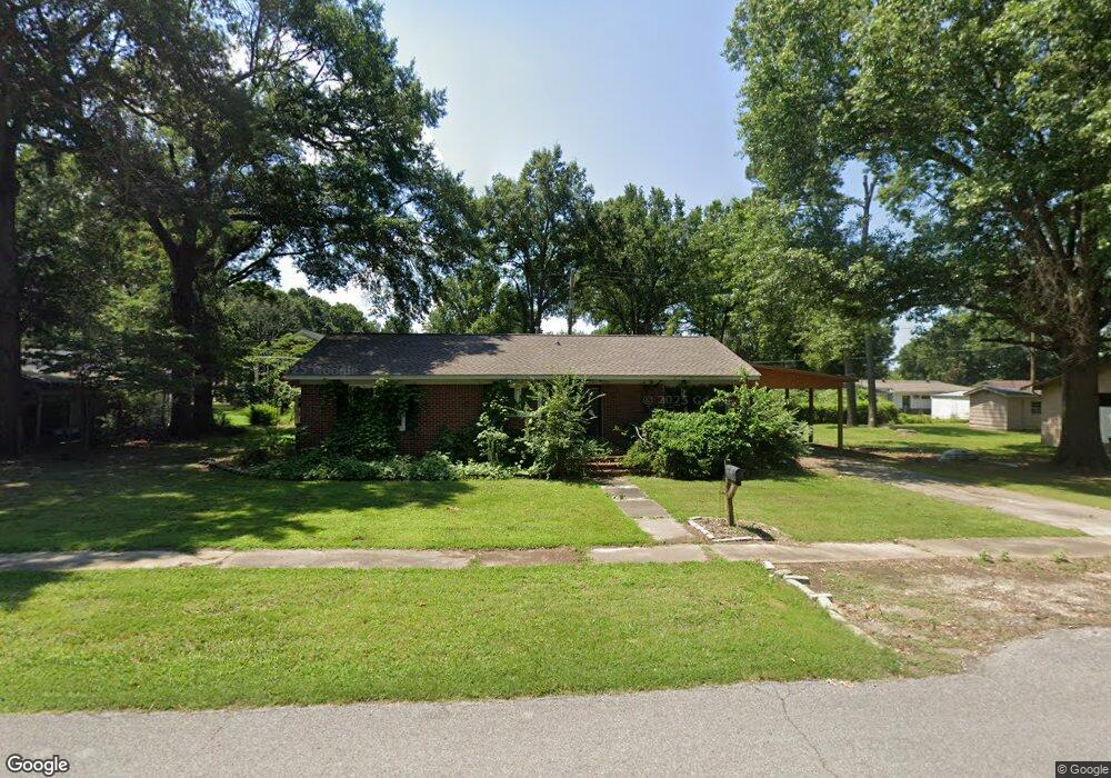
This home is located at 1305 Forrest Ave E, Wynne, AR 72396 and is currently estimated at $177,630, approximately $90 per square foot. 1305 Forrest Ave E is a home located in Cross County with nearby schools including Wynne Intermediate School, Wynne Primary School, and Wynne Junior High School.
Ownership History
Date
Name
Owned For
Owner Type
Purchase Details
Closed on
Feb 1, 2017
Sold by
Shempert Ray Vance and Shempert Brenda Jean
Bought by
White Rocky A
Current Estimated Value
Home Financials for this Owner
Home Financials are based on the most recent Mortgage that was taken out on this home.
Original Mortgage
$114,880
Outstanding Balance
$94,887
Interest Rate
4.37%
Mortgage Type
FHA
Estimated Equity
$82,743
Purchase Details
Closed on
Mar 1, 1988
Bought by
Shempert Ray Vance and Shempert Brenda J
Create a Home Valuation Report for This Property
The Home Valuation Report is an in-depth analysis detailing your home's value as well as a comparison with similar homes in the area
Purchase History
| Date | Buyer | Sale Price | Title Company |
|---|---|---|---|
| White Rocky A | $117,000 | Janus Title Llc | |
| Shempert Ray Vance | -- | -- |
Source: Public Records
Mortgage History
| Date | Status | Borrower | Loan Amount |
|---|---|---|---|
| Open | White Rocky A | $114,880 |
Source: Public Records
Tax History
| Year | Tax Paid | Tax Assessment Tax Assessment Total Assessment is a certain percentage of the fair market value that is determined by local assessors to be the total taxable value of land and additions on the property. | Land | Improvement |
|---|---|---|---|---|
| 2025 | $302 | $27,060 | $5,220 | $21,840 |
| 2024 | $361 | $17,390 | $4,550 | $12,840 |
| 2023 | $703 | $22,790 | $4,550 | $18,240 |
| 2022 | $753 | $22,790 | $4,550 | $18,240 |
| 2021 | $749 | $22,790 | $4,550 | $18,240 |
| 2020 | $698 | $22,790 | $4,550 | $18,240 |
| 2019 | $647 | $20,650 | $4,110 | $16,540 |
| 2018 | $672 | $20,650 | $4,110 | $16,540 |
| 2017 | $672 | $20,650 | $4,110 | $16,540 |
| 2016 | $1,022 | $20,650 | $4,110 | $16,540 |
| 2015 | $1,022 | $20,650 | $4,110 | $16,540 |
| 2014 | $1,023 | $20,670 | $3,770 | $16,900 |
Source: Public Records
Map
Nearby Homes
- 1310 Forrest Ave E
- 594 Malone St N
- 1204 Forrest Ave E
- 1112 Poplar Ave E
- 226 Nathan Dr E
- 909 Killough Rd N
- 108 Nathan Dr E
- 1420 Hamilton Ave E
- 1106 Marion Dr
- 109 Nathan Dr E
- 1104 Hamilton Ave E
- 1011 Hilltop Dr
- 621 Lemons St N
- 1201 Peterson Dr
- 39 Morningside Dr
- 1308 Killough Rd N
- 1621 Dodd Dr
- 802 Poplar Ave E
- 205 Kerry Dr
- 129 Lombardy Ln
- 1303 Forrest Ave E
- 617 Killough Rd N
- 1314 Poplar Ave E
- 1251 Forrest Ave E
- 1302 Forrest Ave E
- 1306 Forrest Ave E
- 1212 Forrest Ave E
- 1212 Poplar Ave E
- 1209 Forrest Ave E
- 1210 Forrest Ave E
- 1402 Poplar Ave E
- 1208 Poplar Ave E
- 1207 Forrest Ave E
- 1206 Forrest Ave E
- 809 Pinewood Cove
- 803 Killough Rd N
- 1205 Forrest Ave E
- 604 Malone St N
- 1204 Poplar Ave E
- 595 Killough Rd N
Your Personal Tour Guide
Ask me questions while you tour the home.