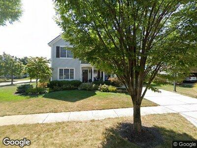
1305 Lewiston Dr Westfield, IN 46074
Estimated Value: $423,000 - $470,000
4
Beds
3
Baths
3,293
Sq Ft
$137/Sq Ft
Est. Value
About This Home
This home is located at 1305 Lewiston Dr, Westfield, IN 46074 and is currently estimated at $452,576, approximately $137 per square foot. 1305 Lewiston Dr is a home located in Hamilton County with nearby schools including Maple Glen Elementary, Westfield Intermediate School, and Westfield Middle School.
Ownership History
Date
Name
Owned For
Owner Type
Purchase Details
Closed on
Aug 26, 2010
Sold by
U S Bank National Association
Bought by
Distler Cheryl L
Current Estimated Value
Purchase Details
Closed on
Apr 29, 2010
Sold by
Harris Wayne C
Bought by
U S Bank National Association
Purchase Details
Closed on
Jul 28, 2004
Sold by
The Estridge Group Inc
Bought by
Harris Wayne C
Home Financials for this Owner
Home Financials are based on the most recent Mortgage that was taken out on this home.
Original Mortgage
$252,600
Interest Rate
6.35%
Mortgage Type
VA
Purchase Details
Closed on
Dec 30, 2003
Sold by
Cec Associates Llc
Bought by
The Estridge Group Inc
Home Financials for this Owner
Home Financials are based on the most recent Mortgage that was taken out on this home.
Original Mortgage
$22,000,000
Interest Rate
5.91%
Mortgage Type
Purchase Money Mortgage
Create a Home Valuation Report for This Property
The Home Valuation Report is an in-depth analysis detailing your home's value as well as a comparison with similar homes in the area
Home Values in the Area
Average Home Value in this Area
Purchase History
| Date | Buyer | Sale Price | Title Company |
|---|---|---|---|
| Distler Cheryl L | $160,000 | Resource Title Agency Of Cin | |
| U S Bank National Association | $195,000 | None Available | |
| Harris Wayne C | -- | -- | |
| The Estridge Group Inc | -- | -- |
Source: Public Records
Mortgage History
| Date | Status | Borrower | Loan Amount |
|---|---|---|---|
| Open | Distler Cheryl L | $207,000 | |
| Previous Owner | Harris Wayne C | $256,450 | |
| Previous Owner | Harris Wayne C | $252,600 | |
| Previous Owner | The Estridge Group Inc | $22,000,000 |
Source: Public Records
Tax History Compared to Growth
Tax History
| Year | Tax Paid | Tax Assessment Tax Assessment Total Assessment is a certain percentage of the fair market value that is determined by local assessors to be the total taxable value of land and additions on the property. | Land | Improvement |
|---|---|---|---|---|
| 2024 | $3,984 | $347,900 | $65,000 | $282,900 |
| 2023 | $4,049 | $351,500 | $65,000 | $286,500 |
| 2022 | $3,597 | $311,100 | $65,000 | $246,100 |
| 2021 | $3,284 | $271,400 | $65,000 | $206,400 |
| 2020 | $3,305 | $270,600 | $65,000 | $205,600 |
| 2019 | $3,118 | $255,500 | $47,500 | $208,000 |
| 2018 | $2,984 | $244,500 | $47,500 | $197,000 |
| 2017 | $2,668 | $235,500 | $47,500 | $188,000 |
| 2016 | $2,659 | $234,700 | $47,500 | $187,200 |
| 2014 | $2,459 | $219,800 | $47,500 | $172,300 |
| 2013 | $2,459 | $207,900 | $47,500 | $160,400 |
Source: Public Records
Map
Nearby Homes
- 15421 Bowie Dr
- 15528 Bowie Dr
- 15329 Smithfield Dr
- 15557 Starflower Dr
- 1505 Avondale Dr
- 15515 Alameda Place
- 1521 Avondale Dr
- 1404 Rosebank Dr
- 15628 Allegro Dr
- 1534 Cloverdon Dr
- 15596 Edenvale Dr
- 1029 Bridgeport Dr
- 1648 Rossmay Dr
- 1655 Avondale Dr
- 15109 Larchwood Dr
- 15844 Nocturne Dr
- 1444 Waterleaf Dr
- 1237 Wolcott Ct
- 14914 Annabel Ct
- 15004 Stonneger St
- 1305 Lewiston Dr
- 1315 Lewiston Dr
- 1310 Lewiston Dr
- 1281 Lewiston Dr
- 1325 Lewiston Dr
- 1320 Lewiston Dr
- 1282 Lewiston Dr
- 1298 Liberty Dr
- 1267 Lewiston Dr
- 1350 Lewiston Dr
- 1335 Lewiston Dr
- 1268 Lewiston Dr
- 1311 Pawtucket Dr
- 1253 Lewiston Dr
- 1345 Lewiston Dr
- 1327 Pawtucket Dr
- 1254 Lewiston Dr
- 1259 Pawtucket Dr
- 1272 Liberty Dr
- 1355 Lewiston Dr