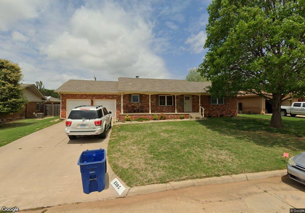
1305 Normandy Rd Duncan, OK 73533
Estimated Value: $167,835 - $196,000
3
Beds
2
Baths
1,839
Sq Ft
$100/Sq Ft
Est. Value
About This Home
This home is located at 1305 Normandy Rd, Duncan, OK 73533 and is currently estimated at $184,709, approximately $100 per square foot. 1305 Normandy Rd is a home with nearby schools including Emerson Elementary School, Duncan Middle School, and Duncan High School.
Ownership History
Date
Name
Owned For
Owner Type
Purchase Details
Closed on
Oct 29, 2007
Sold by
Brown Mary E
Bought by
Peercy Michael Warren and Peercy Victoria Ann
Current Estimated Value
Home Financials for this Owner
Home Financials are based on the most recent Mortgage that was taken out on this home.
Original Mortgage
$95,000
Outstanding Balance
$59,921
Interest Rate
6.32%
Mortgage Type
New Conventional
Estimated Equity
$124,788
Purchase Details
Closed on
Dec 22, 2004
Sold by
Brown Kenneth Robert and Brown Kenneth R
Bought by
Brown Mary Ellen and Brown Mary E
Purchase Details
Closed on
Aug 14, 2002
Sold by
East Loyd E Jr Etal
Purchase Details
Closed on
Jul 26, 2002
Sold by
Halliburton Real Estate
Purchase Details
Closed on
Feb 4, 2002
Sold by
Halliburton Real Estate
Create a Home Valuation Report for This Property
The Home Valuation Report is an in-depth analysis detailing your home's value as well as a comparison with similar homes in the area
Purchase History
| Date | Buyer | Sale Price | Title Company |
|---|---|---|---|
| Peercy Michael Warren | $95,000 | Stewart Abstract & Title | |
| Brown Mary Ellen | -- | None Available | |
| -- | $75,000 | -- | |
| -- | -- | -- | |
| -- | $75,000 | -- |
Source: Public Records
Mortgage History
| Date | Status | Borrower | Loan Amount |
|---|---|---|---|
| Open | Peercy Michael Warren | $95,000 |
Source: Public Records
Tax History
| Year | Tax Paid | Tax Assessment Tax Assessment Total Assessment is a certain percentage of the fair market value that is determined by local assessors to be the total taxable value of land and additions on the property. | Land | Improvement |
|---|---|---|---|---|
| 2025 | $1,374 | $16,295 | $1,222 | $15,073 |
| 2024 | $1,270 | $14,905 | $1,222 | $13,683 |
| 2023 | $1,270 | $14,905 | $1,222 | $13,683 |
| 2022 | $1,149 | $14,195 | $1,222 | $12,973 |
| 2021 | $1,096 | $12,876 | $1,222 | $11,654 |
| 2020 | $1,184 | $13,712 | $1,222 | $12,490 |
| 2019 | $1,132 | $13,081 | $1,222 | $11,859 |
| 2018 | $1,165 | $13,081 | $1,222 | $11,859 |
| 2017 | $1,114 | $13,615 | $1,222 | $12,393 |
| 2016 | $1,050 | $12,350 | $1,222 | $11,128 |
| 2015 | $962 | $11,762 | $1,222 | $10,540 |
| 2014 | $962 | $11,202 | $1,222 | $9,980 |
Source: Public Records
Map
Nearby Homes
- 1312 Mccasland Pkwy
- 1216 N 8th St
- 907 Hillcrest Dr
- 1001 W Jones Ave
- 1125 Peck Ave
- 1205 N 11th St
- 1423 N 7th St
- 1202 N 12th St
- 1061 N 8th St
- 1506 Crescent Dr
- 1112 N 12th St
- 1110 Crescent Dr
- 1606 Indian Terrace
- 1112 N 4th St
- 1309 W Spruce Ave
- 1706 Northridge Dr
- 1449 W Will Rogers Dr
- 905 W Pine Ave
- 1405 Evergreen Dr
- 1275 N 10th St
- 1307 Normandy Rd
- 1303 Normandy Rd
- 1309 Normandy Rd
- 1308 Mccasland Pkwy
- 1306 Mccasland Pkwy
- 1304 Normandy Rd
- 1301 Normandy Rd
- 1310 1310 McCasland Pkwy
- 1311 Normandy Rd
- 1306 Normandy Rd
- 1304 1304 N McCasland
- 1304 Mccasland Pkwy
- 1308 Normandy Rd
- 1313 Normandy Rd
- 1310 Normandy Rd
- 1315 Normandy Rd
- 1312 1312 McCasland Pkwy
- 1302 Mccasland Pkwy
- 1312 Normandy Ct
- 1305 Mccasland Pkwy
Your Personal Tour Guide
Ask me questions while you tour the home.